Property Record
975 Ladd Rd, Walled Lake, MI 48390
NEARBY LISTINGS FOR SALE OR LEASE
Property Detail
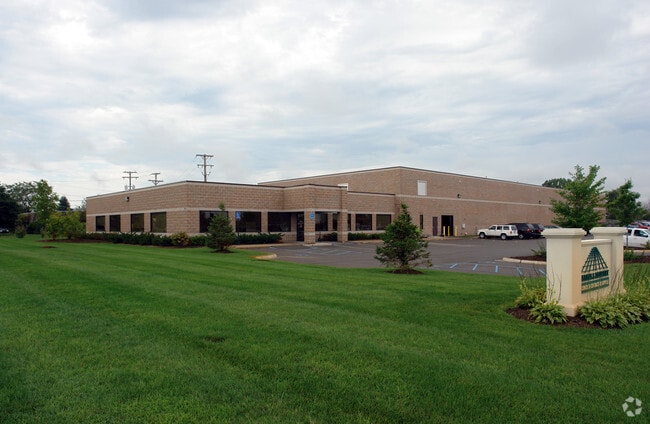
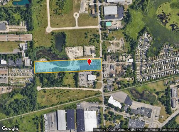
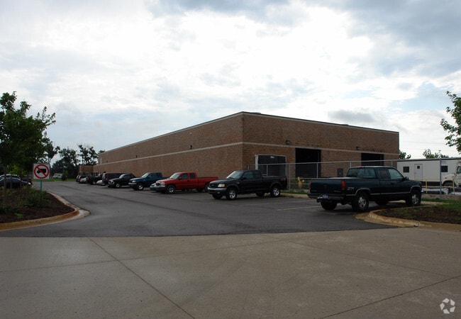
975 Ladd Rd
17-34-101-017
T2N, R8E, SEC 34 PART OF NW 1/4 BEG AT PT DIST S 00-00-39 W 546.36 FT FROM NW SEC COR, TH N 89-48-44 E 945.93 FT, TH N 89-48-44 E 385.98 FT, TH S 00-01-50 W 225 FT, TH S 89-48-44 W 386.88 FT, TH S 89-48-44 W 944.95 FT, TH N 00-00-39 E 225 FT TO BEG 6
Warehouse
Oakland
X
Michigan
26125C0486F
6.71 AC
2024
Central I-96 Corridor
2024
Detroit
135200
Detroit-Warren-Dearborn, MI
25,100 SF
DEMOGRAPHICS near 975 Ladd Rd
1 Mile
3 Mile
5 Mile
2024 Total Population
8,142
60,945
130,523
2029 Population
8,075
60,171
129,096
Pop Growth 2024-2029
(0.82%)
(1.27%)
(1.09%)
Average Age
42
42
42
2024 Total Households
3,675
27,698
54,335
HH Growth 2024-2029
(0.79%)
(1.48%)
(1.19%)
Median Household Inc
$80,078
$75,559
$91,024
Avg Household Size
2.20
2.20
2.40
2024 Avg HH Vehicles
2.00
2.00
2.00
Median Home Value
$266,050
$294,302
$341,278
Median Year Built
1992
1991
1989
Nearby Places
Map Layers
Map Styles
 Street
 Aerial
- Restaurants
- Banks
- Shops
- Fitness
- Groceries
PUBLIC TRANSPORTATION
AIRPORT
Detroit Metro Wayne County
DRIVE
WALK
Distance
Detroit Metro Wayne County
45 min
33.0 mi
Windsor International
DRIVE
WALK
Distance
Windsor International
68 min
43.2 mi
Bishop International
DRIVE
WALK
Distance
Bishop International
68 min
49.8 mi
Nearby Properties
Address
Land Use
TOTAL SIZE
Lot Size
Zoning
Address
Land Use
TOTAL SIZE
Lot Size
Zoning
162,600 SF
102.81 AC
RM-1
Address
Land Use
TOTAL SIZE
Lot Size
Zoning
873,288 SF
Address
Land Use
TOTAL SIZE
Lot Size
Zoning
614,079 SF
57.44 AC
Address
Land Use
TOTAL SIZE
Lot Size
Zoning
72.63 AC
RM-1
Address
Land Use
TOTAL SIZE
Lot Size
Zoning
86.19 AC
RC2
Address
Land Use
TOTAL SIZE
Lot Size
Zoning
563,160 SF
47.06 AC
Address
Land Use
TOTAL SIZE
Lot Size
Zoning
400,505 SF
26.50 AC
Address
Land Use
TOTAL SIZE
Lot Size
Zoning
59.71 AC
RM-1
Address
Land Use
TOTAL SIZE
Lot Size
Zoning
17,277 SF
17.73 AC
R-A
Address
Land Use
TOTAL SIZE
Lot Size
Zoning
188,643 SF
12.81 AC
IV
Address
Land Use
TOTAL SIZE
Lot Size
Zoning
269,975 SF
23.88 AC
AI
Address
Land Use
TOTAL SIZE
Lot Size
Zoning
38.85 AC
RC2
Address
Land Use
TOTAL SIZE
Lot Size
Zoning
19.26 AC
R-A
Address
Land Use
TOTAL SIZE
Lot Size
Zoning
2,073 SF
116.28 AC
MH
Address
Land Use
TOTAL SIZE
Lot Size
Zoning
7,646 SF
24.55 AC
RM1
Address
Land Use
TOTAL SIZE
Lot Size
Zoning
222,664 SF
21.10 AC
BI
Address
Land Use
TOTAL SIZE
Lot Size
Zoning
196,222 SF
Address
Land Use
TOTAL SIZE
Lot Size
Zoning
4,140 SF
120 AC
MM
Address
Land Use
TOTAL SIZE
Lot Size
Zoning
126,720 SF
8.31 AC
Address
Land Use
TOTAL SIZE
Lot Size
Zoning
227,946 SF
20.96 AC
AI
Address
Land Use
TOTAL SIZE
Lot Size
Zoning
22.93 AC
RM-1
Address
Land Use
TOTAL SIZE
Lot Size
Zoning
26.54 AC
RM-1
Address
Land Use
TOTAL SIZE
Lot Size
Zoning
200,926 SF
30.87 AC
M1
Address
Land Use
TOTAL SIZE
Lot Size
Zoning
Address
Land Use
TOTAL SIZE
Lot Size
Zoning
14.93 AC
RC2
Address
Land Use
TOTAL SIZE
Lot Size
Zoning
7,646 SF
24.55 AC
RM-1
Address
Land Use
TOTAL SIZE
Lot Size
Zoning
132,101 SF
Address
Land Use
TOTAL SIZE
Lot Size
Zoning
20.33 AC
RM-1
Address
Land Use
TOTAL SIZE
Lot Size
Zoning
118,592 SF
Address
Land Use
TOTAL SIZE
Lot Size
Zoning
93,440 SF
17.23 AC
BI
The World's #1 Commercial Real Estate Marketplace
Connect with us
© 2025 CoStar Group
The information above has been obtained from sources believed reliable. While we do not doubt its accuracy we have not verified it and make no guarantee, warranty or representation about it. It is your responsibility to independently confirm its accuracy and completeness. Any projections, opinions, assumptions, or estimates used are for example only and do not represent the current or future performance of the property. The value of this transaction to you depends on tax and other factors which should be evaluated by your tax, financial, and legal advisors. You and your advisors should conduct a careful, independent investigation of the property to determine to your satisfaction the suitability of the property for your needs.