Property Record
9750 Hornbaker Rd, Manassas, VA 20109
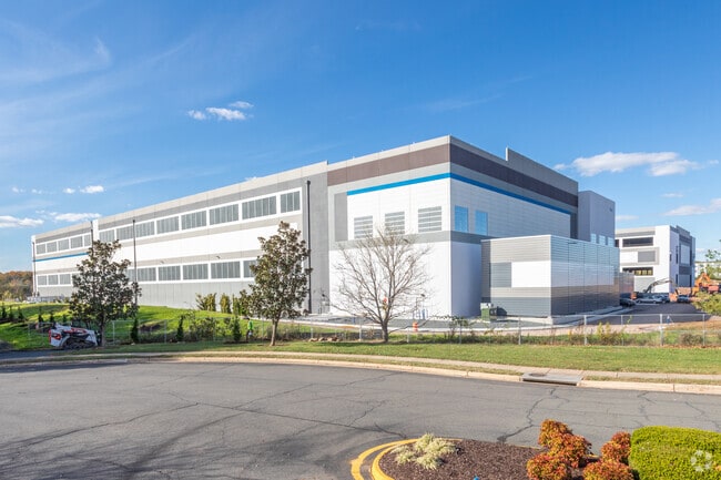

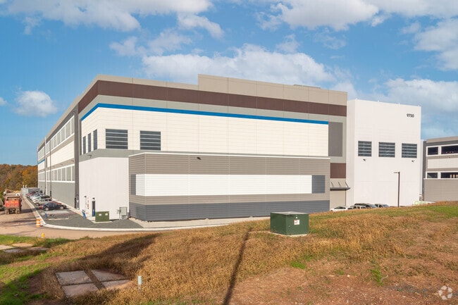
Property Detail
9750 Hornbaker Rd
7595-85-6929
PCL A2A
Notresolvable
PRINCE WILLIAM
PBD
Virginia
2025
12.58 AC
2025
Rt 29/I-66 Corridor
901409
Washington, DC
241,249 SF
Washington-Arlington-Alexandria, DC-VA-MD-WV
NEARBY LISTINGS FOR SALE OR LEASE
DEMOGRAPHICS near 9750 Hornbaker Rd
1 mile
3 mile
5 mile
2025 Total Population
1,587
59,958
164,379
2030 Population
1,654
61,437
168,210
Pop Growth 2025-2030
+ 4.22%
+ 2.47%
+ 2.33%
Average Age
33
36
36
2025 Total Households
414
19,149
50,885
HH Growth 2025-2030
+ 4.35%
+ 2.44%
+ 2.36%
Median Household Inc
$92,499
$140,707
$121,818
Avg Household Size
3.60
3.00
3.10
2025 Avg HH Vehicles
2.00
2.00
2.00
Median Home Value
$715,736
$564,746
$514,431
Median Year Built
2008
1999
1991
Nearby Places
Map Layers
Map Styles
 Street
 Aerial
Layers
 Traffic
 Biking
Places
Listings with unknown addresses are not visible on the map
- Restaurants
- Banks
- Shops
- Fitness
- Groceries
PUBLIC TRANSPORTATION
COMMUTER RAIL
Lead (Manassas Line - Virginia Railway Express)
Drive
Walk
Distance
Lead (Manassas Line - Virginia Railway Express)
7 min
2.5 mi
Manassas Amtrak Station (Cardinal - Amtrak, Crescent - Amtrak, Manassas Line - Amtrak, Northeast Regional - Amtrak)
Drive
Walk
Distance
Manassas Amtrak Station (Cardinal - Amtrak, Crescent - Amtrak, Manassas Line - Amtrak, Northeast Regional - Amtrak)
10 min
4.3 mi
AIRPORT
Washington Dulles International
Drive
Walk
Distance
Washington Dulles International
39 min
23.3 mi
Ronald Reagan Washington Ntl
Drive
Walk
Distance
Ronald Reagan Washington Ntl
53 min
37.8 mi
Freight Ports
Port of Baltimore
Drive
Walk
Distance
Port of Baltimore
98 min
73.7 mi
Nearby Properties
Address
Land Use
TOTAL SIZE
Lot Size
Zoning
Address
Land Use
TOTAL SIZE
Lot Size
Zoning
795,191 SF
82.58 AC
M1
Address
Land Use
TOTAL SIZE
Lot Size
Zoning
347,876 SF
23.23 AC
PBD
Address
Land Use
TOTAL SIZE
Lot Size
Zoning
389,649 SF
11.82 AC
M2
Address
Land Use
TOTAL SIZE
Lot Size
Zoning
394,593 SF
27.60 AC
MT
Address
Land Use
TOTAL SIZE
Lot Size
Zoning
233,757 SF
15.54 AC
PBD
Address
Land Use
TOTAL SIZE
Lot Size
Zoning
223,757 SF
15.92 AC
PBD
Address
Land Use
TOTAL SIZE
Lot Size
Zoning
216,067 SF
15.85 AC
PBD
Address
Land Use
TOTAL SIZE
Lot Size
Zoning
213,320 SF
31.06 AC
PBD
Address
Land Use
TOTAL SIZE
Lot Size
Zoning
305,510 SF
22.72 AC
M2
Address
Land Use
TOTAL SIZE
Lot Size
Zoning
269,091 SF
32.31 AC
M2
Address
Land Use
TOTAL SIZE
Lot Size
Zoning
224,652 SF
12.05 AC
PBD
Address
Land Use
TOTAL SIZE
Lot Size
Zoning
325,918 SF
41.38 AC
M2
Address
Land Use
TOTAL SIZE
Lot Size
Zoning
281,000 SF
10.08 AC
PBD
Address
Land Use
TOTAL SIZE
Lot Size
Zoning
259,200 SF
14.22 AC
PBD
Address
Land Use
TOTAL SIZE
Lot Size
Zoning
230,706 SF
13.94 AC
PMD
Address
Land Use
TOTAL SIZE
Lot Size
Zoning
719,742 SF
62.13 AC
M2
Address
Land Use
TOTAL SIZE
Lot Size
Zoning
656,797 SF
Address
Land Use
TOTAL SIZE
Lot Size
Zoning
824,085 SF
120.07 AC
MIXED
Address
Land Use
TOTAL SIZE
Lot Size
Zoning
139,000 SF
9.78 AC
PBD
Address
Land Use
TOTAL SIZE
Lot Size
Zoning
247,608 SF
19.50 AC
PBD
Address
Land Use
TOTAL SIZE
Lot Size
Zoning
127,000 SF
12.40 AC
M2
Address
Land Use
TOTAL SIZE
Lot Size
Zoning
440,331 SF
61.47 AC
M1
Address
Land Use
TOTAL SIZE
Lot Size
Zoning
409,252 SF
18.75 AC
M2
Address
Land Use
TOTAL SIZE
Lot Size
Zoning
165,230 SF
12 AC
M2
Address
Land Use
TOTAL SIZE
Lot Size
Zoning
136,228 SF
9.19 AC
M2
Address
Land Use
TOTAL SIZE
Lot Size
Zoning
270,540 SF
13.65 AC
PBD
Address
Land Use
TOTAL SIZE
Lot Size
Zoning
352,030 SF
21.14 AC
PBD
Address
Land Use
TOTAL SIZE
Lot Size
Zoning
311,198 SF
23.50 AC
M2
Address
Land Use
TOTAL SIZE
Lot Size
Zoning
446,663 SF
92.79 AC
A1
The World's #1 Commercial Real Estate Marketplace
Connect with us
© 2026 CoStar Group
The information above has been obtained from sources believed reliable. While we do not doubt its accuracy we have not verified it and make no guarantee, warranty or representation about it. It is your responsibility to independently confirm its accuracy and completeness. Any projections, opinions, assumptions, or estimates used are for example only and do not represent the current or future performance of the property. The value of this transaction to you depends on tax and other factors which should be evaluated by your tax, financial, and legal advisors. You and your advisors should conduct a careful, independent investigation of the property to determine to your satisfaction the suitability of the property for your needs.