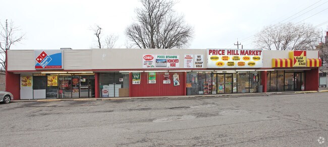
Property Record
977 Hawthorne Ave, Cincinnati, OH 45205


NEARBY LISTINGS FOR SALE OR LEASE
Property Detail
977 Hawthorne Ave
175-0017-0001
977 HAWTHORNE 122.19 X 177 SWC WARSAW & HAWTHORNE AVES PARS 1-2-112 CONS
Storebuilding
Hamilton
X
Ohio
21037C0010E
0.32 AC
2024
Queensgate
2024
Cincinnati/Dayton
009300
Cincinnati, OH-KY-IN
4,922 SF
DEMOGRAPHICS near 977 Hawthorne Ave
1 Mile
3 Mile
5 Mile
2024 Total Population
16,146
134,103
322,344
2029 Population
16,235
135,623
325,485
Pop Growth 2024-2029
+ 0.55%
+ 1.13%
+ 0.97%
Average Age
35
35
37
2024 Total Households
6,273
56,915
140,424
HH Growth 2024-2029
+ 0.41%
+ 1.36%
+ 1.05%
Median Household Inc
$31,610
$41,601
$49,398
Avg Household Size
2.40
2.10
2.10
2024 Avg HH Vehicles
1.00
1.00
1.00
Median Home Value
$88,358
$153,728
$181,567
Median Year Built
1948
1957
1956
Nearby Places
Map Layers
Map Styles
 Street
 Aerial
- Restaurants
- Banks
- Shops
- Fitness
- Groceries
PUBLIC TRANSPORTATION
COMMUTER RAIL
DRIVE
WALK
Distance
7 min
2.6 mi
AIRPORT
Cincinnati/Northern Kentucky International
DRIVE
WALK
Distance
Cincinnati/Northern Kentucky International
25 min
14.4 mi
Nearby Properties
Address
Land Use
TOTAL SIZE
Lot Size
Zoning
Address
Land Use
TOTAL SIZE
Lot Size
Zoning
39.99 AC
MG
Address
Land Use
TOTAL SIZE
Lot Size
Zoning
11.82 AC
Address
Land Use
TOTAL SIZE
Lot Size
Zoning
11.41 AC
IR
Address
Land Use
TOTAL SIZE
Lot Size
Zoning
60,750 SF
1.52 AC
Address
Land Use
TOTAL SIZE
Lot Size
Zoning
2.60 AC
Address
Land Use
TOTAL SIZE
Lot Size
Zoning
3.09 AC
Address
Land Use
TOTAL SIZE
Lot Size
Zoning
290,233 SF
Address
Land Use
TOTAL SIZE
Lot Size
Zoning
3.51 AC
DD
Address
Land Use
TOTAL SIZE
Lot Size
Zoning
9,962 SF
712 AC
Address
Land Use
TOTAL SIZE
Lot Size
Zoning
Address
Land Use
TOTAL SIZE
Lot Size
Zoning
Address
Land Use
TOTAL SIZE
Lot Size
Zoning
2.46 AC
Address
Land Use
TOTAL SIZE
Lot Size
Zoning
844,128 SF
1.22 AC
DD
Address
Land Use
TOTAL SIZE
Lot Size
Zoning
0.43 AC
DD
Address
Land Use
TOTAL SIZE
Lot Size
Zoning
0.91 AC
DD
Address
Land Use
TOTAL SIZE
Lot Size
Zoning
28,160 SF
1 AC
DD
Address
Land Use
TOTAL SIZE
Lot Size
Zoning
9.38 AC
PR
Address
Land Use
TOTAL SIZE
Lot Size
Zoning
1.21 AC
DD
Address
Land Use
TOTAL SIZE
Lot Size
Zoning
2.16 AC
DD
Address
Land Use
TOTAL SIZE
Lot Size
Zoning
12.19 AC
Address
Land Use
TOTAL SIZE
Lot Size
Zoning
10.96 AC
Address
Land Use
TOTAL SIZE
Lot Size
Zoning
Address
Land Use
TOTAL SIZE
Lot Size
Zoning
635,740 SF
1.67 AC
DD
Address
Land Use
TOTAL SIZE
Lot Size
Zoning
755,494 SF
0.08 AC
DD
Address
Land Use
TOTAL SIZE
Lot Size
Zoning
1.67 AC
Address
Land Use
TOTAL SIZE
Lot Size
Zoning
0.25 AC
DD
Address
Land Use
TOTAL SIZE
Lot Size
Zoning
3 AC
DD
Address
Land Use
TOTAL SIZE
Lot Size
Zoning
0.78 AC
DD
Address
Land Use
TOTAL SIZE
Lot Size
Zoning
3.27 AC
CCA
Address
Land Use
TOTAL SIZE
Lot Size
Zoning
2.66 AC
DD
The World's #1 Commercial Real Estate Marketplace
Connect with us
© 2025 CoStar Group
The information above has been obtained from sources believed reliable. While we do not doubt its accuracy we have not verified it and make no guarantee, warranty or representation about it. It is your responsibility to independently confirm its accuracy and completeness. Any projections, opinions, assumptions, or estimates used are for example only and do not represent the current or future performance of the property. The value of this transaction to you depends on tax and other factors which should be evaluated by your tax, financial, and legal advisors. You and your advisors should conduct a careful, independent investigation of the property to determine to your satisfaction the suitability of the property for your needs.