Property Record
977 W County Line Rd, Warminster, PA 18974

Save to a Folder
{{folder.Name}}
{{folder.ListingIds.length}} Properties
{{folder.ListingIds.length}} Property
Create a New Folder
Property Detail
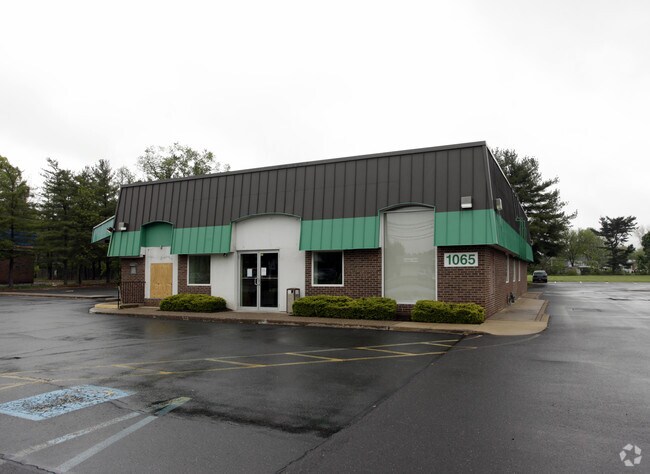
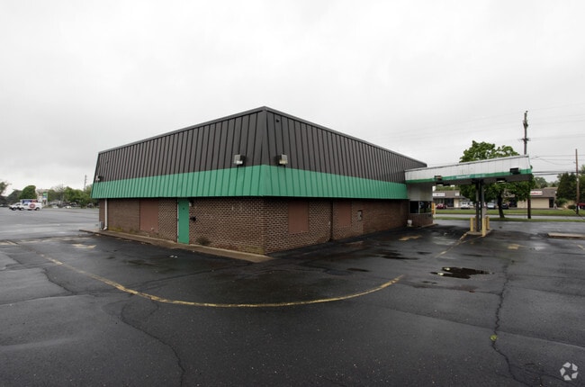
977 W County Line Rd
49-010-001
11.467A PARCEL#1 NS COUNT YLINE RD 121E NORRISTOWN RD 1102ON COUNTYLINE RD
Regionalshoppingcenterormallwithanchorstore
BUCKS
SC
Pennsylvania
B and X Area of moderate flood hazard, usually the area between the limits of the 100-year and 500-year floods.
11.47 AC
2025
Lower Bucks County
2026
Philadelphia
101611
Philadelphia-Camden-Wilmington, PA-NJ-DE-MD
88,320 SF
NEARBY LISTINGS FOR SALE OR LEASE
DEMOGRAPHICS near 977 W County Line Rd
1 mile
3 mile
5 mile
2025 Total Population
10,881
83,539
183,132
2030 Population
11,018
84,839
186,414
Pop Growth 2025-2030
+ 1.26%
+ 1.56%
+ 1.79%
Average Age
45
44
43
2025 Total Households
3,878
33,832
70,301
HH Growth 2025-2030
+ 1.19%
+ 1.58%
+ 1.94%
Median Household Inc
$115,431
$98,867
$109,206
Avg Household Size
2.70
2.40
2.50
2025 Avg HH Vehicles
2.00
2.00
2.00
Median Home Value
$436,001
$417,107
$458,189
Median Year Built
1965
1971
1973
Nearby Places
Map Layers
Map Styles
 Street
 Aerial
Layers
 Traffic
 Biking
Places
Listings with unknown addresses are not visible on the map
- Restaurants
- Banks
- Shops
- Fitness
- Groceries
PUBLIC TRANSPORTATION
COMMUTER RAIL
Warminster (Warminster Line - SEPTA)
Drive
Walk
Distance
Warminster (Warminster Line - SEPTA)
5 min
2.3 mi
Hatboro (Warminster Line - SEPTA)
Drive
Walk
Distance
Hatboro (Warminster Line - SEPTA)
5 min
2.5 mi
AIRPORT
Trenton Mercer
Drive
Walk
Distance
Trenton Mercer
39 min
22.3 mi
Philadelphia International
Drive
Walk
Distance
Philadelphia International
56 min
39.0 mi
Freight Ports
Port of Philadelphia
Drive
Walk
Distance
Port of Philadelphia
34 min
19.0 mi
Nearby Properties
Address
Land Use
TOTAL SIZE
Lot Size
Zoning
Address
Land Use
TOTAL SIZE
Lot Size
Zoning
1,006.32 AC
I1
Address
Land Use
TOTAL SIZE
Lot Size
Zoning
368,492 SF
58.98 AC
I1
Address
Land Use
TOTAL SIZE
Lot Size
Zoning
377,044 SF
58.73 AC
INST
Address
Land Use
TOTAL SIZE
Lot Size
Zoning
297,172 SF
37.55 AC
R4
Address
Land Use
TOTAL SIZE
Lot Size
Zoning
571,213 SF
67.31 AC
M
Address
Land Use
TOTAL SIZE
Lot Size
Zoning
272,344 SF
9.76 AC
I2
Address
Land Use
TOTAL SIZE
Lot Size
Zoning
283,836 SF
16.64 AC
PI
Address
Land Use
TOTAL SIZE
Lot Size
Zoning
84,400 SF
4.70 AC
I
Address
Land Use
TOTAL SIZE
Lot Size
Zoning
309,264 SF
9.93 AC
I
Address
Land Use
TOTAL SIZE
Lot Size
Zoning
368,495 SF
68.37 AC
PI
Address
Land Use
TOTAL SIZE
Lot Size
Zoning
170,183 SF
46.63 AC
I1
Address
Land Use
TOTAL SIZE
Lot Size
Zoning
420,736 SF
29.47 AC
LI
Address
Land Use
TOTAL SIZE
Lot Size
Zoning
256,679 SF
14 AC
MI
Address
Land Use
TOTAL SIZE
Lot Size
Zoning
344,636 SF
25.02 AC
R7
Address
Land Use
TOTAL SIZE
Lot Size
Zoning
110,198 SF
12.18 AC
R2
Address
Land Use
TOTAL SIZE
Lot Size
Zoning
94,059 SF
19.22 AC
R4
Address
Land Use
TOTAL SIZE
Lot Size
Zoning
120,549 SF
10 AC
C2
Address
Land Use
TOTAL SIZE
Lot Size
Zoning
149,423 SF
12.70 AC
I1
Address
Land Use
TOTAL SIZE
Lot Size
Zoning
212,660 SF
10.08 AC
I2
Address
Land Use
TOTAL SIZE
Lot Size
Zoning
193,590 SF
14.23 AC
I1
Address
Land Use
TOTAL SIZE
Lot Size
Zoning
326,717 SF
61.52 AC
I2
Address
Land Use
TOTAL SIZE
Lot Size
Zoning
126,660 SF
17.26 AC
C2
Address
Land Use
TOTAL SIZE
Lot Size
Zoning
321,959 SF
12.66 AC
I2
Address
Land Use
TOTAL SIZE
Lot Size
Zoning
88,000 SF
14.40 AC
PI
Address
Land Use
TOTAL SIZE
Lot Size
Zoning
89,667 SF
18.75 AC
I1
Address
Land Use
TOTAL SIZE
Lot Size
Zoning
213,350 SF
11.78 AC
R7
Address
Land Use
TOTAL SIZE
Lot Size
Zoning
182,364 SF
21.06 AC
M
Address
Land Use
TOTAL SIZE
Lot Size
Zoning
141,532 SF
21.43 AC
R6
Address
Land Use
TOTAL SIZE
Lot Size
Zoning
148,942 SF
34.95 AC
R4
Address
Land Use
TOTAL SIZE
Lot Size
Zoning
157,870 SF
13.20 AC
I1
The World's #1 Commercial Real Estate Marketplace
Connect with us
© 2026 CoStar Group
The information above has been obtained from sources believed reliable. While we do not doubt its accuracy we have not verified it and make no guarantee, warranty or representation about it. It is your responsibility to independently confirm its accuracy and completeness. Any projections, opinions, assumptions, or estimates used are for example only and do not represent the current or future performance of the property. The value of this transaction to you depends on tax and other factors which should be evaluated by your tax, financial, and legal advisors. You and your advisors should conduct a careful, independent investigation of the property to determine to your satisfaction the suitability of the property for your needs.