Property Record
980 Bethlehem Pike, Glenside, PA 19038


NEARBY LISTINGS FOR SALE OR LEASE
Property Detail
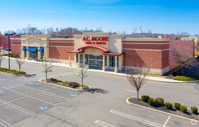
980 Bethlehem Pike
Philadelphia-Camden-Wilmington, PA-NJ-DE-MD
Property/P Clark Hopkins
46-00-00313-001
307 X IRR 3.69 AC
Storemultistory
Montgomery
X
Pennsylvania
42091C0276G
9
2024
3.69 AC
2025
Ft Wash/Spring House
210400
Philadelphia
40,296 SF
DEMOGRAPHICS near 980 Bethlehem Pike
1 Mile
3 Mile
5 Mile
2024 Total Population
5,872
67,176
155,951
2029 Population
5,920
68,290
157,887
Pop Growth 2024-2029
+ 0.82%
+ 1.66%
+ 1.24%
Average Age
43
43
43
2024 Total Households
2,368
25,463
58,726
HH Growth 2024-2029
+ 0.76%
+ 1.61%
+ 1.18%
Median Household Inc
$110,726
$109,179
$116,237
Avg Household Size
2.50
2.50
2.60
2024 Avg HH Vehicles
2.00
2.00
2.00
Median Home Value
$325,699
$402,192
$428,189
Median Year Built
1993
1982
1981
Nearby Places
Map Layers
Map Styles
 Street
 Aerial
- Restaurants
- Banks
- Shops
- Fitness
- Groceries
PUBLIC TRANSPORTATION
COMMUTER RAIL
Fortuna (R5 - Southeastern Pennsylvania Transportation Authority Regional Rail (SEPTA Regional Rail))
DRIVE
WALK
Distance
Fortuna (R5 - Southeastern Pennsylvania Transportation Authority Regional Rail (SEPTA Regional Rail))
7 min
3.5 mi
North Wales (R5 - Southeastern Pennsylvania Transportation Authority Regional Rail (SEPTA Regional Rail))
DRIVE
WALK
Distance
North Wales (R5 - Southeastern Pennsylvania Transportation Authority Regional Rail (SEPTA Regional Rail))
8 min
3.6 mi
AIRPORT
Philadelphia International
DRIVE
WALK
Distance
Philadelphia International
56 min
32.8 mi
Lehigh Valley International
DRIVE
WALK
Distance
Lehigh Valley International
59 min
35.3 mi
Trenton Mercer
DRIVE
WALK
Distance
Trenton Mercer
53 min
37.6 mi
Freight Ports
Port of Philadelphia
DRIVE
WALK
Distance
Port of Philadelphia
35 min
21.3 mi
SALE & LEASE HISTORY
LISTING DATE
SALE/LEASE

May 01, 2020
For Lease
Jun 16, 2021
For Lease
Apr 27, 2020
For Lease
Apr 27, 2020
For Lease
Apr 27, 2020
For Lease
Apr 27, 2020
For Lease
Apr 26, 2020
For Lease
Apr 26, 2020
For Lease
Apr 26, 2020
For Lease
Apr 01, 2020
For Lease
Nearby Properties
Address
Land Use
TOTAL SIZE
Lot Size
Zoning
Address
Land Use
TOTAL SIZE
Lot Size
Zoning
1,744,364 SF
91.78 AC
LI
Address
Land Use
TOTAL SIZE
Lot Size
Zoning
832,797 SF
171.68 AC
A
Address
Land Use
TOTAL SIZE
Lot Size
Zoning
614,768 SF
30.16 AC
R7
Address
Land Use
TOTAL SIZE
Lot Size
Zoning
483,618 SF
142.84 AC
A
Address
Land Use
TOTAL SIZE
Lot Size
Zoning
404,986 SF
22.21 AC
I
Address
Land Use
TOTAL SIZE
Lot Size
Zoning
258,179 SF
65.34 AC
IN
Address
Land Use
TOTAL SIZE
Lot Size
Zoning
268,288 SF
30.59 AC
RA
Address
Land Use
TOTAL SIZE
Lot Size
Zoning
1,127,663 SF
14.16 AC
RS
Address
Land Use
TOTAL SIZE
Lot Size
Zoning
657,589 SF
100.81 AC
MF3A
Address
Land Use
TOTAL SIZE
Lot Size
Zoning
262,457 SF
40.75 AC
E
Address
Land Use
TOTAL SIZE
Lot Size
Zoning
319,136 SF
18.35 AC
HDR
Address
Land Use
TOTAL SIZE
Lot Size
Zoning
301,431 SF
41.90 AC
S
Address
Land Use
TOTAL SIZE
Lot Size
Zoning
517,834 SF
31.33 AC
GA
Address
Land Use
TOTAL SIZE
Lot Size
Zoning
418,962 SF
37.87 AC
O1
Address
Land Use
TOTAL SIZE
Lot Size
Zoning
110,113 SF
13.35 AC
SC1
Address
Land Use
TOTAL SIZE
Lot Size
Zoning
245,104 SF
31.21 AC
C
Address
Land Use
TOTAL SIZE
Lot Size
Zoning
199,368 SF
24.65 AC
RC
Address
Land Use
TOTAL SIZE
Lot Size
Zoning
225,154 SF
6.38 AC
B
Address
Land Use
TOTAL SIZE
Lot Size
Zoning
767,474 SF
64.82 AC
RC
Address
Land Use
TOTAL SIZE
Lot Size
Zoning
334,450 SF
18.86 AC
GA
Address
Land Use
TOTAL SIZE
Lot Size
Zoning
139,081 SF
15.20 AC
LI
Address
Land Use
TOTAL SIZE
Lot Size
Zoning
59,634 SF
16 AC
A
Address
Land Use
TOTAL SIZE
Lot Size
Zoning
142,336 SF
3.17 AC
RS
Address
Land Use
TOTAL SIZE
Lot Size
Zoning
337,074 SF
12.92 AC
A
Address
Land Use
TOTAL SIZE
Lot Size
Zoning
289,681 SF
4.75 AC
BPO
Address
Land Use
TOTAL SIZE
Lot Size
Zoning
152,000 SF
154.42 AC
F1
Address
Land Use
TOTAL SIZE
Lot Size
Zoning
233,730 SF
19.10 AC
GA
Address
Land Use
TOTAL SIZE
Lot Size
Zoning
333,600 SF
24.72 AC
LI
Address
Land Use
TOTAL SIZE
Lot Size
Zoning
93,657 SF
27.40 AC
A1
Address
Land Use
TOTAL SIZE
Lot Size
Zoning
105,435 SF
12.70 AC
D2
The World's #1 Commercial Real Estate Marketplace
Connect with us
© 2026 CoStar Group
The information above has been obtained from sources believed reliable. While we do not doubt its accuracy we have not verified it and make no guarantee, warranty or representation about it. It is your responsibility to independently confirm its accuracy and completeness. Any projections, opinions, assumptions, or estimates used are for example only and do not represent the current or future performance of the property. The value of this transaction to you depends on tax and other factors which should be evaluated by your tax, financial, and legal advisors. You and your advisors should conduct a careful, independent investigation of the property to determine to your satisfaction the suitability of the property for your needs.