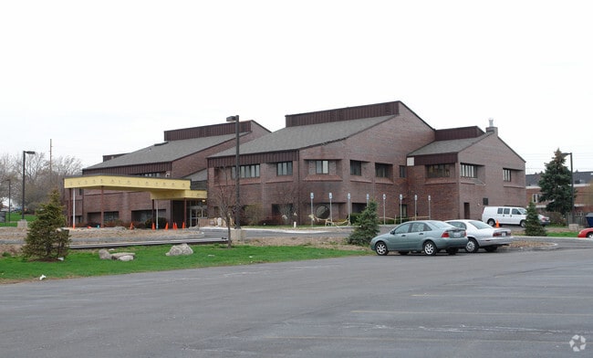
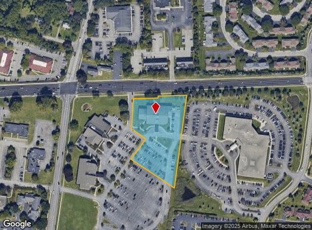
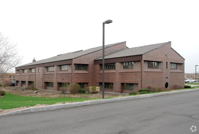
Property Record
979 Westfall Rd, Rochester, NY 14618
NEARBY LISTINGS FOR SALE OR LEASE
Property Detail
979 Westfall Rd
Rochester, NY
C W Associatiates Resubdivision
262000-136-190-0001-060-400
47-13-7 PARCEL 3 EDMUNDS FARM LM 228/6 SPLIT BY DEED 6451/195
Professionalbldglegalinsurancerealestateetc
Monroe
X
New York
36055C0351G
60.400
2025
2.67 AC
2024
South Central
012900
Rochester
28,616 SF
DEMOGRAPHICS near 979 Westfall Rd
1 Mile
3 Mile
5 Mile
2024 Total Population
7,078
99,525
256,902
2029 Population
6,990
98,173
253,027
Pop Growth 2024-2029
(1.24%)
(1.36%)
(1.51%)
Average Age
46
39
38
2024 Total Households
3,372
47,768
109,942
HH Growth 2024-2029
(1.57%)
(1.38%)
(1.55%)
Median Household Inc
$59,194
$59,357
$53,920
Avg Household Size
1.80
1.90
2.20
2024 Avg HH Vehicles
1.00
1.00
1.00
Median Home Value
$241,607
$197,857
$162,306
Median Year Built
1976
1951
1950
Nearby Places
Map Layers
Map Styles
 Street
 Aerial
- Restaurants
- Banks
- Shops
- Fitness
- Groceries
PUBLIC TRANSPORTATION
COMMUTER RAIL
DRIVE
WALK
Distance
10 min
3.9 mi
AIRPORT
Frederick Douglass/Greater Rochester International
DRIVE
WALK
Distance
Frederick Douglass/Greater Rochester International
10 min
4.6 mi
SALE & LEASE HISTORY
LISTING DATE
SALE/LEASE

Jan 18, 2018
For Lease
Nearby Properties
Address
Land Use
TOTAL SIZE
Lot Size
Zoning
Address
Land Use
TOTAL SIZE
Lot Size
Zoning
57,638 SF
227.96 AC
02 - SINGL
Address
Land Use
TOTAL SIZE
Lot Size
Zoning
173,649 SF
85.98 AC
Address
Land Use
TOTAL SIZE
Lot Size
Zoning
1,216,095 SF
22.89 AC
Address
Land Use
TOTAL SIZE
Lot Size
Zoning
Address
Land Use
TOTAL SIZE
Lot Size
Zoning
400,000 SF
43.50 AC
06 - INDUS
Address
Land Use
TOTAL SIZE
Lot Size
Zoning
60,120 SF
12.90 AC
Address
Land Use
TOTAL SIZE
Lot Size
Zoning
7,800 SF
166.42 AC
02 - SINGL
Address
Land Use
TOTAL SIZE
Lot Size
Zoning
1,878,160 SF
4.05 AC
Address
Land Use
TOTAL SIZE
Lot Size
Zoning
0.13 AC
Address
Land Use
TOTAL SIZE
Lot Size
Zoning
51,276 SF
48.95 AC
02 - SINGL
Address
Land Use
TOTAL SIZE
Lot Size
Zoning
01 - NOT Z
Address
Land Use
TOTAL SIZE
Lot Size
Zoning
Address
Land Use
TOTAL SIZE
Lot Size
Zoning
614,053 SF
9.30 AC
Address
Land Use
TOTAL SIZE
Lot Size
Zoning
01 - NOT Z
Address
Land Use
TOTAL SIZE
Lot Size
Zoning
330,090 SF
62.41 AC
Address
Land Use
TOTAL SIZE
Lot Size
Zoning
01 - NOT Z
Address
Land Use
TOTAL SIZE
Lot Size
Zoning
0.01 AC
Address
Land Use
TOTAL SIZE
Lot Size
Zoning
6,056 SF
37.65 AC
Address
Land Use
TOTAL SIZE
Lot Size
Zoning
01 - NOT Z
Address
Land Use
TOTAL SIZE
Lot Size
Zoning
128,539 SF
15.01 AC
Address
Land Use
TOTAL SIZE
Lot Size
Zoning
424,207 SF
39.50 AC
Address
Land Use
TOTAL SIZE
Lot Size
Zoning
Address
Land Use
TOTAL SIZE
Lot Size
Zoning
3.09 AC
02 - SINGL
Address
Land Use
TOTAL SIZE
Lot Size
Zoning
373,200 SF
5.42 AC
Address
Land Use
TOTAL SIZE
Lot Size
Zoning
01 - NOT Z
Address
Land Use
TOTAL SIZE
Lot Size
Zoning
0.01 AC
Address
Land Use
TOTAL SIZE
Lot Size
Zoning
302,484 SF
2.53 AC
Address
Land Use
TOTAL SIZE
Lot Size
Zoning
473,876 SF
1.49 AC
Address
Land Use
TOTAL SIZE
Lot Size
Zoning
342,266 SF
1.44 AC
Address
Land Use
TOTAL SIZE
Lot Size
Zoning
01 - NOT Z
The World's #1 Commercial Real Estate Marketplace
Connect with us
© 2026 CoStar Group
The information above has been obtained from sources believed reliable. While we do not doubt its accuracy we have not verified it and make no guarantee, warranty or representation about it. It is your responsibility to independently confirm its accuracy and completeness. Any projections, opinions, assumptions, or estimates used are for example only and do not represent the current or future performance of the property. The value of this transaction to you depends on tax and other factors which should be evaluated by your tax, financial, and legal advisors. You and your advisors should conduct a careful, independent investigation of the property to determine to your satisfaction the suitability of the property for your needs.