Property Record
9795 Perry Hwy, Wexford, PA 15090


NEARBY LISTINGS FOR SALE OR LEASE
Property Detail
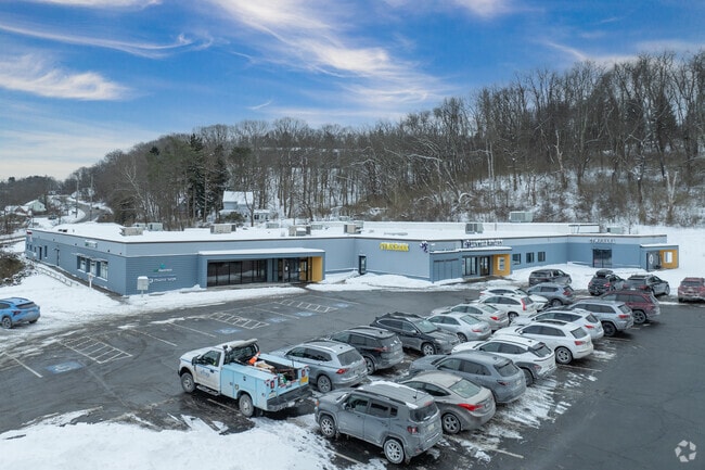
9795 Perry Hwy
Pittsburgh, PA
F
0944-F-00284-0000-00
LOT =52X10X202X73.5X174.42X30X78.14X30X229.14X205.14X435.15X 219.21X799.58
Regionalshoppingcenterormallwithanchorstore
Allegheny
AE
Pennsylvania
42003C0183H
284
2024
6.73 AC
2025
North Pittsburgh/Rte 19
413202
Pittsburgh
DEMOGRAPHICS near 9795 Perry Hwy
1 mile
3 mile
5 mile
2024 Total Population
5,695
43,649
105,903
2029 Population
5,496
42,371
102,860
Pop Growth 2024-2029
(3.49%)
(2.93%)
(2.87%)
Average Age
43
43
43
2024 Total Households
2,355
17,417
42,351
HH Growth 2024-2029
(3.61%)
(3.04%)
(3.03%)
Median Household Inc
$105,375
$109,606
$111,660
Avg Household Size
2.30
2.40
2.40
2024 Avg HH Vehicles
2.00
2.00
2.00
Median Home Value
$322,787
$316,128
$308,454
Median Year Built
1974
1976
1974
Nearby Places
Map Layers
Map Styles
 Street
 Aerial
Transit
 Traffic
 Biking
Places
Listings with unknown addresses are not visible on the map
- Restaurants
- Banks
- Shops
- Fitness
- Groceries
PUBLIC TRANSPORTATION
AIRPORT
Pittsburgh International
Drive
Walk
Distance
Pittsburgh International
33 min
16.8 mi
Freight Ports
Port of Toledo
Drive
Walk
Distance
Port of Toledo
252 min
220.0 mi
SALE & LEASE HISTORY
LISTING DATE
SALE/LEASE

Sep 24, 2016
For Lease
Jul 14, 2020
For Lease
Nearby Properties
Address
Land Use
TOTAL SIZE
Lot Size
Zoning
Address
Land Use
TOTAL SIZE
Lot Size
Zoning
117.63 AC
Address
Land Use
TOTAL SIZE
Lot Size
Zoning
24.94 AC
Address
Land Use
TOTAL SIZE
Lot Size
Zoning
43.72 AC
Address
Land Use
TOTAL SIZE
Lot Size
Zoning
1,296 SF
3,074.89 AC
Address
Land Use
TOTAL SIZE
Lot Size
Zoning
75.05 AC
Address
Land Use
TOTAL SIZE
Lot Size
Zoning
9.71 AC
Address
Land Use
TOTAL SIZE
Lot Size
Zoning
1,648 SF
43.30 AC
Address
Land Use
TOTAL SIZE
Lot Size
Zoning
113.59 AC
Address
Land Use
TOTAL SIZE
Lot Size
Zoning
21.56 AC
Address
Land Use
TOTAL SIZE
Lot Size
Zoning
10.51 AC
Address
Land Use
TOTAL SIZE
Lot Size
Zoning
19.62 AC
Address
Land Use
TOTAL SIZE
Lot Size
Zoning
15.05 AC
Address
Land Use
TOTAL SIZE
Lot Size
Zoning
4.51 AC
Address
Land Use
TOTAL SIZE
Lot Size
Zoning
Address
Land Use
TOTAL SIZE
Lot Size
Zoning
15.37 AC
Address
Land Use
TOTAL SIZE
Lot Size
Zoning
40.92 AC
Address
Land Use
TOTAL SIZE
Lot Size
Zoning
26.07 AC
Address
Land Use
TOTAL SIZE
Lot Size
Zoning
626 SF
51.78 AC
Address
Land Use
TOTAL SIZE
Lot Size
Zoning
Address
Land Use
TOTAL SIZE
Lot Size
Zoning
29.62 AC
Address
Land Use
TOTAL SIZE
Lot Size
Zoning
6.50 AC
Address
Land Use
TOTAL SIZE
Lot Size
Zoning
Address
Land Use
TOTAL SIZE
Lot Size
Zoning
Address
Land Use
TOTAL SIZE
Lot Size
Zoning
Address
Land Use
TOTAL SIZE
Lot Size
Zoning
7.21 AC
Address
Land Use
TOTAL SIZE
Lot Size
Zoning
Address
Land Use
TOTAL SIZE
Lot Size
Zoning
23.87 AC
Address
Land Use
TOTAL SIZE
Lot Size
Zoning
Address
Land Use
TOTAL SIZE
Lot Size
Zoning
5.08 AC
Address
Land Use
TOTAL SIZE
Lot Size
Zoning
The World's #1 Commercial Real Estate Marketplace
Connect with us
© 2026 CoStar Group
The information above has been obtained from sources believed reliable. While we do not doubt its accuracy we have not verified it and make no guarantee, warranty or representation about it. It is your responsibility to independently confirm its accuracy and completeness. Any projections, opinions, assumptions, or estimates used are for example only and do not represent the current or future performance of the property. The value of this transaction to you depends on tax and other factors which should be evaluated by your tax, financial, and legal advisors. You and your advisors should conduct a careful, independent investigation of the property to determine to your satisfaction the suitability of the property for your needs.