Property Record
9799 Base Line Rd, Rancho Cucamonga, CA 91730


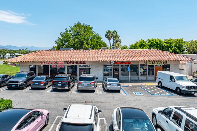
Property Detail
9799 Base Line Rd
1077-011-47
PARCEL MAP 4251 PARCEL 1
Storebuilding
San Bernardino
B and X Area of moderate flood hazard, usually the area between the limits of the 100-year and 500-year floods.
California
2025
0.37 AC
2025
Airport Area
002027
Inland Empire (California)
4,730 SF
Riverside-San Bernardino-Ontario, CA
NEARBY LISTINGS FOR SALE OR LEASE
DEMOGRAPHICS near 9799 Base Line Rd
1 mile
3 mile
5 mile
2025 Total Population
23,036
148,608
301,811
2030 Population
23,120
149,308
303,825
Pop Growth 2025-2030
+ 0.36%
+ 0.47%
+ 0.67%
Average Age
42
40
39
2025 Total Households
8,459
50,994
99,481
HH Growth 2025-2030
+ 0.33%
+ 0.46%
+ 0.71%
Median Household Inc
$93,382
$106,201
$106,244
Avg Household Size
2.70
2.80
2.90
2025 Avg HH Vehicles
2.00
2.00
2.00
Median Home Value
$681,034
$729,016
$741,129
Median Year Built
1980
1984
1983
Nearby Places
Map Layers
Map Styles
 Street
 Aerial
Layers
 Traffic
 Biking
Places
Listings with unknown addresses are not visible on the map
- Restaurants
- Banks
- Shops
- Fitness
- Groceries
PUBLIC TRANSPORTATION
COMMUTER RAIL
Rancho Cucamonga (San Bernardino Line - Southern California Regional Rail Authority (Metrolink))
Drive
Walk
Distance
Rancho Cucamonga (San Bernardino Line - Southern California Regional Rail Authority (Metrolink))
8 min
4.2 mi
Upland (San Bernardino Line - Southern California Regional Rail Authority (Metrolink))
Drive
Walk
Distance
Upland (San Bernardino Line - Southern California Regional Rail Authority (Metrolink))
10 min
4.7 mi
AIRPORT
Ontario International
Drive
Walk
Distance
Ontario International
10 min
5.0 mi
Freight Ports
Port of Long Beach
Drive
Walk
Distance
Port of Long Beach
71 min
57.3 mi
Nearby Properties
Address
Land Use
TOTAL SIZE
Lot Size
Zoning
Address
Land Use
TOTAL SIZE
Lot Size
Zoning
376,610 SF
25.22 AC
Address
Land Use
TOTAL SIZE
Lot Size
Zoning
293,860 SF
16.10 AC
Address
Land Use
TOTAL SIZE
Lot Size
Zoning
830,300 SF
39.99 AC
Address
Land Use
TOTAL SIZE
Lot Size
Zoning
190,724 SF
10.69 AC
Address
Land Use
TOTAL SIZE
Lot Size
Zoning
468,682 SF
19.40 AC
Address
Land Use
TOTAL SIZE
Lot Size
Zoning
174,092 SF
4.42 AC
Address
Land Use
TOTAL SIZE
Lot Size
Zoning
251,645 SF
4.50 AC
Address
Land Use
TOTAL SIZE
Lot Size
Zoning
401,226 SF
17.62 AC
Address
Land Use
TOTAL SIZE
Lot Size
Zoning
175,291 SF
9.44 AC
Address
Land Use
TOTAL SIZE
Lot Size
Zoning
502,917 SF
35.94 AC
Address
Land Use
TOTAL SIZE
Lot Size
Zoning
340,104 SF
8.95 AC
Address
Land Use
TOTAL SIZE
Lot Size
Zoning
249,672 SF
13.80 AC
Address
Land Use
TOTAL SIZE
Lot Size
Zoning
405,970 SF
19.23 AC
Address
Land Use
TOTAL SIZE
Lot Size
Zoning
139,059 SF
20.83 AC
Address
Land Use
TOTAL SIZE
Lot Size
Zoning
122,563 SF
5.76 AC
Address
Land Use
TOTAL SIZE
Lot Size
Zoning
225,727 SF
7.18 AC
Address
Land Use
TOTAL SIZE
Lot Size
Zoning
344,840 SF
14.67 AC
Address
Land Use
TOTAL SIZE
Lot Size
Zoning
354,616 SF
20.07 AC
Address
Land Use
TOTAL SIZE
Lot Size
Zoning
131,190 SF
6.71 AC
Address
Land Use
TOTAL SIZE
Lot Size
Zoning
468,410 SF
22.71 AC
Address
Land Use
TOTAL SIZE
Lot Size
Zoning
309,265 SF
18.65 AC
Address
Land Use
TOTAL SIZE
Lot Size
Zoning
443,300 SF
23.06 AC
Address
Land Use
TOTAL SIZE
Lot Size
Zoning
441,970 SF
20.58 AC
Address
Land Use
TOTAL SIZE
Lot Size
Zoning
331,872 SF
14.50 AC
Address
Land Use
TOTAL SIZE
Lot Size
Zoning
449,370 SF
21.05 AC
Address
Land Use
TOTAL SIZE
Lot Size
Zoning
156,900 SF
7.39 AC
Address
Land Use
TOTAL SIZE
Lot Size
Zoning
127,559 SF
5.63 AC
Address
Land Use
TOTAL SIZE
Lot Size
Zoning
324,131 SF
19.81 AC
Address
Land Use
TOTAL SIZE
Lot Size
Zoning
161,555 SF
8.25 AC
Address
Land Use
TOTAL SIZE
Lot Size
Zoning
95,240 SF
8.42 AC
The World's #1 Commercial Real Estate Marketplace
Connect with us
© 2026 CoStar Group
The information above has been obtained from sources believed reliable. While we do not doubt its accuracy we have not verified it and make no guarantee, warranty or representation about it. It is your responsibility to independently confirm its accuracy and completeness. Any projections, opinions, assumptions, or estimates used are for example only and do not represent the current or future performance of the property. The value of this transaction to you depends on tax and other factors which should be evaluated by your tax, financial, and legal advisors. You and your advisors should conduct a careful, independent investigation of the property to determine to your satisfaction the suitability of the property for your needs.