Property Record
98 Horseneck Rd, Westport, MA 02790
NEARBY LISTINGS FOR SALE OR LEASE
-
-
View all Westport listings for sale on LoopNet.com
Property Detail
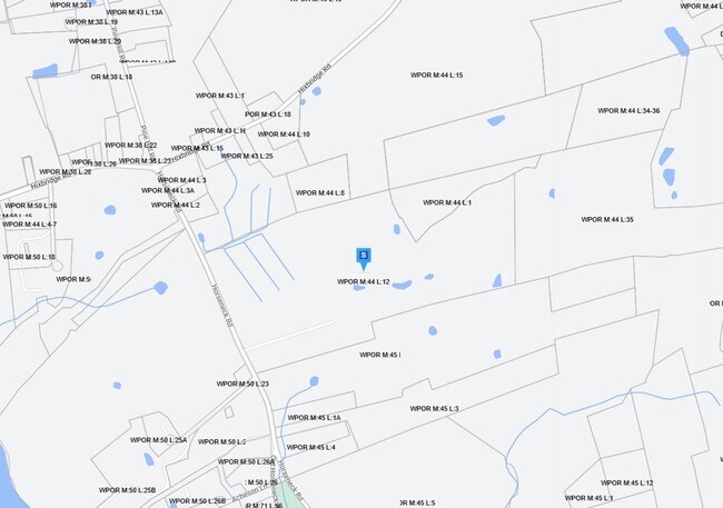
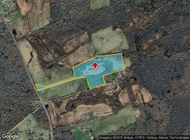
98 Horseneck Rd
WPOR-000044-000000-000012
Bristol
Agriculturalland
Massachusetts
X
12
25005C0458G
9.20 AC
2025
Attleboro/New Bedford
2025
Boston
646104
Providence-Warwick, RI-MA
15,455 SF
DEMOGRAPHICS near 98 Horseneck Rd
1 Mile
3 Mile
5 Mile
2024 Total Population
21,508
99,423
132,833
2029 Population
20,888
97,210
130,483
Pop Growth 2024-2029
(2.88%)
(2.23%)
(1.77%)
Average Age
41
40
41
2024 Total Households
9,160
41,154
54,534
HH Growth 2024-2029
(2.93%)
(2.28%)
(1.81%)
Median Household Inc
$55,238
$50,204
$57,064
Avg Household Size
2.30
2.30
2.30
2024 Avg HH Vehicles
1.00
1.00
2.00
Median Home Value
$300,287
$334,729
$346,481
Median Year Built
1947
1948
1949
Nearby Places
Map Layers
Map Styles
 Street
 Aerial
- Restaurants
- Banks
- Shops
- Fitness
- Groceries
PUBLIC TRANSPORTATION
AIRPORT
Rhode Island Tf Green International
DRIVE
WALK
Distance
Rhode Island Tf Green International
58 min
37.1 mi
Freight Ports
Port of New Bedford Harbor
DRIVE
WALK
Distance
Port of New Bedford Harbor
26 min
12.2 mi
Nearby Properties
Address
Land Use
TOTAL SIZE
Lot Size
Zoning
Address
Land Use
TOTAL SIZE
Lot Size
Zoning
473 AC
SRB
Address
Land Use
TOTAL SIZE
Lot Size
Zoning
885 SF
6.70 AC
R1
Address
Land Use
TOTAL SIZE
Lot Size
Zoning
42,756 SF
37.10 AC
R1
Address
Land Use
TOTAL SIZE
Lot Size
Zoning
50,922 SF
1.88 AC
R1
Address
Land Use
TOTAL SIZE
Lot Size
Zoning
74 AC
SRB
Address
Land Use
TOTAL SIZE
Lot Size
Zoning
45.52 AC
Address
Land Use
TOTAL SIZE
Lot Size
Zoning
7.82 AC
SRB
Address
Land Use
TOTAL SIZE
Lot Size
Zoning
9,622 SF
28 AC
E1
Address
Land Use
TOTAL SIZE
Lot Size
Zoning
2,244 SF
278.19 AC
SRB
Address
Land Use
TOTAL SIZE
Lot Size
Zoning
31.61 AC
R1
Address
Land Use
TOTAL SIZE
Lot Size
Zoning
2.70 AC
R1
Address
Land Use
TOTAL SIZE
Lot Size
Zoning
2,120 SF
224.43 AC
SRB
Address
Land Use
TOTAL SIZE
Lot Size
Zoning
5,172 SF
30 AC
HISTOR
Address
Land Use
TOTAL SIZE
Lot Size
Zoning
20.10 AC
R1
Address
Land Use
TOTAL SIZE
Lot Size
Zoning
2.73 AC
R1
Address
Land Use
TOTAL SIZE
Lot Size
Zoning
195.45 AC
SRB
Address
Land Use
TOTAL SIZE
Lot Size
Zoning
19.43 AC
HISTOR
Address
Land Use
TOTAL SIZE
Lot Size
Zoning
2.40 AC
R1
Address
Land Use
TOTAL SIZE
Lot Size
Zoning
2.59 AC
Address
Land Use
TOTAL SIZE
Lot Size
Zoning
2,381 SF
1.39 AC
R1
Address
Land Use
TOTAL SIZE
Lot Size
Zoning
2,221 SF
0.30 AC
HISTOR
Address
Land Use
TOTAL SIZE
Lot Size
Zoning
6.87 AC
SRB
Address
Land Use
TOTAL SIZE
Lot Size
Zoning
1,410 SF
65.80 AC
HISTOR
Address
Land Use
TOTAL SIZE
Lot Size
Zoning
0.71 AC
R1
Address
Land Use
TOTAL SIZE
Lot Size
Zoning
29.89 AC
HISTOR
Address
Land Use
TOTAL SIZE
Lot Size
Zoning
48.40 AC
R1
Address
Land Use
TOTAL SIZE
Lot Size
Zoning
1.38 AC
CEMETA
Address
Land Use
TOTAL SIZE
Lot Size
Zoning
7.60 AC
E1
Address
Land Use
TOTAL SIZE
Lot Size
Zoning
2 AC
R1
Address
Land Use
TOTAL SIZE
Lot Size
Zoning
19.38 AC
SRB
The World's #1 Commercial Real Estate Marketplace
Connect with us
© 2026 CoStar Group
The information above has been obtained from sources believed reliable. While we do not doubt its accuracy we have not verified it and make no guarantee, warranty or representation about it. It is your responsibility to independently confirm its accuracy and completeness. Any projections, opinions, assumptions, or estimates used are for example only and do not represent the current or future performance of the property. The value of this transaction to you depends on tax and other factors which should be evaluated by your tax, financial, and legal advisors. You and your advisors should conduct a careful, independent investigation of the property to determine to your satisfaction the suitability of the property for your needs.