Property Record
980 Derita Rd, Concord, NC 28027

NEARBY LISTINGS FOR SALE OR LEASE
-
-
View all Concord listings for lease on LoopNet.com
Property Detail
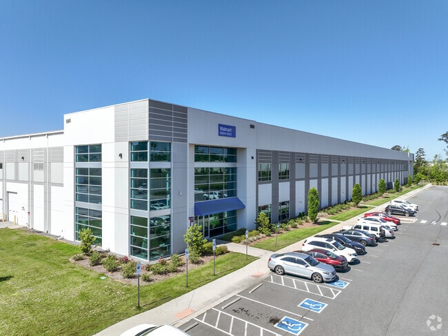
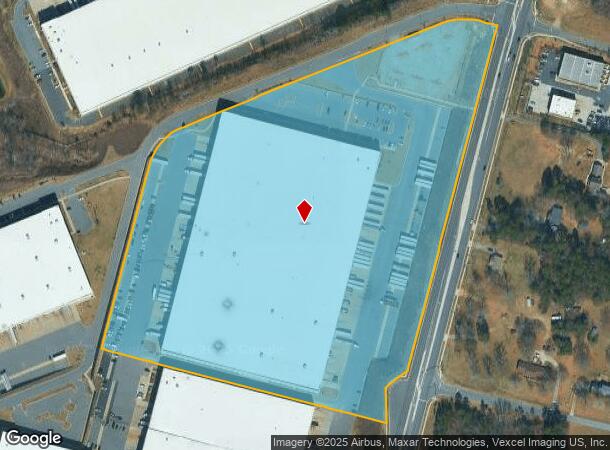
980 Derita Rd
Charlotte-Concord-Gastonia, NC-SC
Airport
4680-84-1853-0000
MAP2
Warehouse
Cabarrus
X
North Carolina
3710468000K
4
2025
22.94 AC
2025
Cabarrus County
041306
Charlotte
411,200 SF
DEMOGRAPHICS near 980 Derita Rd
1 Mile
3 Mile
5 Mile
2024 Total Population
2,190
47,295
113,634
2029 Population
2,450
52,614
125,010
Pop Growth 2024-2029
+ 11.87%
+ 11.25%
+ 10.01%
Average Age
36
37
37
2024 Total Households
778
16,953
41,949
HH Growth 2024-2029
+ 9.51%
+ 10.03%
+ 9.16%
Median Household Inc
$100,951
$104,275
$95,551
Avg Household Size
2.80
2.70
2.70
2024 Avg HH Vehicles
2.00
2.00
2.00
Median Home Value
$360,769
$345,504
$331,227
Median Year Built
2004
2005
2004
Nearby Places
Map Layers
Map Styles
 Street
 Aerial
- Restaurants
- Banks
- Shops
- Fitness
- Groceries
PUBLIC TRANSPORTATION
AIRPORT
Concord-Padgett Regional
DRIVE
WALK
Distance
Concord-Padgett Regional
6 min
1.7 mi
Charlotte/Douglas International
DRIVE
WALK
Distance
Charlotte/Douglas International
39 min
23.8 mi
SALE & LEASE HISTORY
LISTING DATE
SALE/LEASE

Feb 27, 2024
For Lease
Aug 22, 2017
For Lease
Nearby Properties
Address
Land Use
TOTAL SIZE
Lot Size
Zoning
Address
Land Use
TOTAL SIZE
Lot Size
Zoning
701,530 SF
143.45 AC
C-2
Address
Land Use
TOTAL SIZE
Lot Size
Zoning
381,490 SF
29.24 AC
C-2
Address
Land Use
TOTAL SIZE
Lot Size
Zoning
374,697 SF
12.46 AC
Address
Land Use
TOTAL SIZE
Lot Size
Zoning
324,349 SF
4.69 AC
C-2
Address
Land Use
TOTAL SIZE
Lot Size
Zoning
14,742 SF
587.28 AC
I-1
Address
Land Use
TOTAL SIZE
Lot Size
Zoning
375,242 SF
25.64 AC
CC
Address
Land Use
TOTAL SIZE
Lot Size
Zoning
23,940 SF
45.03 AC
C-1
Address
Land Use
TOTAL SIZE
Lot Size
Zoning
26,733 SF
48.78 AC
C-2
Address
Land Use
TOTAL SIZE
Lot Size
Zoning
29,658 SF
17.25 AC
MX-IB
Address
Land Use
TOTAL SIZE
Lot Size
Zoning
146,501 SF
78.92 AC
O-I
Address
Land Use
TOTAL SIZE
Lot Size
Zoning
29,424 SF
22.77 AC
CD
Address
Land Use
TOTAL SIZE
Lot Size
Zoning
30,586 SF
54.10 AC
C-2
Address
Land Use
TOTAL SIZE
Lot Size
Zoning
57,268 SF
25.88 AC
C-2
Address
Land Use
TOTAL SIZE
Lot Size
Zoning
31,248 SF
21.72 AC
C-2
Address
Land Use
TOTAL SIZE
Lot Size
Zoning
276,620 SF
19.76 AC
R3
Address
Land Use
TOTAL SIZE
Lot Size
Zoning
43,005 SF
97.30 AC
RM-2
Address
Land Use
TOTAL SIZE
Lot Size
Zoning
330,544 SF
54.39 AC
CD
Address
Land Use
TOTAL SIZE
Lot Size
Zoning
62,780 SF
21.89 AC
Address
Land Use
TOTAL SIZE
Lot Size
Zoning
289,262 SF
14.50 AC
CC
Address
Land Use
TOTAL SIZE
Lot Size
Zoning
22,198 SF
18.46 AC
C-2
Address
Land Use
TOTAL SIZE
Lot Size
Zoning
30,360 SF
17.59 AC
CD-R
Address
Land Use
TOTAL SIZE
Lot Size
Zoning
30,682 SF
24.33 AC
LDR
Address
Land Use
TOTAL SIZE
Lot Size
Zoning
30,108 SF
42.53 AC
CD
Address
Land Use
TOTAL SIZE
Lot Size
Zoning
249,618 SF
63.24 AC
RL
Address
Land Use
TOTAL SIZE
Lot Size
Zoning
600,000 SF
27.59 AC
I-2-CD
Address
Land Use
TOTAL SIZE
Lot Size
Zoning
190,305 SF
7.20 AC
CC
Address
Land Use
TOTAL SIZE
Lot Size
Zoning
210,190 SF
10.87 AC
CC
Address
Land Use
TOTAL SIZE
Lot Size
Zoning
55,158 SF
63.68 AC
O-I
Address
Land Use
TOTAL SIZE
Lot Size
Zoning
360,209 SF
24.50 AC
CD
Address
Land Use
TOTAL SIZE
Lot Size
Zoning
443,944 SF
33.24 AC
CD-I-2
The World's #1 Commercial Real Estate Marketplace
Connect with us
© 2025 CoStar Group
The information above has been obtained from sources believed reliable. While we do not doubt its accuracy we have not verified it and make no guarantee, warranty or representation about it. It is your responsibility to independently confirm its accuracy and completeness. Any projections, opinions, assumptions, or estimates used are for example only and do not represent the current or future performance of the property. The value of this transaction to you depends on tax and other factors which should be evaluated by your tax, financial, and legal advisors. You and your advisors should conduct a careful, independent investigation of the property to determine to your satisfaction the suitability of the property for your needs.