Property Record
980 Highway 287 N, Mansfield, TX 76063

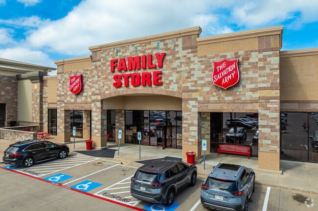
Property Detail
980 Highway 287 N
Dallas-Fort Worth-Arlington, TX
MANSFIELD COMMONS ADDITION LOT 4
07875592
TARRANT
Commercialnec
Texas
AE The base floodplain where base flood elevations are provided. AE Zones are now used on new format FIRMs instead of A1-A30 Zones.
4
2024
5.76 AC
2025
SE Outlying Tarrant
111312
Dallas/Ft Worth
56,646 SF
NEARBY LISTINGS FOR SALE OR LEASE
DEMOGRAPHICS near 980 Highway 287 N
1 mile
3 mile
5 mile
2025 Total Population
7,905
79,968
185,726
2030 Population
8,422
84,982
197,474
Pop Growth 2025-2030
+ 6.54%
+ 6.27%
+ 6.33%
Average Age
41
38
37
2025 Total Households
2,910
26,189
59,630
HH Growth 2025-2030
+ 6.74%
+ 6.52%
+ 6.55%
Median Household Inc
$91,110
$108,466
$108,955
Avg Household Size
2.60
3.00
3.10
2025 Avg HH Vehicles
2.00
2.00
2.00
Median Home Value
$379,969
$384,202
$378,924
Median Year Built
1993
2003
2003
Nearby Places
Map Layers
Map Styles
 Street
 Aerial
Layers
 Traffic
 Biking
Places
Listings with unknown addresses are not visible on the map
- Restaurants
- Banks
- Shops
- Fitness
- Groceries
PUBLIC TRANSPORTATION
AIRPORT
Dallas-Fort Worth International
Drive
Walk
Distance
Dallas-Fort Worth International
38 min
26.0 mi
Dallas Love Field
Drive
Walk
Distance
Dallas Love Field
49 min
34.6 mi
Freight Ports
Port of Shreveport
Drive
Walk
Distance
Port of Shreveport
240 min
220.3 mi
SALE & LEASE HISTORY
LISTING DATE
SALE/LEASE

Sep 25, 2016
For Lease
Feb 16, 2022
For Lease
Apr 27, 2022
For Lease
Nearby Properties
Address
Land Use
TOTAL SIZE
Lot Size
Zoning
Address
Land Use
TOTAL SIZE
Lot Size
Zoning
565,115 SF
27.71 AC
Address
Land Use
TOTAL SIZE
Lot Size
Zoning
512,471 SF
69.41 AC
Address
Land Use
TOTAL SIZE
Lot Size
Zoning
426,667 SF
12.87 AC
Address
Land Use
TOTAL SIZE
Lot Size
Zoning
339,196 SF
12.48 AC
Address
Land Use
TOTAL SIZE
Lot Size
Zoning
348,951 SF
18.66 AC
Address
Land Use
TOTAL SIZE
Lot Size
Zoning
317,142 SF
11.40 AC
Address
Land Use
TOTAL SIZE
Lot Size
Zoning
160,000 SF
26.90 AC
Address
Land Use
TOTAL SIZE
Lot Size
Zoning
413,000 SF
19.16 AC
Address
Land Use
TOTAL SIZE
Lot Size
Zoning
298,988 SF
7.16 AC
Address
Land Use
TOTAL SIZE
Lot Size
Zoning
273,381 SF
8.32 AC
Address
Land Use
TOTAL SIZE
Lot Size
Zoning
276,467 SF
7.61 AC
Address
Land Use
TOTAL SIZE
Lot Size
Zoning
246,204 SF
15.16 AC
Address
Land Use
TOTAL SIZE
Lot Size
Zoning
249,922 SF
17.26 AC
Address
Land Use
TOTAL SIZE
Lot Size
Zoning
255,134 SF
21.62 AC
Address
Land Use
TOTAL SIZE
Lot Size
Zoning
79,330 SF
23.78 AC
Address
Land Use
TOTAL SIZE
Lot Size
Zoning
353,016 SF
8.08 AC
Address
Land Use
TOTAL SIZE
Lot Size
Zoning
209,307 SF
15.34 AC
Address
Land Use
TOTAL SIZE
Lot Size
Zoning
724,286 SF
48.41 AC
Address
Land Use
TOTAL SIZE
Lot Size
Zoning
208,630 SF
8.62 AC
Address
Land Use
TOTAL SIZE
Lot Size
Zoning
231,551 SF
25.69 AC
Address
Land Use
TOTAL SIZE
Lot Size
Zoning
171,820 SF
59.63 AC
Address
Land Use
TOTAL SIZE
Lot Size
Zoning
98,664 SF
5.47 AC
Address
Land Use
TOTAL SIZE
Lot Size
Zoning
234,580 SF
65.82 AC
Address
Land Use
TOTAL SIZE
Lot Size
Zoning
200,443 SF
14.01 AC
Address
Land Use
TOTAL SIZE
Lot Size
Zoning
234,051 SF
5.37 AC
Address
Land Use
TOTAL SIZE
Lot Size
Zoning
Address
Land Use
TOTAL SIZE
Lot Size
Zoning
229,168 SF
6.13 AC
Address
Land Use
TOTAL SIZE
Lot Size
Zoning
318,000 SF
19.93 AC
Address
Land Use
TOTAL SIZE
Lot Size
Zoning
359,397 SF
17.31 AC
Address
Land Use
TOTAL SIZE
Lot Size
Zoning
149,494 SF
3.73 AC
The World's #1 Commercial Real Estate Marketplace
Connect with us
© 2026 CoStar Group
The information above has been obtained from sources believed reliable. While we do not doubt its accuracy we have not verified it and make no guarantee, warranty or representation about it. It is your responsibility to independently confirm its accuracy and completeness. Any projections, opinions, assumptions, or estimates used are for example only and do not represent the current or future performance of the property. The value of this transaction to you depends on tax and other factors which should be evaluated by your tax, financial, and legal advisors. You and your advisors should conduct a careful, independent investigation of the property to determine to your satisfaction the suitability of the property for your needs.