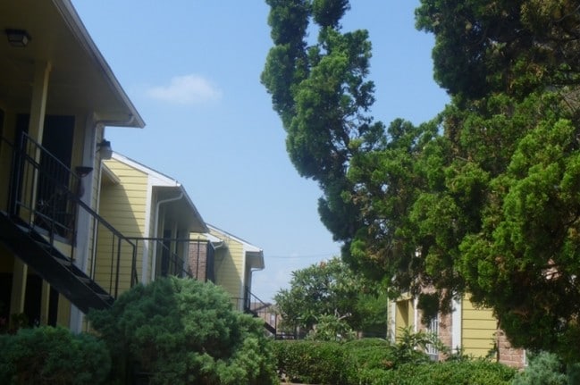
Property Record
9800 Braeburn Glen Blvd, Houston, TX 77074


NEARBY LISTINGS FOR SALE OR LEASE
Property Detail
9800 Braeburn Glen Blvd
1051770000028
Century Village
Apartment
RES A1 CENTURY VILLAGE
AE
Harris
48201C0845M
Texas
2024
1.89 AC
2025
Braeburn
423100
Houston
41,121 SF
Houston-The Woodlands-Sugar Land, TX
DEMOGRAPHICS near 9800 Braeburn Glen Blvd
1 Mile
3 Mile
5 Mile
2024 Total Population
22,488
224,163
530,039
2029 Population
23,419
229,499
549,678
Pop Growth 2024-2029
+ 4.14%
+ 2.38%
+ 3.71%
Average Age
34
36
36
2024 Total Households
8,266
79,618
195,969
HH Growth 2024-2029
+ 4.04%
+ 2.30%
+ 3.72%
Median Household Inc
$34,739
$39,597
$43,896
Avg Household Size
2.60
2.70
2.60
2024 Avg HH Vehicles
1.00
1.00
2.00
Median Home Value
$170,550
$199,500
$211,034
Median Year Built
1977
1977
1978
Nearby Places
Map Layers
Map Styles
 Street
 Aerial
- Restaurants
- Banks
- Shops
- Fitness
- Groceries
PUBLIC TRANSPORTATION
AIRPORT
William P Hobby
DRIVE
WALK
Distance
William P Hobby
35 min
22.0 mi
George Bush Intcntl/Houston
DRIVE
WALK
Distance
George Bush Intcntl/Houston
42 min
32.7 mi
Freight Ports
Port of Houston
DRIVE
WALK
Distance
Port of Houston
33 min
20.1 mi
SALE & LEASE HISTORY
LISTING DATE
SALE/LEASE

Jun 14, 2024
For Sale
Nearby Properties
Address
Land Use
TOTAL SIZE
Lot Size
Zoning
Address
Land Use
TOTAL SIZE
Lot Size
Zoning
627,632 SF
24.12 AC
Address
Land Use
TOTAL SIZE
Lot Size
Zoning
816,006 SF
40.26 AC
Address
Land Use
TOTAL SIZE
Lot Size
Zoning
188,178 SF
18.49 AC
Address
Land Use
TOTAL SIZE
Lot Size
Zoning
539,308 SF
21 AC
Address
Land Use
TOTAL SIZE
Lot Size
Zoning
183,015 SF
9.91 AC
Address
Land Use
TOTAL SIZE
Lot Size
Zoning
456,076 SF
19.09 AC
Address
Land Use
TOTAL SIZE
Lot Size
Zoning
322,894 SF
17.51 AC
Address
Land Use
TOTAL SIZE
Lot Size
Zoning
304,006 SF
11.14 AC
Address
Land Use
TOTAL SIZE
Lot Size
Zoning
623,343 SF
22.89 AC
Address
Land Use
TOTAL SIZE
Lot Size
Zoning
355,887 SF
13.89 AC
Address
Land Use
TOTAL SIZE
Lot Size
Zoning
391,473 SF
17.11 AC
Address
Land Use
TOTAL SIZE
Lot Size
Zoning
434,744 SF
16.74 AC
Address
Land Use
TOTAL SIZE
Lot Size
Zoning
364,674 SF
13.79 AC
Address
Land Use
TOTAL SIZE
Lot Size
Zoning
307,488 SF
11 AC
Address
Land Use
TOTAL SIZE
Lot Size
Zoning
256,810 SF
22.65 AC
Address
Land Use
TOTAL SIZE
Lot Size
Zoning
349,982 SF
18.44 AC
Address
Land Use
TOTAL SIZE
Lot Size
Zoning
443,535 SF
13.14 AC
Address
Land Use
TOTAL SIZE
Lot Size
Zoning
352,526 SF
11.50 AC
Address
Land Use
TOTAL SIZE
Lot Size
Zoning
240,853 SF
19.07 AC
Address
Land Use
TOTAL SIZE
Lot Size
Zoning
280,253 SF
12.54 AC
Address
Land Use
TOTAL SIZE
Lot Size
Zoning
272,600 SF
7.13 AC
Address
Land Use
TOTAL SIZE
Lot Size
Zoning
292,235 SF
9.78 AC
Address
Land Use
TOTAL SIZE
Lot Size
Zoning
341,127 SF
10 AC
Address
Land Use
TOTAL SIZE
Lot Size
Zoning
89,524 SF
19.94 AC
Address
Land Use
TOTAL SIZE
Lot Size
Zoning
192,093 SF
15.66 AC
Address
Land Use
TOTAL SIZE
Lot Size
Zoning
362,942 SF
16.30 AC
Address
Land Use
TOTAL SIZE
Lot Size
Zoning
282,897 SF
11.41 AC
Address
Land Use
TOTAL SIZE
Lot Size
Zoning
450,647 SF
23.98 AC
Address
Land Use
TOTAL SIZE
Lot Size
Zoning
361,496 SF
15.95 AC
Address
Land Use
TOTAL SIZE
Lot Size
Zoning
273,920 SF
17.16 AC
QSY
The World's #1 Commercial Real Estate Marketplace
Connect with us
© 2026 CoStar Group
The information above has been obtained from sources believed reliable. While we do not doubt its accuracy we have not verified it and make no guarantee, warranty or representation about it. It is your responsibility to independently confirm its accuracy and completeness. Any projections, opinions, assumptions, or estimates used are for example only and do not represent the current or future performance of the property. The value of this transaction to you depends on tax and other factors which should be evaluated by your tax, financial, and legal advisors. You and your advisors should conduct a careful, independent investigation of the property to determine to your satisfaction the suitability of the property for your needs.