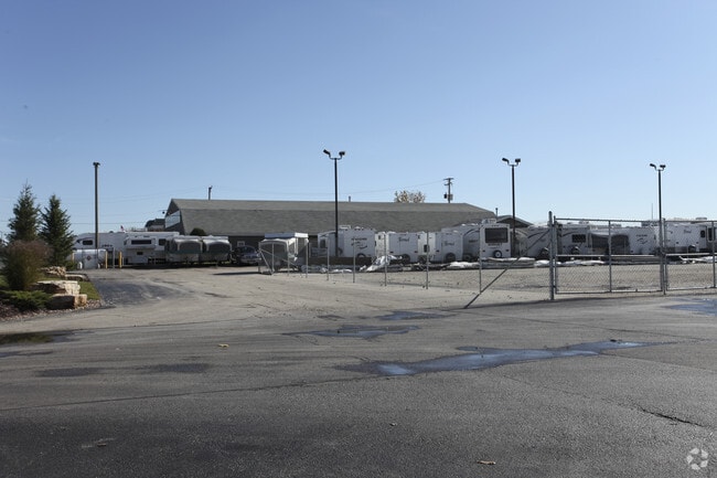
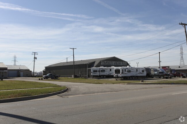
Property Record
9801 191St St, Mokena, IL 60448

NEARBY LISTINGS FOR SALE OR LEASE
Property Detail
9801 191St St
19-09-09-200-020
Clear Vue Corporate Center
Commercialnec
THE W 160 FT OF THE E 370 FT OF THE N 534 FT OF THE NW1/4 NE1/4 OF SEC 9, T35N-R12E. (EX THT PRT THEREOF LYING WITHIN THE ROW
X
Will
17197C0211G
Illinois
2024
1.76 AC
2024
Joliet Area
883522
Chicago
7,064 SF
Chicago-Naperville-Elgin, IL-IN
DEMOGRAPHICS near 9801 191St St
1 mile
3 mile
5 mile
2024 Total Population
5,394
58,344
148,553
2029 Population
5,363
57,519
145,984
Pop Growth 2024-2029
(0.57%)
(1.41%)
(1.73%)
Average Age
42
43
43
2024 Total Households
1,911
20,957
54,776
HH Growth 2024-2029
(0.52%)
(1.53%)
(2.02%)
Median Household Inc
$117,802
$114,980
$103,092
Avg Household Size
2.80
2.70
2.70
2024 Avg HH Vehicles
2.00
2.00
2.00
Median Home Value
$329,358
$333,833
$312,181
Median Year Built
1995
1994
1991
Nearby Places
Map Layers
Map Styles
 Street
 Aerial
Transit
 Traffic
 Biking
Places
Listings with unknown addresses are not visible on the map
- Restaurants
- Banks
- Shops
- Fitness
- Groceries
PUBLIC TRANSPORTATION
COMMUTER RAIL
Drive
Walk
Distance
4 min
20 min
1.0 mi
Mokena/Front Street Station (Rock Island District Line - Northeast Illinois Regional Commuter Railroad (Metra))
Drive
Walk
Distance
Mokena/Front Street Station (Rock Island District Line - Northeast Illinois Regional Commuter Railroad (Metra))
7 min
2.8 mi
AIRPORT
Chicago Midway International
Drive
Walk
Distance
Chicago Midway International
36 min
22.9 mi
Chicago O'Hare International
Drive
Walk
Distance
Chicago O'Hare International
56 min
33.3 mi
Nearby Properties
Address
Land Use
TOTAL SIZE
Lot Size
Zoning
Address
Land Use
TOTAL SIZE
Lot Size
Zoning
68,954 SF
Address
Land Use
TOTAL SIZE
Lot Size
Zoning
30.10 AC
Address
Land Use
TOTAL SIZE
Lot Size
Zoning
Address
Land Use
TOTAL SIZE
Lot Size
Zoning
111,100 SF
8.87 AC
Address
Land Use
TOTAL SIZE
Lot Size
Zoning
103,663 SF
13.06 AC
Address
Land Use
TOTAL SIZE
Lot Size
Zoning
79,455 SF
5.36 AC
Address
Land Use
TOTAL SIZE
Lot Size
Zoning
304,608 SF
19.51 AC
Address
Land Use
TOTAL SIZE
Lot Size
Zoning
238,068 SF
13.96 AC
Address
Land Use
TOTAL SIZE
Lot Size
Zoning
200,815 SF
10 AC
Address
Land Use
TOTAL SIZE
Lot Size
Zoning
603,729 SF
Address
Land Use
TOTAL SIZE
Lot Size
Zoning
216,900 SF
10.11 AC
Address
Land Use
TOTAL SIZE
Lot Size
Zoning
Address
Land Use
TOTAL SIZE
Lot Size
Zoning
23.67 AC
Address
Land Use
TOTAL SIZE
Lot Size
Zoning
8.50 AC
Address
Land Use
TOTAL SIZE
Lot Size
Zoning
77,290 SF
10.23 AC
Address
Land Use
TOTAL SIZE
Lot Size
Zoning
92,499 SF
5.29 AC
Address
Land Use
TOTAL SIZE
Lot Size
Zoning
113,474 SF
19.83 AC
Address
Land Use
TOTAL SIZE
Lot Size
Zoning
77,779 SF
1.65 AC
Address
Land Use
TOTAL SIZE
Lot Size
Zoning
106,359 SF
8.25 AC
Address
Land Use
TOTAL SIZE
Lot Size
Zoning
126,480 SF
10.58 AC
Address
Land Use
TOTAL SIZE
Lot Size
Zoning
8.76 AC
Address
Land Use
TOTAL SIZE
Lot Size
Zoning
8,826 SF
61.49 AC
Address
Land Use
TOTAL SIZE
Lot Size
Zoning
113,936 SF
6.96 AC
Address
Land Use
TOTAL SIZE
Lot Size
Zoning
63,239 SF
9.25 AC
Address
Land Use
TOTAL SIZE
Lot Size
Zoning
53,072 SF
0.63 AC
Address
Land Use
TOTAL SIZE
Lot Size
Zoning
97,318 SF
9.80 AC
Address
Land Use
TOTAL SIZE
Lot Size
Zoning
125,016 SF
6.63 AC
Address
Land Use
TOTAL SIZE
Lot Size
Zoning
4.62 AC
Address
Land Use
TOTAL SIZE
Lot Size
Zoning
48,238 SF
5.17 AC
Address
Land Use
TOTAL SIZE
Lot Size
Zoning
143,821 SF
4.80 AC
The World's #1 Commercial Real Estate Marketplace
Connect with us
© 2026 CoStar Group
The information above has been obtained from sources believed reliable. While we do not doubt its accuracy we have not verified it and make no guarantee, warranty or representation about it. It is your responsibility to independently confirm its accuracy and completeness. Any projections, opinions, assumptions, or estimates used are for example only and do not represent the current or future performance of the property. The value of this transaction to you depends on tax and other factors which should be evaluated by your tax, financial, and legal advisors. You and your advisors should conduct a careful, independent investigation of the property to determine to your satisfaction the suitability of the property for your needs.