Property Record
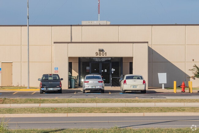
9801 N Kelley Ave, Oklahoma City, OK 73131


NEARBY LISTINGS FOR SALE OR LEASE
Property Detail
9801 N Kelley Ave
134777200
Lombardy Heights Add
Commercialnec
LOMBARDY HEIGHTS ADD 000 000 PT BLKS 13 & 14 BEG 70FT S NE/C BLK 13 TH S245.01FT W600FT N630.01FT E250FT S385FT E350FT TO BEG & A TR BEG NE/C BLK 14 TH S35FT W350FT N35FT E350FT TO BEG PLUS PT OF VACATED NEIL AVE BEG SW/C BLK 13 TH W30FT N364.01FT E3
X
Oklahoma
40109C0178J
Oklahoma
2023
6.13 AC
2024
Northeast
108301
Oklahoma City
68,287 SF
Oklahoma City, OK
DEMOGRAPHICS near 9801 N Kelley Ave
1 Mile
3 Mile
5 Mile
2024 Total Population
922
30,504
131,105
2029 Population
937
31,424
134,423
Pop Growth 2024-2029
+ 1.63%
+ 3.02%
+ 2.53%
Average Age
39
37
39
2024 Total Households
347
12,854
58,796
HH Growth 2024-2029
+ 1.73%
+ 3.15%
+ 2.71%
Median Household Inc
$37,500
$50,397
$57,985
Avg Household Size
2.50
2.30
2.10
2024 Avg HH Vehicles
2.00
2.00
2.00
Median Home Value
$211,309
$166,128
$217,169
Median Year Built
1974
1975
1977
Nearby Places
Map Layers
Map Styles
 Street
 Aerial
- Restaurants
- Banks
- Shops
- Fitness
- Groceries
PUBLIC TRANSPORTATION
COMMUTER RAIL
Oklahoma City (Heartland Flyer - Amtrak)
DRIVE
WALK
Distance
Oklahoma City (Heartland Flyer - Amtrak)
13 min
8.6 mi
AIRPORT
Will Rogers World
DRIVE
WALK
Distance
Will Rogers World
29 min
17.4 mi
Freight Ports
Tulsa Port Of Catoosa
DRIVE
WALK
Distance
Tulsa Port Of Catoosa
128 min
117.5 mi
Nearby Properties
Address
Land Use
TOTAL SIZE
Lot Size
Zoning
Address
Land Use
TOTAL SIZE
Lot Size
Zoning
233,053 SF
18.93 AC
O-2
Address
Land Use
TOTAL SIZE
Lot Size
Zoning
777,727 SF
54.25 AC
I-2
Address
Land Use
TOTAL SIZE
Lot Size
Zoning
469,063 SF
71.44 AC
I-2
Address
Land Use
TOTAL SIZE
Lot Size
Zoning
294,583 SF
20.14 AC
PUD
Address
Land Use
TOTAL SIZE
Lot Size
Zoning
93,244 SF
7.54 AC
PUD
Address
Land Use
TOTAL SIZE
Lot Size
Zoning
399,688 SF
80.57 AC
PUD
Address
Land Use
TOTAL SIZE
Lot Size
Zoning
241,874 SF
36.89 AC
PUD
Address
Land Use
TOTAL SIZE
Lot Size
Zoning
258,381 SF
2.54 AC
PUD
Address
Land Use
TOTAL SIZE
Lot Size
Zoning
254,126 SF
2.11 AC
SPUD
Address
Land Use
TOTAL SIZE
Lot Size
Zoning
105,426 SF
15.58 AC
O-2
Address
Land Use
TOTAL SIZE
Lot Size
Zoning
13,101 SF
1.22 AC
PUD
Address
Land Use
TOTAL SIZE
Lot Size
Zoning
43,489 SF
14.86 AC
PUD
Address
Land Use
TOTAL SIZE
Lot Size
Zoning
21,000 SF
2.64 AC
I-1
Address
Land Use
TOTAL SIZE
Lot Size
Zoning
280,970 SF
24.32 AC
Address
Land Use
TOTAL SIZE
Lot Size
Zoning
242,907 SF
I-2
Address
Land Use
TOTAL SIZE
Lot Size
Zoning
574,062 SF
57.69 AC
I-2
Address
Land Use
TOTAL SIZE
Lot Size
Zoning
160,389 SF
16.48 AC
PUD
Address
Land Use
TOTAL SIZE
Lot Size
Zoning
145,124 SF
55 AC
PUD
Address
Land Use
TOTAL SIZE
Lot Size
Zoning
436,316 SF
5.23 AC
I-1
Address
Land Use
TOTAL SIZE
Lot Size
Zoning
39,800 SF
4.10 AC
PUD
Address
Land Use
TOTAL SIZE
Lot Size
Zoning
316,358 SF
39.39 AC
PUD
Address
Land Use
TOTAL SIZE
Lot Size
Zoning
113,781 SF
14.06 AC
Address
Land Use
TOTAL SIZE
Lot Size
Zoning
570,717 SF
44 AC
I-2
Address
Land Use
TOTAL SIZE
Lot Size
Zoning
1 SF
3.72 AC
C-3
Address
Land Use
TOTAL SIZE
Lot Size
Zoning
59,307 SF
3.75 AC
PUD
Address
Land Use
TOTAL SIZE
Lot Size
Zoning
198,422 SF
4.17 AC
O-2
Address
Land Use
TOTAL SIZE
Lot Size
Zoning
160,816 SF
16.14 AC
Address
Land Use
TOTAL SIZE
Lot Size
Zoning
39,883 SF
2.35 AC
PUD
Address
Land Use
TOTAL SIZE
Lot Size
Zoning
70,284 SF
9.40 AC
PUD
The World's #1 Commercial Real Estate Marketplace
Connect with us
© 2026 CoStar Group
The information above has been obtained from sources believed reliable. While we do not doubt its accuracy we have not verified it and make no guarantee, warranty or representation about it. It is your responsibility to independently confirm its accuracy and completeness. Any projections, opinions, assumptions, or estimates used are for example only and do not represent the current or future performance of the property. The value of this transaction to you depends on tax and other factors which should be evaluated by your tax, financial, and legal advisors. You and your advisors should conduct a careful, independent investigation of the property to determine to your satisfaction the suitability of the property for your needs.