Property Record
9810 W Flight Dr, Spokane, WA 99224
NEARBY LISTINGS FOR SALE OR LEASE
-
-
View all Spokane listings for sale on LoopNet.com
Property Detail
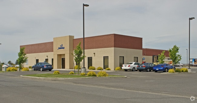
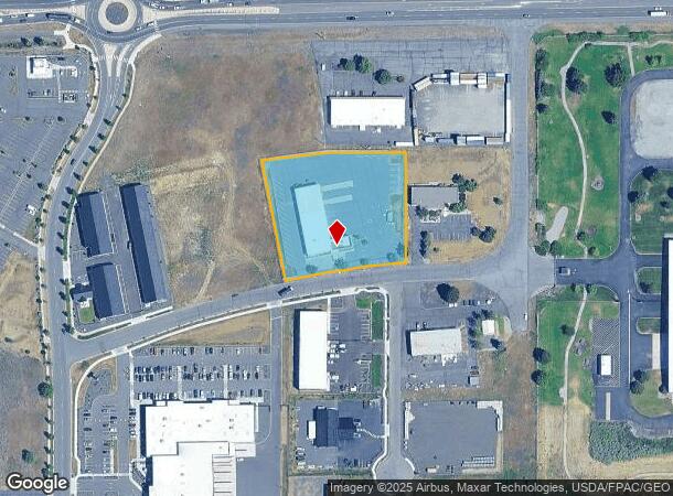
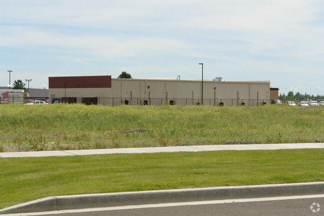
9810 W Flight Dr
Spokane-Spokane Valley, WA
Airport Village
25301.0239
30-25-42 NE: THAT PTN OF LOT 2, BLOCK 1, AIRPORT VILLAGE DAF: BEGINNING AT THE SE CORNER OF SAID LOT 2; THENCE ON A CURVE TO THE LEFT, HAVING A TANGENT BEARING OF S820603W, A CENTRAL ANGLE OF 030550, A RADIUS OF 2774.74 FT, A DISTANCE OF 150.00 FT; T
Wholesaleoutletdiscountstore
Spokane
X
Washington
53063C0525D
2
0
2.05 AC
2025
West Plains
013700
Spokane
11,538 SF
DEMOGRAPHICS near 9810 W Flight Dr
1 Mile
3 Mile
5 Mile
2024 Total Population
6,015
15,485
37,366
2029 Population
6,333
16,708
40,244
Pop Growth 2024-2029
+ 5.29%
+ 7.90%
+ 7.70%
Average Age
39
37
38
2024 Total Households
1,720
5,237
14,383
HH Growth 2024-2029
+ 5.70%
+ 8.25%
+ 8.07%
Median Household Inc
$61,239
$61,227
$62,710
Avg Household Size
2.30
2.50
2.40
2024 Avg HH Vehicles
2.00
2.00
2.00
Median Home Value
$462,595
$321,486
$338,864
Median Year Built
2007
2006
1998
Nearby Places
Map Layers
Map Styles
 Street
 Aerial
- Restaurants
- Banks
- Shops
- Fitness
- Groceries
PUBLIC TRANSPORTATION
COMMUTER RAIL
DRIVE
WALK
Distance
13 min
7.7 mi
AIRPORT
Spokane International
DRIVE
WALK
Distance
Spokane International
9 min
4.0 mi
SALE & LEASE HISTORY
LISTING DATE
SALE/LEASE

Sep 21, 2023
For Sale
Nearby Properties
Address
Land Use
TOTAL SIZE
Lot Size
Zoning
Address
Land Use
TOTAL SIZE
Lot Size
Zoning
2,689,133 SF
79.07 AC
LI
Address
Land Use
TOTAL SIZE
Lot Size
Zoning
884,262 SF
152.68 AC
PUBLIC
Address
Land Use
TOTAL SIZE
Lot Size
Zoning
702,957 SF
277.93 AC
Address
Land Use
TOTAL SIZE
Lot Size
Zoning
1,180,186 SF
22.94 AC
TRIBAL
Address
Land Use
TOTAL SIZE
Lot Size
Zoning
808,710 SF
646.44 AC
Address
Land Use
TOTAL SIZE
Lot Size
Zoning
534,093 SF
113 AC
TRIBAL
Address
Land Use
TOTAL SIZE
Lot Size
Zoning
375,237 SF
138.63 AC
TRIBAL
Address
Land Use
TOTAL SIZE
Lot Size
Zoning
118,996 SF
8.21 AC
LI
Address
Land Use
TOTAL SIZE
Lot Size
Zoning
274,308 SF
13 AC
R-3
Address
Land Use
TOTAL SIZE
Lot Size
Zoning
191,286 SF
10.81 AC
R-3
Address
Land Use
TOTAL SIZE
Lot Size
Zoning
218,400 SF
14.69 AC
Address
Land Use
TOTAL SIZE
Lot Size
Zoning
187,000 SF
12.43 AC
I-2
Address
Land Use
TOTAL SIZE
Lot Size
Zoning
314,707 SF
16 AC
LI
Address
Land Use
TOTAL SIZE
Lot Size
Zoning
177,707 SF
44.44 AC
LI
Address
Land Use
TOTAL SIZE
Lot Size
Zoning
122,949 SF
11.07 AC
LI
Address
Land Use
TOTAL SIZE
Lot Size
Zoning
159,706 SF
918.26 AC
LI
Address
Land Use
TOTAL SIZE
Lot Size
Zoning
149,942 SF
8.27 AC
R-3
Address
Land Use
TOTAL SIZE
Lot Size
Zoning
164,522 SF
19.37 AC
Address
Land Use
TOTAL SIZE
Lot Size
Zoning
59,171 SF
10.12 AC
Address
Land Use
TOTAL SIZE
Lot Size
Zoning
104,889 SF
21.60 AC
LI
Address
Land Use
TOTAL SIZE
Lot Size
Zoning
141,000 SF
14.82 AC
Address
Land Use
TOTAL SIZE
Lot Size
Zoning
238,830 SF
19.75 AC
LI
Address
Land Use
TOTAL SIZE
Lot Size
Zoning
183,750 SF
21.40 AC
I-2
Address
Land Use
TOTAL SIZE
Lot Size
Zoning
387,963 SF
49.93 AC
LI
Address
Land Use
TOTAL SIZE
Lot Size
Zoning
46,520 SF
70 AC
I-1
Address
Land Use
TOTAL SIZE
Lot Size
Zoning
108,962 SF
14.58 AC
Address
Land Use
TOTAL SIZE
Lot Size
Zoning
58,548 SF
107.94 AC
Address
Land Use
TOTAL SIZE
Lot Size
Zoning
101,970 SF
7.88 AC
LI
Address
Land Use
TOTAL SIZE
Lot Size
Zoning
287,334 SF
39.24 AC
I-2
Address
Land Use
TOTAL SIZE
Lot Size
Zoning
152,130 SF
35.26 AC
I-2
The World's #1 Commercial Real Estate Marketplace
Connect with us
© 2025 CoStar Group
The information above has been obtained from sources believed reliable. While we do not doubt its accuracy we have not verified it and make no guarantee, warranty or representation about it. It is your responsibility to independently confirm its accuracy and completeness. Any projections, opinions, assumptions, or estimates used are for example only and do not represent the current or future performance of the property. The value of this transaction to you depends on tax and other factors which should be evaluated by your tax, financial, and legal advisors. You and your advisors should conduct a careful, independent investigation of the property to determine to your satisfaction the suitability of the property for your needs.