Property Record
0 Eisenhower Dr, Apex, NC 27539

This Property Is For Sale
NEARBY LISTINGS FOR SALE OR LEASE
Property Detail
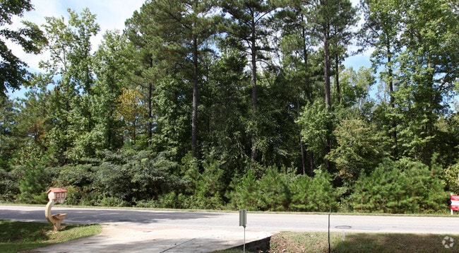
0 Eisenhower Dr
Raleigh, NC
Sunset Acres
0659.02-97-0504-000
LO69 SUNSET ACRES BM2012-01156
Vacantlandnec
Wake
X
North Carolina
3720065900K
69
2025
2.28 AC
2025
Southwest Wake County
053210
Raleigh/Durham
DEMOGRAPHICS near 0 Eisenhower Dr
1 Mile
3 Mile
5 Mile
2024 Total Population
6,325
53,716
118,769
2029 Population
6,815
58,253
129,690
Pop Growth 2024-2029
+ 7.75%
+ 8.45%
+ 9.20%
Average Age
37
37
38
2024 Total Households
2,077
18,225
41,251
HH Growth 2024-2029
+ 7.75%
+ 8.46%
+ 9.16%
Median Household Inc
$138,680
$122,586
$119,446
Avg Household Size
3.00
2.90
2.90
2024 Avg HH Vehicles
2.00
2.00
2.00
Median Home Value
$458,451
$437,472
$436,000
Median Year Built
2000
2003
2003
Nearby Places
Map Layers
Map Styles
 Street
 Aerial
- Restaurants
- Banks
- Shops
- Fitness
- Groceries
PUBLIC TRANSPORTATION
COMMUTER RAIL
Cary Station (Piedmont - North Carolina by Train (NC Train))
DRIVE
WALK
Distance
Cary Station (Piedmont - North Carolina by Train (NC Train))
19 min
9.7 mi
AIRPORT
Raleigh-Durham International
DRIVE
WALK
Distance
Raleigh-Durham International
32 min
19.6 mi
Freight Ports
Port of Wilmington
DRIVE
WALK
Distance
Port of Wilmington
162 min
132.3 mi
Nearby Properties
Address
Land Use
TOTAL SIZE
Lot Size
Zoning
Address
Land Use
TOTAL SIZE
Lot Size
Zoning
295,615 SF
38.04 AC
SP
Address
Land Use
TOTAL SIZE
Lot Size
Zoning
402,468 SF
37.03 AC
HD MF
Address
Land Use
TOTAL SIZE
Lot Size
Zoning
325,231 SF
61.90 AC
R40-C
Address
Land Use
TOTAL SIZE
Lot Size
Zoning
362,567 SF
17.97 AC
NMX
Address
Land Use
TOTAL SIZE
Lot Size
Zoning
364,727 SF
27.65 AC
RMF-C
Address
Land Use
TOTAL SIZE
Lot Size
Zoning
301,882 SF
19.44 AC
MXR
Address
Land Use
TOTAL SIZE
Lot Size
Zoning
242,251 SF
35.55 AC
SR
Address
Land Use
TOTAL SIZE
Lot Size
Zoning
208,323 SF
36.14 AC
CB
Address
Land Use
TOTAL SIZE
Lot Size
Zoning
230,176 SF
16.83 AC
MXR
Address
Land Use
TOTAL SIZE
Lot Size
Zoning
213,912 SF
16.33 AC
MXR
Address
Land Use
TOTAL SIZE
Lot Size
Zoning
201,269 SF
61.99 AC
R40
Address
Land Use
TOTAL SIZE
Lot Size
Zoning
159,046 SF
6.47 AC
CB
Address
Land Use
TOTAL SIZE
Lot Size
Zoning
154,305 SF
12.87 AC
NMX
Address
Land Use
TOTAL SIZE
Lot Size
Zoning
99,326 SF
12.66 AC
TF-CZ
Address
Land Use
TOTAL SIZE
Lot Size
Zoning
140,774 SF
8.56 AC
MXR
Address
Land Use
TOTAL SIZE
Lot Size
Zoning
125,702 SF
1.35 AC
GCP
Address
Land Use
TOTAL SIZE
Lot Size
Zoning
44,526 SF
34.82 AC
R40
Address
Land Use
TOTAL SIZE
Lot Size
Zoning
145,707 SF
15.40 AC
PUD
Address
Land Use
TOTAL SIZE
Lot Size
Zoning
88,972 SF
18.28 AC
R40-C
Address
Land Use
TOTAL SIZE
Lot Size
Zoning
59,764 SF
8.36 AC
MXR
Address
Land Use
TOTAL SIZE
Lot Size
Zoning
85,705 SF
11.01 AC
GCP
Address
Land Use
TOTAL SIZE
Lot Size
Zoning
180,595 SF
35.61 AC
CB
Address
Land Use
TOTAL SIZE
Lot Size
Zoning
72,096 SF
5.51 AC
NMX
Address
Land Use
TOTAL SIZE
Lot Size
Zoning
86,659 SF
10.08 AC
CB
Address
Land Use
TOTAL SIZE
Lot Size
Zoning
93,174 SF
9.07 AC
PUD
Address
Land Use
TOTAL SIZE
Lot Size
Zoning
84,165 SF
46.70 AC
GCP
Address
Land Use
TOTAL SIZE
Lot Size
Zoning
81,948 SF
38.04 AC
SP
Address
Land Use
TOTAL SIZE
Lot Size
Zoning
65,569 SF
14.80 AC
CB
Address
Land Use
TOTAL SIZE
Lot Size
Zoning
54,943 SF
21.71 AC
RR
Address
Land Use
TOTAL SIZE
Lot Size
Zoning
35.83 AC
CB
The World's #1 Commercial Real Estate Marketplace
Connect with us
© 2026 CoStar Group
The information above has been obtained from sources believed reliable. While we do not doubt its accuracy we have not verified it and make no guarantee, warranty or representation about it. It is your responsibility to independently confirm its accuracy and completeness. Any projections, opinions, assumptions, or estimates used are for example only and do not represent the current or future performance of the property. The value of this transaction to you depends on tax and other factors which should be evaluated by your tax, financial, and legal advisors. You and your advisors should conduct a careful, independent investigation of the property to determine to your satisfaction the suitability of the property for your needs.