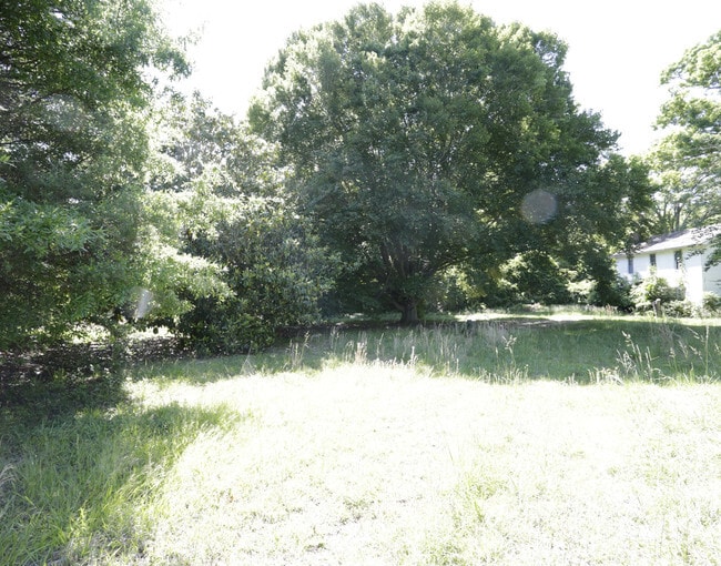
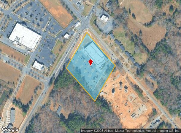
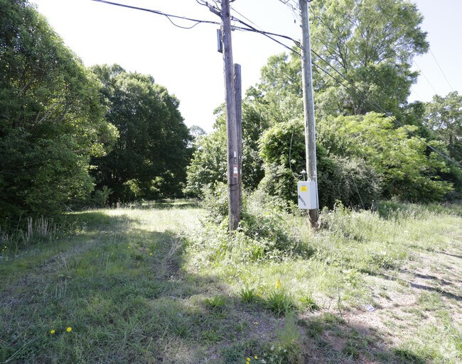
Property Record
9816 Idlewild Rd, Matthews, NC 28105
NEARBY LISTINGS FOR SALE OR LEASE
Property Detail
9816 Idlewild Rd
Charlotte-Concord-Gastonia, NC-SC
J W Spralt
193-051-19
TRACT 1 U/M
Supermarket
Mecklenburg
X
North Carolina
3710459200K
19
0
4.55 AC
2025
Matthews
005866
Charlotte
29,256 SF
DEMOGRAPHICS near 9816 Idlewild Rd
1 Mile
3 Mile
5 Mile
2024 Total Population
9,780
79,156
189,039
2029 Population
10,292
83,065
199,684
Pop Growth 2024-2029
+ 5.24%
+ 4.94%
+ 5.63%
Average Age
38
37
38
2024 Total Households
3,733
30,605
73,218
HH Growth 2024-2029
+ 5.41%
+ 5.04%
+ 5.67%
Median Household Inc
$66,279
$58,767
$64,710
Avg Household Size
2.60
2.50
2.50
2024 Avg HH Vehicles
2.00
2.00
2.00
Median Home Value
$255,774
$256,253
$291,101
Median Year Built
1990
1985
1984
Nearby Places
Map Layers
Map Styles
 Street
 Aerial
- Restaurants
- Banks
- Shops
- Fitness
- Groceries
PUBLIC TRANSPORTATION
AIRPORT
Charlotte/Douglas International
DRIVE
WALK
Distance
Charlotte/Douglas International
30 min
17.3 mi
Concord-Padgett Regional
DRIVE
WALK
Distance
Concord-Padgett Regional
31 min
20.1 mi
Freight Ports
North Charleston Terminal
DRIVE
WALK
Distance
North Charleston Terminal
242 min
209.4 mi
Nearby Properties
Address
Land Use
TOTAL SIZE
Lot Size
Zoning
Address
Land Use
TOTAL SIZE
Lot Size
Zoning
539,702 SF
83.70 AC
I
Address
Land Use
TOTAL SIZE
Lot Size
Zoning
382,175 SF
31.67 AC
R12MFCD
Address
Land Use
TOTAL SIZE
Lot Size
Zoning
362,388 SF
26.88 AC
R12MFCD
Address
Land Use
TOTAL SIZE
Lot Size
Zoning
282,780 SF
21.75 AC
R17MF
Address
Land Use
TOTAL SIZE
Lot Size
Zoning
333,218 SF
22.86 AC
R17MF
Address
Land Use
TOTAL SIZE
Lot Size
Zoning
258,272 SF
22.10 AC
R9MFCD
Address
Land Use
TOTAL SIZE
Lot Size
Zoning
347,952 SF
28.37 AC
OACUD
Address
Land Use
TOTAL SIZE
Lot Size
Zoning
300,346 SF
45.50 AC
R3
Address
Land Use
TOTAL SIZE
Lot Size
Zoning
254,369 SF
43.75 AC
B1SCD
Address
Land Use
TOTAL SIZE
Lot Size
Zoning
218,876 SF
14.82 AC
R6MFCD
Address
Land Use
TOTAL SIZE
Lot Size
Zoning
324,323 SF
31.39 AC
R17MF
Address
Land Use
TOTAL SIZE
Lot Size
Zoning
316,763 SF
21.18 AC
R17MF
Address
Land Use
TOTAL SIZE
Lot Size
Zoning
254,671 SF
16.10 AC
R12MFCD
Address
Land Use
TOTAL SIZE
Lot Size
Zoning
227,750 SF
25.53 AC
C
Address
Land Use
TOTAL SIZE
Lot Size
Zoning
246,624 SF
24.06 AC
R17MF
Address
Land Use
TOTAL SIZE
Lot Size
Zoning
258,047 SF
64.31 AC
I-CUD
Address
Land Use
TOTAL SIZE
Lot Size
Zoning
255,404 SF
17.76 AC
R12MFCD
Address
Land Use
TOTAL SIZE
Lot Size
Zoning
270,091 SF
32.43 AC
R17MF
Address
Land Use
TOTAL SIZE
Lot Size
Zoning
197,180 SF
4.89 AC
Address
Land Use
TOTAL SIZE
Lot Size
Zoning
211,146 SF
18.83 AC
R15MFCD
Address
Land Use
TOTAL SIZE
Lot Size
Zoning
208,846 SF
14.99 AC
R17MF
Address
Land Use
TOTAL SIZE
Lot Size
Zoning
197,367 SF
6.07 AC
Address
Land Use
TOTAL SIZE
Lot Size
Zoning
142,300 SF
5.50 AC
Address
Land Use
TOTAL SIZE
Lot Size
Zoning
205,701 SF
13.73 AC
OACUD
Address
Land Use
TOTAL SIZE
Lot Size
Zoning
249,650 SF
20.17 AC
R17MF
Address
Land Use
TOTAL SIZE
Lot Size
Zoning
227,278 SF
27.50 AC
Address
Land Use
TOTAL SIZE
Lot Size
Zoning
207,338 SF
13.96 AC
R17MF
Address
Land Use
TOTAL SIZE
Lot Size
Zoning
306,762 SF
21.23 AC
R17MF
Address
Land Use
TOTAL SIZE
Lot Size
Zoning
160,078 SF
14.95 AC
R17MF
Address
Land Use
TOTAL SIZE
Lot Size
Zoning
177,855 SF
9.14 AC
O2
The World's #1 Commercial Real Estate Marketplace
Connect with us
© 2025 CoStar Group
The information above has been obtained from sources believed reliable. While we do not doubt its accuracy we have not verified it and make no guarantee, warranty or representation about it. It is your responsibility to independently confirm its accuracy and completeness. Any projections, opinions, assumptions, or estimates used are for example only and do not represent the current or future performance of the property. The value of this transaction to you depends on tax and other factors which should be evaluated by your tax, financial, and legal advisors. You and your advisors should conduct a careful, independent investigation of the property to determine to your satisfaction the suitability of the property for your needs.