Property Record
9831 Dundee St, Detroit, MI 48204
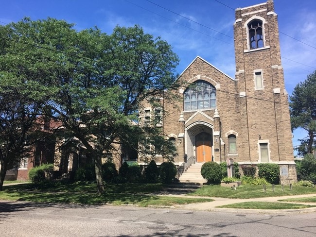

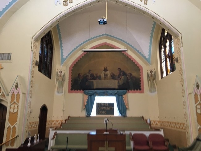
This Property Is For Sale
NEARBY LISTINGS FOR SALE OR LEASE
Property Detail
9831 Dundee St
16-005266
Nardin Park
Commercialnec
N DUNDEE 250 THRU 248 NARDIN PARK SUB L26 P96 PLATS, W C R 16/191 74.6 IRREG
X
Wayne
26163C0260E
Michigan
2025
0.31 AC
2025
Detroit W of Woodward
530800
Detroit
7,183 SF
Detroit-Warren-Dearborn, MI
DEMOGRAPHICS near 9831 Dundee St
1 mile
3 mile
5 mile
2024 Total Population
18,207
159,944
435,374
2029 Population
19,000
161,715
430,986
Pop Growth 2024-2029
+ 4.36%
+ 1.11%
(1.01%)
Average Age
39
38
37
2024 Total Households
7,798
62,438
164,273
HH Growth 2024-2029
+ 4.41%
+ 1.44%
(0.68%)
Median Household Inc
$29,750
$31,605
$35,692
Avg Household Size
2.30
2.40
2.50
2024 Avg HH Vehicles
1.00
1.00
1.00
Median Home Value
$68,202
$82,573
$90,550
Median Year Built
1946
1947
1948
Nearby Places
Map Layers
Map Styles
 Street
 Aerial
Transit
 Traffic
 Biking
Places
Listings with unknown addresses are not visible on the map
- Restaurants
- Banks
- Shops
- Fitness
- Groceries
PUBLIC TRANSPORTATION
COMMUTER RAIL
Drive
Walk
Distance
10 min
4.8 mi
AIRPORT
Windsor International
Drive
Walk
Distance
Windsor International
32 min
16.1 mi
Detroit Metro Wayne County
Drive
Walk
Distance
Detroit Metro Wayne County
33 min
21.9 mi
Freight Ports
Drive
Walk
Distance
78 min
62.6 mi
Nearby Properties
Address
Land Use
TOTAL SIZE
Lot Size
Zoning
Address
Land Use
TOTAL SIZE
Lot Size
Zoning
334,904 SF
B5
Address
Land Use
TOTAL SIZE
Lot Size
Zoning
506,450 SF
3.84 AC
B5
Address
Land Use
TOTAL SIZE
Lot Size
Zoning
266,016 SF
7.76 AC
PD
Address
Land Use
TOTAL SIZE
Lot Size
Zoning
783,976 SF
52.57 AC
M4
Address
Land Use
TOTAL SIZE
Lot Size
Zoning
152,232 SF
SD2
Address
Land Use
TOTAL SIZE
Lot Size
Zoning
531,360 SF
1.44 AC
B5
Address
Land Use
TOTAL SIZE
Lot Size
Zoning
678,539 SF
3.52 AC
B5
Address
Land Use
TOTAL SIZE
Lot Size
Zoning
164,797 SF
2.03 AC
Address
Land Use
TOTAL SIZE
Lot Size
Zoning
449,083 SF
2.39 AC
B2
Address
Land Use
TOTAL SIZE
Lot Size
Zoning
171,665 SF
3.73 AC
R5
Address
Land Use
TOTAL SIZE
Lot Size
Zoning
76,986 SF
2.73 AC
B4
Address
Land Use
TOTAL SIZE
Lot Size
Zoning
274,900 SF
M2
Address
Land Use
TOTAL SIZE
Lot Size
Zoning
520,522 SF
51.78 AC
M4
Address
Land Use
TOTAL SIZE
Lot Size
Zoning
135,296 SF
1.09 AC
R5
Address
Land Use
TOTAL SIZE
Lot Size
Zoning
185,944 SF
B2
Address
Land Use
TOTAL SIZE
Lot Size
Zoning
590,652 SF
21.79 AC
TM
Address
Land Use
TOTAL SIZE
Lot Size
Zoning
446,500 SF
27.90 AC
Address
Land Use
TOTAL SIZE
Lot Size
Zoning
224,410 SF
2.11 AC
M3
Address
Land Use
TOTAL SIZE
Lot Size
Zoning
Address
Land Use
TOTAL SIZE
Lot Size
Zoning
46,723 SF
B2
Address
Land Use
TOTAL SIZE
Lot Size
Zoning
58,261 SF
607 AC
B5
Address
Land Use
TOTAL SIZE
Lot Size
Zoning
261,677 SF
1.77 AC
M3
Address
Land Use
TOTAL SIZE
Lot Size
Zoning
75,870 SF
B5
Address
Land Use
TOTAL SIZE
Lot Size
Zoning
91,778 SF
10.19 AC
PD
Address
Land Use
TOTAL SIZE
Lot Size
Zoning
150,689 SF
4.87 AC
R5
Address
Land Use
TOTAL SIZE
Lot Size
Zoning
1,452 SF
19.24 AC
IC
Address
Land Use
TOTAL SIZE
Lot Size
Zoning
483,165 SF
22.98 AC
IB
Address
Land Use
TOTAL SIZE
Lot Size
Zoning
500,072 SF
12.50 AC
SD2
Address
Land Use
TOTAL SIZE
Lot Size
Zoning
336,958 SF
15.54 AC
IB
Address
Land Use
TOTAL SIZE
Lot Size
Zoning
104,625 SF
1.80 AC
B4
The World's #1 Commercial Real Estate Marketplace
Connect with us
© 2026 CoStar Group
The information above has been obtained from sources believed reliable. While we do not doubt its accuracy we have not verified it and make no guarantee, warranty or representation about it. It is your responsibility to independently confirm its accuracy and completeness. Any projections, opinions, assumptions, or estimates used are for example only and do not represent the current or future performance of the property. The value of this transaction to you depends on tax and other factors which should be evaluated by your tax, financial, and legal advisors. You and your advisors should conduct a careful, independent investigation of the property to determine to your satisfaction the suitability of the property for your needs.