Property Record
9833 Watson Rd, Saint Louis, MO 63126


NEARBY LISTINGS FOR SALE OR LEASE
Property Detail
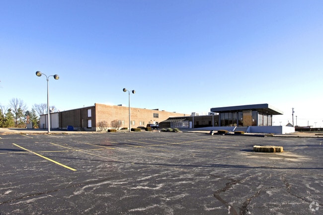
9833 Watson Rd
St. Louis, MO-IL
Oswald Sturdy Estate
25M-33-0593
OSWALD STURDY ESTATE LOT PTS 7 & 8
Storebuilding
St. Louis
X
Missouri
29099C0050F
7,8
2024
4 AC
2025
South County
221000
St. Louis
29,364 SF
DEMOGRAPHICS near 9833 Watson Rd
1 Mile
3 Mile
5 Mile
2024 Total Population
9,040
77,282
194,208
2029 Population
8,797
75,699
189,898
Pop Growth 2024-2029
(2.69%)
(2.05%)
(2.22%)
Average Age
41
43
43
2024 Total Households
3,672
31,838
81,672
HH Growth 2024-2029
(2.81%)
(2.09%)
(2.31%)
Median Household Inc
$92,431
$98,397
$88,013
Avg Household Size
2.40
2.40
2.30
2024 Avg HH Vehicles
2.00
2.00
2.00
Median Home Value
$265,747
$348,848
$303,426
Median Year Built
1959
1960
1963
Nearby Places
Map Layers
Map Styles
 Street
 Aerial
- Restaurants
- Banks
- Shops
- Fitness
- Groceries
PUBLIC TRANSPORTATION
COMMUTER RAIL
DRIVE
WALK
Distance
7 min
2.9 mi
Shrewsbury-Lansdowne (Shrewsbury-Lansdowne I-44 Emerson Park - St. Louis MetroLink (MetroLink))
DRIVE
WALK
Distance
Shrewsbury-Lansdowne (Shrewsbury-Lansdowne I-44 Emerson Park - St. Louis MetroLink (MetroLink))
11 min
5.8 mi
AIRPORT
St Louis Lambert International
DRIVE
WALK
Distance
St Louis Lambert International
29 min
17.0 mi
Scott AFB/Midamerica St Louis
DRIVE
WALK
Distance
Scott AFB/Midamerica St Louis
58 min
38.7 mi
Nearby Properties
Address
Land Use
TOTAL SIZE
Lot Size
Zoning
Address
Land Use
TOTAL SIZE
Lot Size
Zoning
31,582 SF
77.77 AC
32R3
Address
Land Use
TOTAL SIZE
Lot Size
Zoning
476,802 SF
20.71 AC
32R3
Address
Land Use
TOTAL SIZE
Lot Size
Zoning
844,350 SF
63.08 AC
64A1
Address
Land Use
TOTAL SIZE
Lot Size
Zoning
43.43 AC
R3
Address
Land Use
TOTAL SIZE
Lot Size
Zoning
851,923 SF
32.28 AC
101PDMXD
Address
Land Use
TOTAL SIZE
Lot Size
Zoning
289,641 SF
24.38 AC
101PD-BC
Address
Land Use
TOTAL SIZE
Lot Size
Zoning
Address
Land Use
TOTAL SIZE
Lot Size
Zoning
389,475 SF
27.55 AC
D
Address
Land Use
TOTAL SIZE
Lot Size
Zoning
474,239 SF
34.85 AC
R4
Address
Land Use
TOTAL SIZE
Lot Size
Zoning
255,646 SF
19.76 AC
32B5
Address
Land Use
TOTAL SIZE
Lot Size
Zoning
142,232 SF
28.76 AC
NU
Address
Land Use
TOTAL SIZE
Lot Size
Zoning
5,040 SF
53.51 AC
101R-1
Address
Land Use
TOTAL SIZE
Lot Size
Zoning
396 SF
8.57 AC
69M-1
Address
Land Use
TOTAL SIZE
Lot Size
Zoning
27,679 SF
2.56 AC
32B2
Address
Land Use
TOTAL SIZE
Lot Size
Zoning
114,244 SF
5.74 AC
101PD-BC
Address
Land Use
TOTAL SIZE
Lot Size
Zoning
1,512 SF
23.22 AC
41SP
Address
Land Use
TOTAL SIZE
Lot Size
Zoning
6.93 AC
101R-2
Address
Land Use
TOTAL SIZE
Lot Size
Zoning
113,971 SF
6.64 AC
C-8
Address
Land Use
TOTAL SIZE
Lot Size
Zoning
90,223 SF
8.51 AC
PD3-C
Address
Land Use
TOTAL SIZE
Lot Size
Zoning
132,860 SF
4.91 AC
32B5
Address
Land Use
TOTAL SIZE
Lot Size
Zoning
65,702 SF
12.33 AC
21HP-1
Address
Land Use
TOTAL SIZE
Lot Size
Zoning
22.67 AC
PCD
Address
Land Use
TOTAL SIZE
Lot Size
Zoning
262,264 SF
16.27 AC
R6
Address
Land Use
TOTAL SIZE
Lot Size
Zoning
2,369 SF
10.70 AC
R4
Address
Land Use
TOTAL SIZE
Lot Size
Zoning
96,990 SF
4.52 AC
32R4
Address
Land Use
TOTAL SIZE
Lot Size
Zoning
17.92 AC
64A4
Address
Land Use
TOTAL SIZE
Lot Size
Zoning
36,112 SF
84.29 AC
AA
Address
Land Use
TOTAL SIZE
Lot Size
Zoning
98,008 SF
10.19 AC
C-8
Address
Land Use
TOTAL SIZE
Lot Size
Zoning
156,719 SF
6.44 AC
101PD-BC
Address
Land Use
TOTAL SIZE
Lot Size
Zoning
181,253 SF
4.66 AC
37MULTI
The World's #1 Commercial Real Estate Marketplace
Connect with us
© 2026 CoStar Group
The information above has been obtained from sources believed reliable. While we do not doubt its accuracy we have not verified it and make no guarantee, warranty or representation about it. It is your responsibility to independently confirm its accuracy and completeness. Any projections, opinions, assumptions, or estimates used are for example only and do not represent the current or future performance of the property. The value of this transaction to you depends on tax and other factors which should be evaluated by your tax, financial, and legal advisors. You and your advisors should conduct a careful, independent investigation of the property to determine to your satisfaction the suitability of the property for your needs.