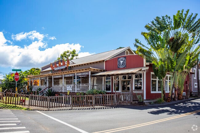
Property Record
4470 Halepule Rd, Waimea, HI 96796
NEARBY LISTINGS FOR SALE OR LEASE
-
-
View all Waimea listings for sale on LoopNet.com
Property Detail
4470 Halepule Rd
Kapaa, HI
Waimea Town Lots
4-1-6-007-017-0000
PARCEL 1-7080 SF DES PARCEL 2- LOT 1, BLK E WAIMEA TOWN LOTS 1783 SF DES PARCEL 3- LP GR 7302:2 130 SF DES
Residentialnec
Kauai
AE
Hawaii
1500020258G
1,
2024
0.22 AC
2025
Kauai
040900
Hawaii
DEMOGRAPHICS near 4470 Halepule Rd
1 Mile
3 Mile
5 Mile
2024 Total Population
0
1,749
2,460
2029 Population
0
1,758
2,474
Pop Growth 2024-2029
0.00%
+ 0.51%
+ 0.57%
Average Age
0
43
42
2024 Total Households
0
551
767
HH Growth 2024-2029
0.00%
+ 0.36%
+ 0.39%
Median Household Inc
$0
$66,594
$69,097
Avg Household Size
.00
2.90
2.80
2024 Avg HH Vehicles
.00
2.00
2.00
Median Home Value
$0
$805,920
$791,125
Median Year Built
0
1983
1983
Nearby Places
- Restaurants
- Banks
- Shops
- Fitness
- Groceries
PUBLIC TRANSPORTATION
AIRPORT
Lihue
DRIVE
WALK
Distance
Lihue
49 min
26.2 mi
SALE & LEASE HISTORY
LISTING DATE
SALE/LEASE

Sep 18, 2017
For Sale
Jan 25, 2018
For Sale
Nearby Properties
Address
Land Use
TOTAL SIZE
Lot Size
Zoning
Address
Land Use
TOTAL SIZE
Lot Size
Zoning
71,324 SF
42.41 AC
O
Address
Land Use
TOTAL SIZE
Lot Size
Zoning
27,760 SF
1,077.53 AC
A
Address
Land Use
TOTAL SIZE
Lot Size
Zoning
21,241 SF
1.53 AC
R-4
Address
Land Use
TOTAL SIZE
Lot Size
Zoning
7.60 AC
R-1/ST-P
Address
Land Use
TOTAL SIZE
Lot Size
Zoning
37,200 SF
18 AC
A
Address
Land Use
TOTAL SIZE
Lot Size
Zoning
9,467 SF
1.10 AC
R-1/ST-P
Address
Land Use
TOTAL SIZE
Lot Size
Zoning
18,668 SF
1.70 AC
C-G
Address
Land Use
TOTAL SIZE
Lot Size
Zoning
16.36 AC
CON
Address
Land Use
TOTAL SIZE
Lot Size
Zoning
4,847.99 AC
A
Address
Land Use
TOTAL SIZE
Lot Size
Zoning
15,910 SF
0.64 AC
C-G
Address
Land Use
TOTAL SIZE
Lot Size
Zoning
144.14 AC
A
Address
Land Use
TOTAL SIZE
Lot Size
Zoning
7,410 SF
0.37 AC
C-G
Address
Land Use
TOTAL SIZE
Lot Size
Zoning
9,630 SF
0.96 AC
C-G
Address
Land Use
TOTAL SIZE
Lot Size
Zoning
7,833 SF
0.47 AC
R-10
Address
Land Use
TOTAL SIZE
Lot Size
Zoning
12.95 AC
A
Address
Land Use
TOTAL SIZE
Lot Size
Zoning
Address
Land Use
TOTAL SIZE
Lot Size
Zoning
182.51 AC
O
Address
Land Use
TOTAL SIZE
Lot Size
Zoning
45.82 AC
A
Address
Land Use
TOTAL SIZE
Lot Size
Zoning
0.04 AC
P-D
Address
Land Use
TOTAL SIZE
Lot Size
Zoning
33.36 AC
A
Address
Land Use
TOTAL SIZE
Lot Size
Zoning
4,484 SF
0.36 AC
C-G
Address
Land Use
TOTAL SIZE
Lot Size
Zoning
6,048 SF
0.40 AC
R-10
Address
Land Use
TOTAL SIZE
Lot Size
Zoning
3,636 SF
0.45 AC
C-G
Address
Land Use
TOTAL SIZE
Lot Size
Zoning
9,198 SF
0.55 AC
C-G
Address
Land Use
TOTAL SIZE
Lot Size
Zoning
0.07 AC
P-D
Address
Land Use
TOTAL SIZE
Lot Size
Zoning
6,830 SF
0.30 AC
C-G
Address
Land Use
TOTAL SIZE
Lot Size
Zoning
0.05 AC
P-D
Address
Land Use
TOTAL SIZE
Lot Size
Zoning
159.48 AC
A
Address
Land Use
TOTAL SIZE
Lot Size
Zoning
4,592 SF
0.41 AC
C-G
Address
Land Use
TOTAL SIZE
Lot Size
Zoning
2,556 SF
0.14 AC
C-G
The World's #1 Commercial Real Estate Marketplace
Connect with us
© 2025 CoStar Group
The information above has been obtained from sources believed reliable. While we do not doubt its accuracy we have not verified it and make no guarantee, warranty or representation about it. It is your responsibility to independently confirm its accuracy and completeness. Any projections, opinions, assumptions, or estimates used are for example only and do not represent the current or future performance of the property. The value of this transaction to you depends on tax and other factors which should be evaluated by your tax, financial, and legal advisors. You and your advisors should conduct a careful, independent investigation of the property to determine to your satisfaction the suitability of the property for your needs.