Property Record
980 Atlanta Hwy Nw, Auburn, GA 30011
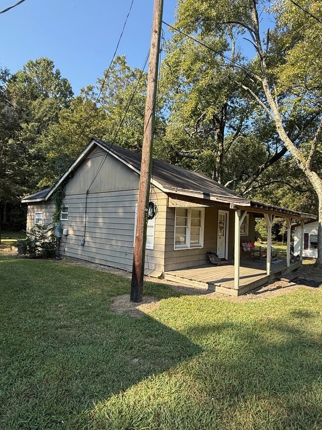
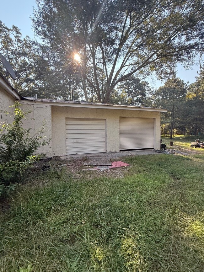
This Property Is For Sale
NEARBY LISTINGS FOR SALE OR LEASE
-
-
View all Auburn listings for sale on LoopNet.com
Property Detail
980 Atlanta Hwy Nw
Atlanta-Sandy Springs-Roswell, GA
E H Elder Subd
XX038A-012
LOTS 55 AND 56 E H ELDER SUBD
Commercialacreage
Barrow
X
Georgia
13013C0045D
55,56
2024
0.60 AC
2024
Barrow County
180108
Atlanta
DEMOGRAPHICS near 980 Atlanta Hwy Nw
1 Mile
3 Mile
5 Mile
2024 Total Population
1,121
16,477
60,951
2029 Population
1,500
21,935
78,885
Pop Growth 2024-2029
+ 33.81%
+ 33.12%
+ 29.42%
Average Age
38
38
37
2024 Total Households
381
5,573
20,484
HH Growth 2024-2029
+ 33.86%
+ 33.48%
+ 30.09%
Median Household Inc
$63,900
$76,210
$75,471
Avg Household Size
2.90
2.90
2.90
2024 Avg HH Vehicles
2.00
2.00
2.00
Median Home Value
$245,217
$279,007
$313,446
Median Year Built
1991
1994
1999
Nearby Places
- Restaurants
- Banks
- Shops
- Fitness
- Groceries
Nearby Properties
Address
Land Use
TOTAL SIZE
Lot Size
Zoning
Address
Land Use
TOTAL SIZE
Lot Size
Zoning
222,481 SF
23.20 AC
M-1
Address
Land Use
TOTAL SIZE
Lot Size
Zoning
420,876 SF
26.80 AC
M-2
Address
Land Use
TOTAL SIZE
Lot Size
Zoning
Address
Land Use
TOTAL SIZE
Lot Size
Zoning
165,737 SF
134.60 AC
G
Address
Land Use
TOTAL SIZE
Lot Size
Zoning
305,327 SF
22.10 AC
M-2
Address
Land Use
TOTAL SIZE
Lot Size
Zoning
690,427 SF
156 AC
M-1
Address
Land Use
TOTAL SIZE
Lot Size
Zoning
301,200 SF
39.20 AC
M-2
Address
Land Use
TOTAL SIZE
Lot Size
Zoning
231,285 SF
34.50 AC
M-2
Address
Land Use
TOTAL SIZE
Lot Size
Zoning
183,060 SF
17.90 AC
M-2
Address
Land Use
TOTAL SIZE
Lot Size
Zoning
202,250 SF
36.80 AC
M-1
Address
Land Use
TOTAL SIZE
Lot Size
Zoning
89,520 SF
14 AC
M-2
Address
Land Use
TOTAL SIZE
Lot Size
Zoning
189,400 SF
24.80 AC
C-2
Address
Land Use
TOTAL SIZE
Lot Size
Zoning
233,462 SF
25.20 AC
C-2
Address
Land Use
TOTAL SIZE
Lot Size
Zoning
137,200 SF
20 AC
M-2
Address
Land Use
TOTAL SIZE
Lot Size
Zoning
60,540 SF
79.30 AC
AG
Address
Land Use
TOTAL SIZE
Lot Size
Zoning
24,188 SF
40.70 AC
M-1
Address
Land Use
TOTAL SIZE
Lot Size
Zoning
26,616 SF
0.70 AC
Address
Land Use
TOTAL SIZE
Lot Size
Zoning
26,616 SF
0.70 AC
Address
Land Use
TOTAL SIZE
Lot Size
Zoning
84,363 SF
20.80 AC
C-2
Address
Land Use
TOTAL SIZE
Lot Size
Zoning
14,800 SF
57.90 AC
M-1
Address
Land Use
TOTAL SIZE
Lot Size
Zoning
69,285 SF
53.10 AC
M-2
Address
Land Use
TOTAL SIZE
Lot Size
Zoning
59,898 SF
38.90 AC
M-1
Address
Land Use
TOTAL SIZE
Lot Size
Zoning
64,800 SF
47.30 AC
M-1
Address
Land Use
TOTAL SIZE
Lot Size
Zoning
22,500 SF
10.50 AC
M-1
Address
Land Use
TOTAL SIZE
Lot Size
Zoning
65,500 SF
10.50 AC
DOWNTOWN O
Address
Land Use
TOTAL SIZE
Lot Size
Zoning
56,250 SF
4.70 AC
M-1
Address
Land Use
TOTAL SIZE
Lot Size
Zoning
71,300 SF
13.80 AC
M-2
Address
Land Use
TOTAL SIZE
Lot Size
Zoning
60,307 SF
33.40 AC
AG
Address
Land Use
TOTAL SIZE
Lot Size
Zoning
387.40 AC
AG
Address
Land Use
TOTAL SIZE
Lot Size
Zoning
18,750 SF
4.60 AC
M-1
The World's #1 Commercial Real Estate Marketplace
Connect with us
© 2025 CoStar Group
The information above has been obtained from sources believed reliable. While we do not doubt its accuracy we have not verified it and make no guarantee, warranty or representation about it. It is your responsibility to independently confirm its accuracy and completeness. Any projections, opinions, assumptions, or estimates used are for example only and do not represent the current or future performance of the property. The value of this transaction to you depends on tax and other factors which should be evaluated by your tax, financial, and legal advisors. You and your advisors should conduct a careful, independent investigation of the property to determine to your satisfaction the suitability of the property for your needs.