Property Record
986 Orchard Way, Dalton, GA 30721

Property Detail
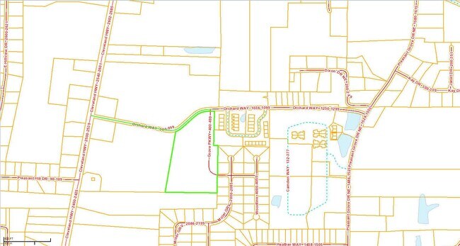
986 Orchard Way
Dalton, GA
7.44A LL 089-12
12-089-01-015
Whitfield
Commercialnec
Georgia
B and X Area of moderate flood hazard, usually the area between the limits of the 100-year and 500-year floods.
89
2025
7.44 AC
2025
Georgia Northwest
000301
Other Market Areas
20,154 SF
NEARBY LISTINGS FOR SALE OR LEASE
-
-
View all Dalton listings for sale on LoopNet.com
DEMOGRAPHICS near 986 Orchard Way
1 mile
3 mile
5 mile
2025 Total Population
4,926
19,661
58,460
2030 Population
5,005
20,140
59,991
Pop Growth 2025-2030
+ 1.60%
+ 2.44%
+ 2.62%
Average Age
37
38
38
2025 Total Households
1,615
6,664
20,238
HH Growth 2025-2030
+ 1.61%
+ 2.43%
+ 2.69%
Median Household Inc
$53,750
$66,934
$63,447
Avg Household Size
3.00
2.90
2.80
2025 Avg HH Vehicles
2.00
2.00
2.00
Median Home Value
$231,250
$227,309
$234,712
Median Year Built
1995
1990
1986
Nearby Places
Map Layers
Map Styles
 Street
 Aerial
Layers
 Traffic
 Biking
Places
Listings with unknown addresses are not visible on the map
- Restaurants
- Banks
- Shops
- Fitness
- Groceries
PUBLIC TRANSPORTATION
AIRPORT
Lovell Field
Drive
Walk
Distance
Lovell Field
42 min
29.9 mi
Freight Ports
Georgia Ports - Savannah
Drive
Walk
Distance
Georgia Ports - Savannah
385 min
342.1 mi
Nearby Properties
Address
Land Use
TOTAL SIZE
Lot Size
Zoning
Address
Land Use
TOTAL SIZE
Lot Size
Zoning
199,398 SF
37.16 AC
Address
Land Use
TOTAL SIZE
Lot Size
Zoning
39,664 SF
27.50 AC
C-2
Address
Land Use
TOTAL SIZE
Lot Size
Zoning
784,920 SF
56.60 AC
M-2
Address
Land Use
TOTAL SIZE
Lot Size
Zoning
346,476 SF
31.41 AC
Address
Land Use
TOTAL SIZE
Lot Size
Zoning
195,990 SF
60.25 AC
Address
Land Use
TOTAL SIZE
Lot Size
Zoning
664,020 SF
28.75 AC
M-2
Address
Land Use
TOTAL SIZE
Lot Size
Zoning
1,188,135 SF
106.61 AC
M2
Address
Land Use
TOTAL SIZE
Lot Size
Zoning
84,200 SF
22.70 AC
Address
Land Use
TOTAL SIZE
Lot Size
Zoning
391,865 SF
17.51 AC
Address
Land Use
TOTAL SIZE
Lot Size
Zoning
219,744 SF
12.74 AC
M-2
Address
Land Use
TOTAL SIZE
Lot Size
Zoning
127,376 SF
5.64 AC
Address
Land Use
TOTAL SIZE
Lot Size
Zoning
211,512 SF
3.60 AC
M2
Address
Land Use
TOTAL SIZE
Lot Size
Zoning
3,638 SF
117.55 AC
Address
Land Use
TOTAL SIZE
Lot Size
Zoning
193,500 SF
10.95 AC
M-2
Address
Land Use
TOTAL SIZE
Lot Size
Zoning
48,171 SF
27.94 AC
Address
Land Use
TOTAL SIZE
Lot Size
Zoning
151,722 SF
15.17 AC
C2
Address
Land Use
TOTAL SIZE
Lot Size
Zoning
95,840 SF
80.46 AC
Address
Land Use
TOTAL SIZE
Lot Size
Zoning
231,291 SF
23.73 AC
M-2
Address
Land Use
TOTAL SIZE
Lot Size
Zoning
462,493 SF
43.34 AC
M-2
Address
Land Use
TOTAL SIZE
Lot Size
Zoning
92,766 SF
31.69 AC
C4
Address
Land Use
TOTAL SIZE
Lot Size
Zoning
133,852 SF
13.28 AC
C-2
Address
Land Use
TOTAL SIZE
Lot Size
Zoning
21,864 SF
15.25 AC
R-7
Address
Land Use
TOTAL SIZE
Lot Size
Zoning
211,177 SF
13.59 AC
M-2
Address
Land Use
TOTAL SIZE
Lot Size
Zoning
142,636 SF
8.99 AC
Address
Land Use
TOTAL SIZE
Lot Size
Zoning
329,676 SF
12.21 AC
M-2
Address
Land Use
TOTAL SIZE
Lot Size
Zoning
20,561 SF
3.35 AC
Address
Land Use
TOTAL SIZE
Lot Size
Zoning
164,143 SF
6.87 AC
M-2
Address
Land Use
TOTAL SIZE
Lot Size
Zoning
74,369 SF
8.18 AC
C-2
Address
Land Use
TOTAL SIZE
Lot Size
Zoning
23,549 SF
204.02 AC
R2
Address
Land Use
TOTAL SIZE
Lot Size
Zoning
55,187 SF
38.56 AC
The World's #1 Commercial Real Estate Marketplace
Connect with us
© 2026 CoStar Group
The information above has been obtained from sources believed reliable. While we do not doubt its accuracy we have not verified it and make no guarantee, warranty or representation about it. It is your responsibility to independently confirm its accuracy and completeness. Any projections, opinions, assumptions, or estimates used are for example only and do not represent the current or future performance of the property. The value of this transaction to you depends on tax and other factors which should be evaluated by your tax, financial, and legal advisors. You and your advisors should conduct a careful, independent investigation of the property to determine to your satisfaction the suitability of the property for your needs.