Property Record
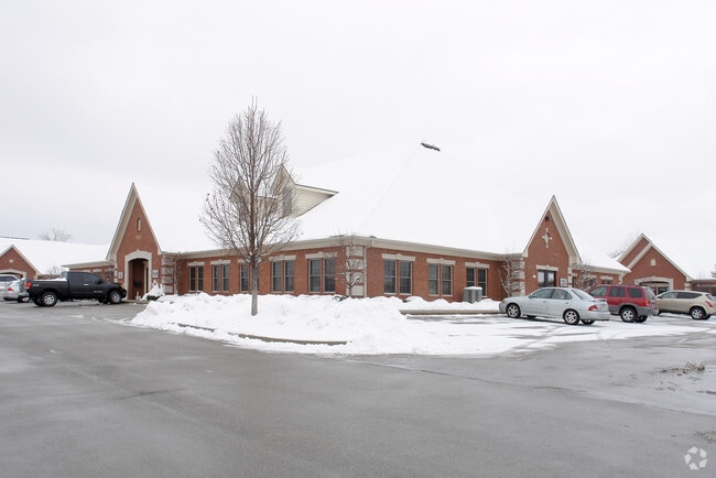
9860 Westpoint Dr, Indianapolis, IN 46256


NEARBY LISTINGS FOR SALE OR LEASE
Property Detail
9860 Westpoint Dr
Indianapolis-Carmel-Anderson, IN
Crosspoint Corner Section 2
29-14-12-010-005.000-006
ACREAGE 1.03, SECTION 12, TOWNSHIP 17, RANGE 4, CROSSPOINT CORNER, SECTION 2, LOT 7, IRREGULAR SHAPE
Officebuilding
Hamilton
X
Indiana
18097C0066F
7
2023
1.03 AC
2024
Fishers/Geist
110810
Indianapolis
12,256 SF
DEMOGRAPHICS near 9860 Westpoint Dr
1 Mile
3 Mile
5 Mile
2024 Total Population
2,098
60,347
160,523
2029 Population
2,310
64,260
170,819
Pop Growth 2024-2029
+ 10.10%
+ 6.48%
+ 6.41%
Average Age
39
39
40
2024 Total Households
960
26,682
65,155
HH Growth 2024-2029
+ 10.00%
+ 5.91%
+ 5.86%
Median Household Inc
$69,274
$80,549
$97,003
Avg Household Size
2.20
2.20
2.40
2024 Avg HH Vehicles
2.00
2.00
2.00
Median Home Value
$256,991
$263,212
$305,431
Median Year Built
1995
1989
1991
Nearby Places
Map Layers
Map Styles
 Street
 Aerial
- Restaurants
- Banks
- Shops
- Fitness
- Groceries
PUBLIC TRANSPORTATION
AIRPORT
Indianapolis International
DRIVE
WALK
Distance
Indianapolis International
48 min
28.5 mi
Nearby Properties
Address
Land Use
TOTAL SIZE
Lot Size
Zoning
Address
Land Use
TOTAL SIZE
Lot Size
Zoning
366,825 SF
26.60 AC
ZO01
Address
Land Use
TOTAL SIZE
Lot Size
Zoning
21,742 SF
39.35 AC
ZO01
Address
Land Use
TOTAL SIZE
Lot Size
Zoning
16,704 SF
109.83 AC
ZO01
Address
Land Use
TOTAL SIZE
Lot Size
Zoning
4,246 SF
89.83 AC
ZO01
Address
Land Use
TOTAL SIZE
Lot Size
Zoning
22,081 SF
27.39 AC
ZO01
Address
Land Use
TOTAL SIZE
Lot Size
Zoning
10,911 SF
11.56 AC
ZO01
Address
Land Use
TOTAL SIZE
Lot Size
Zoning
683,795 SF
25.53 AC
Address
Land Use
TOTAL SIZE
Lot Size
Zoning
555,234 SF
36.07 AC
Address
Land Use
TOTAL SIZE
Lot Size
Zoning
328,241 SF
91.83 AC
Address
Land Use
TOTAL SIZE
Lot Size
Zoning
528,117 SF
57.02 AC
Address
Land Use
TOTAL SIZE
Lot Size
Zoning
372,138 SF
20.71 AC
Address
Land Use
TOTAL SIZE
Lot Size
Zoning
363,408 SF
30.78 AC
Address
Land Use
TOTAL SIZE
Lot Size
Zoning
5,314 SF
13.92 AC
ZO01
Address
Land Use
TOTAL SIZE
Lot Size
Zoning
125.31 AC
Address
Land Use
TOTAL SIZE
Lot Size
Zoning
286,120 SF
8.03 AC
Address
Land Use
TOTAL SIZE
Lot Size
Zoning
6,252 SF
52.04 AC
ZO01
Address
Land Use
TOTAL SIZE
Lot Size
Zoning
176,103 SF
0.90 AC
Address
Land Use
TOTAL SIZE
Lot Size
Zoning
6,229 SF
36.20 AC
ZO01
Address
Land Use
TOTAL SIZE
Lot Size
Zoning
289,664 SF
35.22 AC
Address
Land Use
TOTAL SIZE
Lot Size
Zoning
6,366 SF
19.40 AC
ZO01
Address
Land Use
TOTAL SIZE
Lot Size
Zoning
391,181 SF
23.82 AC
Address
Land Use
TOTAL SIZE
Lot Size
Zoning
217,633 SF
78.75 AC
Address
Land Use
TOTAL SIZE
Lot Size
Zoning
224,368 SF
0.73 AC
Address
Land Use
TOTAL SIZE
Lot Size
Zoning
24,192 SF
5.93 AC
Address
Land Use
TOTAL SIZE
Lot Size
Zoning
140,987 SF
13.99 AC
Address
Land Use
TOTAL SIZE
Lot Size
Zoning
288,939 SF
34.29 AC
Address
Land Use
TOTAL SIZE
Lot Size
Zoning
308,854 SF
13.64 AC
Address
Land Use
TOTAL SIZE
Lot Size
Zoning
167,734 SF
3.69 AC
Address
Land Use
TOTAL SIZE
Lot Size
Zoning
151,823 SF
57.55 AC
ZO01
Address
Land Use
TOTAL SIZE
Lot Size
Zoning
23,452 SF
14.94 AC
ZO01
The World's #1 Commercial Real Estate Marketplace
Connect with us
© 2026 CoStar Group
The information above has been obtained from sources believed reliable. While we do not doubt its accuracy we have not verified it and make no guarantee, warranty or representation about it. It is your responsibility to independently confirm its accuracy and completeness. Any projections, opinions, assumptions, or estimates used are for example only and do not represent the current or future performance of the property. The value of this transaction to you depends on tax and other factors which should be evaluated by your tax, financial, and legal advisors. You and your advisors should conduct a careful, independent investigation of the property to determine to your satisfaction the suitability of the property for your needs.