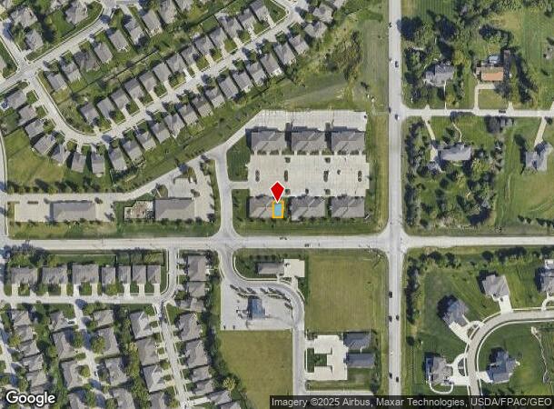
Property Record
9869 S 168Th Ave, Omaha, NE 68136


NEARBY LISTINGS FOR SALE OR LEASE
-
-
View all Omaha listings for lease on LoopNet.com
Property Detail
9869 S 168Th Ave
011597351
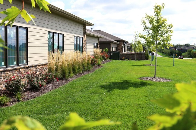
Outland Crossing Office Condominium
Commercialnec
UNIT 1C OUTLAND CROSSING OFFICE CONDOMINIUMS (3.27%)
X
Sarpy
31153C0041H
Nebraska
2024
0.15 AC
2025
Southwest Omaha
010636
Omaha/Council Bluffs
1,664 SF
Omaha-Council Bluffs, NE-IA
DEMOGRAPHICS near 9869 S 168Th Ave
1 Mile
3 Mile
5 Mile
2024 Total Population
7,046
52,640
116,691
2029 Population
7,764
56,286
122,279
Pop Growth 2024-2029
+ 10.19%
+ 6.93%
+ 4.79%
Average Age
36
36
37
2024 Total Households
2,265
18,145
41,852
HH Growth 2024-2029
+ 10.55%
+ 7.09%
+ 4.80%
Median Household Inc
$134,166
$118,718
$107,650
Avg Household Size
3.10
2.90
2.70
2024 Avg HH Vehicles
2.00
2.00
2.00
Median Home Value
$345,611
$288,308
$278,486
Median Year Built
2010
2004
2000
Nearby Places
Map Layers
Map Styles
 Street
 Aerial
- Restaurants
- Banks
- Shops
- Fitness
- Groceries
PUBLIC TRANSPORTATION
AIRPORT
Eppley Airfield
DRIVE
WALK
Distance
Eppley Airfield
32 min
22.8 mi
Lincoln
DRIVE
WALK
Distance
Lincoln
42 min
43.1 mi
SALE & LEASE HISTORY
LISTING DATE
SALE/LEASE

Sep 25, 2016
For Lease
Sep 08, 2022
For Lease
Jul 21, 2017
For Lease
Jan 22, 2021
For Lease
Jan 22, 2021
For Sale
Feb 15, 2022
For Sale
Feb 05, 2021
For Sale
Feb 05, 2020
For Lease
Dec 20, 2018
For Sale
Nearby Properties
Address
Land Use
TOTAL SIZE
Lot Size
Zoning
Address
Land Use
TOTAL SIZE
Lot Size
Zoning
94.11 AC
Address
Land Use
TOTAL SIZE
Lot Size
Zoning
2,400 SF
21.27 AC
Address
Land Use
TOTAL SIZE
Lot Size
Zoning
72.91 AC
Address
Land Use
TOTAL SIZE
Lot Size
Zoning
543,301 SF
2.30 AC
IL
Address
Land Use
TOTAL SIZE
Lot Size
Zoning
48.50 AC
Address
Land Use
TOTAL SIZE
Lot Size
Zoning
315,685 SF
21.57 AC
RG10
Address
Land Use
TOTAL SIZE
Lot Size
Zoning
56,174 SF
8.65 AC
Address
Land Use
TOTAL SIZE
Lot Size
Zoning
9,600 SF
2.07 AC
IL
Address
Land Use
TOTAL SIZE
Lot Size
Zoning
23.99 AC
Address
Land Use
TOTAL SIZE
Lot Size
Zoning
334,533 SF
23.32 AC
Address
Land Use
TOTAL SIZE
Lot Size
Zoning
17.40 AC
Address
Land Use
TOTAL SIZE
Lot Size
Zoning
22.05 AC
Address
Land Use
TOTAL SIZE
Lot Size
Zoning
24,294 SF
25.79 AC
Address
Land Use
TOTAL SIZE
Lot Size
Zoning
183,184 SF
20.66 AC
Address
Land Use
TOTAL SIZE
Lot Size
Zoning
2,295 SF
11.77 AC
Address
Land Use
TOTAL SIZE
Lot Size
Zoning
27,027 SF
11.15 AC
Address
Land Use
TOTAL SIZE
Lot Size
Zoning
240,122 SF
10.16 AC
Address
Land Use
TOTAL SIZE
Lot Size
Zoning
16.57 AC
Address
Land Use
TOTAL SIZE
Lot Size
Zoning
250,999 SF
17.10 AC
Address
Land Use
TOTAL SIZE
Lot Size
Zoning
250,999 SF
15.44 AC
Address
Land Use
TOTAL SIZE
Lot Size
Zoning
12.60 AC
Address
Land Use
TOTAL SIZE
Lot Size
Zoning
120,500 SF
12.05 AC
IL
Address
Land Use
TOTAL SIZE
Lot Size
Zoning
12,720 SF
3.44 AC
IL
Address
Land Use
TOTAL SIZE
Lot Size
Zoning
20.66 AC
Address
Land Use
TOTAL SIZE
Lot Size
Zoning
170,760 SF
10.30 AC
RG10
Address
Land Use
TOTAL SIZE
Lot Size
Zoning
17.75 AC
Address
Land Use
TOTAL SIZE
Lot Size
Zoning
184,800 SF
8.85 AC
Address
Land Use
TOTAL SIZE
Lot Size
Zoning
184,800 SF
9.41 AC
Address
Land Use
TOTAL SIZE
Lot Size
Zoning
40,121 SF
20.69 AC
Address
Land Use
TOTAL SIZE
Lot Size
Zoning
168,547 SF
10.57 AC
The World's #1 Commercial Real Estate Marketplace
Connect with us
© 2025 CoStar Group
The information above has been obtained from sources believed reliable. While we do not doubt its accuracy we have not verified it and make no guarantee, warranty or representation about it. It is your responsibility to independently confirm its accuracy and completeness. Any projections, opinions, assumptions, or estimates used are for example only and do not represent the current or future performance of the property. The value of this transaction to you depends on tax and other factors which should be evaluated by your tax, financial, and legal advisors. You and your advisors should conduct a careful, independent investigation of the property to determine to your satisfaction the suitability of the property for your needs.