Property Record
9870 Doerr Ln, Schertz, TX 78154
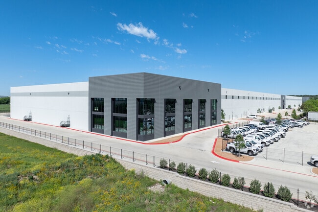

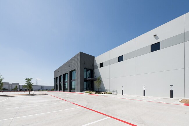

Property Detail
9870 Doerr Ln
San Antonio-New Braunfels, TX
DOERR INDUSTRIAL, BLOCK 1, LOT 3
16-0101-0002-00
Comal
Commercialnec
Texas
B and X Area of moderate flood hazard, usually the area between the limits of the 100-year and 500-year floods.
3
2024
26.51 AC
2025
Comal County
310801
San Antonio
308,264 SF
NEARBY LISTINGS FOR SALE OR LEASE
DEMOGRAPHICS near 9870 Doerr Ln
1 mile
3 mile
5 mile
2025 Total Population
529
32,721
117,977
2030 Population
610
36,149
128,676
Pop Growth 2025-2030
+ 15.31%
+ 10.48%
+ 9.07%
Average Age
47
40
39
2025 Total Households
199
11,596
42,680
HH Growth 2025-2030
+ 15.08%
+ 10.87%
+ 9.28%
Median Household Inc
$143,999
$115,640
$98,563
Avg Household Size
2.60
2.80
2.70
2025 Avg HH Vehicles
2.00
2.00
2.00
Median Home Value
$627,404
$360,167
$324,968
Median Year Built
1993
2004
2002
Nearby Places
Map Layers
Map Styles
 Street
 Aerial
Transit
 Traffic
 Biking
Places
Listings with unknown addresses are not visible on the map
- Restaurants
- Banks
- Shops
- Fitness
- Groceries
PUBLIC TRANSPORTATION
AIRPORT
San Antonio International
Drive
Walk
Distance
San Antonio International
23 min
15.5 mi
Freight Ports
Calhoun Port
Drive
Walk
Distance
Calhoun Port
185 min
151.2 mi
SALE & LEASE HISTORY
LISTING DATE
SALE/LEASE

Mar 08, 2022
For Lease
Nearby Properties
Address
Land Use
TOTAL SIZE
Lot Size
Zoning
Address
Land Use
TOTAL SIZE
Lot Size
Zoning
538,168 SF
176.13 AC
Address
Land Use
TOTAL SIZE
Lot Size
Zoning
566,929 SF
89.66 AC
Address
Land Use
TOTAL SIZE
Lot Size
Zoning
95,470 SF
35.26 AC
Address
Land Use
TOTAL SIZE
Lot Size
Zoning
Address
Land Use
TOTAL SIZE
Lot Size
Zoning
214,405 SF
11.85 AC
Address
Land Use
TOTAL SIZE
Lot Size
Zoning
55,640 SF
24.17 AC
Address
Land Use
TOTAL SIZE
Lot Size
Zoning
511,000 SF
32.40 AC
Address
Land Use
TOTAL SIZE
Lot Size
Zoning
430,320 SF
25.03 AC
Address
Land Use
TOTAL SIZE
Lot Size
Zoning
111,269 SF
73.47 AC
Address
Land Use
TOTAL SIZE
Lot Size
Zoning
7,176 SF
24.22 AC
Address
Land Use
TOTAL SIZE
Lot Size
Zoning
358,036 SF
20.77 AC
Address
Land Use
TOTAL SIZE
Lot Size
Zoning
223,965 SF
14.45 AC
Address
Land Use
TOTAL SIZE
Lot Size
Zoning
86,124 SF
9.37 AC
Address
Land Use
TOTAL SIZE
Lot Size
Zoning
73,813 SF
17.33 AC
Address
Land Use
TOTAL SIZE
Lot Size
Zoning
312,696 SF
18.01 AC
Address
Land Use
TOTAL SIZE
Lot Size
Zoning
307,240 SF
20.16 AC
Address
Land Use
TOTAL SIZE
Lot Size
Zoning
112,870 SF
13.32 AC
Address
Land Use
TOTAL SIZE
Lot Size
Zoning
576 SF
41.86 AC
Address
Land Use
TOTAL SIZE
Lot Size
Zoning
321,016 SF
18.67 AC
Address
Land Use
TOTAL SIZE
Lot Size
Zoning
30,994 SF
29.09 AC
Address
Land Use
TOTAL SIZE
Lot Size
Zoning
267,716 SF
21.11 AC
Address
Land Use
TOTAL SIZE
Lot Size
Zoning
109,469 SF
5.88 AC
Address
Land Use
TOTAL SIZE
Lot Size
Zoning
187,650 SF
42.50 AC
Address
Land Use
TOTAL SIZE
Lot Size
Zoning
19,650 SF
32.94 AC
Address
Land Use
TOTAL SIZE
Lot Size
Zoning
64,208 SF
8.88 AC
Address
Land Use
TOTAL SIZE
Lot Size
Zoning
102,924 SF
14.23 AC
Address
Land Use
TOTAL SIZE
Lot Size
Zoning
202,165 SF
23.97 AC
Address
Land Use
TOTAL SIZE
Lot Size
Zoning
197,100 SF
11.43 AC
Address
Land Use
TOTAL SIZE
Lot Size
Zoning
215,765 SF
14.98 AC
The World's #1 Commercial Real Estate Marketplace
Connect with us
© 2026 CoStar Group
The information above has been obtained from sources believed reliable. While we do not doubt its accuracy we have not verified it and make no guarantee, warranty or representation about it. It is your responsibility to independently confirm its accuracy and completeness. Any projections, opinions, assumptions, or estimates used are for example only and do not represent the current or future performance of the property. The value of this transaction to you depends on tax and other factors which should be evaluated by your tax, financial, and legal advisors. You and your advisors should conduct a careful, independent investigation of the property to determine to your satisfaction the suitability of the property for your needs.