Property Record
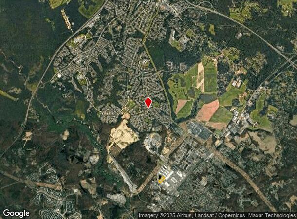
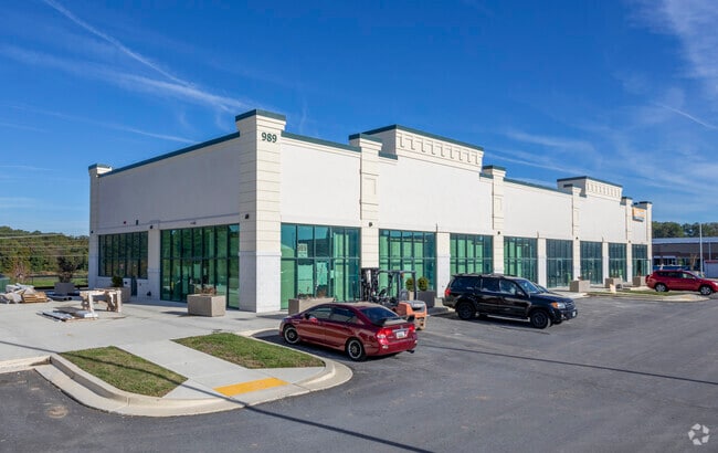
989 Waugh Chapel Way, Gambrills, MD 21054

NEARBY LISTINGS FOR SALE OR LEASE
Property Detail
989 Waugh Chapel Way
Baltimore-Columbia-Towson, MD
Waugh Chapel Towne Centr
04-883-90043811
LT 2RR WAUGH CHAPEL TOWNE CENTR
Storebuilding
Anne Arundel
X
Maryland
24033C0090E
2rr
2024
2.95 AC
2025
I-97/Crain Hwy Corridor
740800
Baltimore
20,160 SF
DEMOGRAPHICS near 989 Waugh Chapel Way
1 Mile
3 Mile
5 Mile
2024 Total Population
10,324
59,070
98,114
2029 Population
10,617
60,663
99,804
Pop Growth 2024-2029
+ 2.84%
+ 2.70%
+ 1.72%
Average Age
37
39
39
2024 Total Households
3,989
22,080
36,456
HH Growth 2024-2029
+ 2.98%
+ 2.90%
+ 2.01%
Median Household Inc
$113,317
$128,862
$124,051
Avg Household Size
2.50
2.60
2.60
2024 Avg HH Vehicles
2.00
2.00
2.00
Median Home Value
$377,651
$450,723
$435,245
Median Year Built
1996
1993
1992
Nearby Places
Map Layers
Map Styles
 Street
 Aerial
- Restaurants
- Banks
- Shops
- Fitness
- Groceries
PUBLIC TRANSPORTATION
COMMUTER RAIL
Odenton (PENN - WASHINGTON - Maryland Area Regional Commuter Trains (The MARC), Penn Line - Maryland Area Regional Commuter Trains (The MARC))
DRIVE
WALK
Distance
Odenton (PENN - WASHINGTON - Maryland Area Regional Commuter Trains (The MARC), Penn Line - Maryland Area Regional Commuter Trains (The MARC))
6 min
3.3 mi
AIRPORT
Baltimore/Washington International Thurgood Marshall
DRIVE
WALK
Distance
Baltimore/Washington International Thurgood Marshall
21 min
11.6 mi
Ronald Reagan Washington Ntl
DRIVE
WALK
Distance
Ronald Reagan Washington Ntl
45 min
30.8 mi
Freight Ports
Port of Baltimore
DRIVE
WALK
Distance
Port of Baltimore
33 min
22.2 mi
SALE & LEASE HISTORY
LISTING DATE
SALE/LEASE

Oct 22, 2020
For Lease
Jan 08, 2020
For Lease
Nearby Properties
Address
Land Use
TOTAL SIZE
Lot Size
Zoning
Address
Land Use
TOTAL SIZE
Lot Size
Zoning
472,057 SF
15.16 AC
OCOR
Address
Land Use
TOTAL SIZE
Lot Size
Zoning
444,842 SF
19.48 AC
R22
Address
Land Use
TOTAL SIZE
Lot Size
Zoning
360,354 SF
7.36 AC
MXD-C
Address
Land Use
TOTAL SIZE
Lot Size
Zoning
432,928 SF
6.33 AC
O-COR
Address
Land Use
TOTAL SIZE
Lot Size
Zoning
246,000 SF
15.73 AC
MXDR
Address
Land Use
TOTAL SIZE
Lot Size
Zoning
273,816 SF
44.22 AC
MXD-C
Address
Land Use
TOTAL SIZE
Lot Size
Zoning
14.65 AC
R15
Address
Land Use
TOTAL SIZE
Lot Size
Zoning
499,471 SF
10.10 AC
O-COR
Address
Land Use
TOTAL SIZE
Lot Size
Zoning
311,870 SF
10.03 AC
Address
Land Use
TOTAL SIZE
Lot Size
Zoning
296,453 SF
16.23 AC
R15
Address
Land Use
TOTAL SIZE
Lot Size
Zoning
230,204 SF
6.74 AC
O COR
Address
Land Use
TOTAL SIZE
Lot Size
Zoning
8.70 AC
R15
Address
Land Use
TOTAL SIZE
Lot Size
Zoning
237,377 SF
9.86 AC
R15
Address
Land Use
TOTAL SIZE
Lot Size
Zoning
265,645 SF
12.79 AC
R15
Address
Land Use
TOTAL SIZE
Lot Size
Zoning
125.95 AC
R5
Address
Land Use
TOTAL SIZE
Lot Size
Zoning
185,440 SF
3.53 AC
W2
Address
Land Use
TOTAL SIZE
Lot Size
Zoning
155,269 SF
13.27 AC
O-EOD
Address
Land Use
TOTAL SIZE
Lot Size
Zoning
342,464 SF
22.95 AC
O-IND
Address
Land Use
TOTAL SIZE
Lot Size
Zoning
108,480 SF
17.66 AC
C4
Address
Land Use
TOTAL SIZE
Lot Size
Zoning
72,925 SF
4.12 AC
MXR
Address
Land Use
TOTAL SIZE
Lot Size
Zoning
37,320 SF
18.76 AC
O-COR
Address
Land Use
TOTAL SIZE
Lot Size
Zoning
43,842 SF
27.74 AC
C4
Address
Land Use
TOTAL SIZE
Lot Size
Zoning
10.95 AC
O-EOD
Address
Land Use
TOTAL SIZE
Lot Size
Zoning
47,744 SF
1.79 AC
MXD-C
Address
Land Use
TOTAL SIZE
Lot Size
Zoning
39,695 SF
11.66 AC
C4
Address
Land Use
TOTAL SIZE
Lot Size
Zoning
134,923 SF
8.35 AC
MXD-C
Address
Land Use
TOTAL SIZE
Lot Size
Zoning
86,496 SF
6.86 AC
R5
Address
Land Use
TOTAL SIZE
Lot Size
Zoning
87,919 SF
9.71 AC
R5
Address
Land Use
TOTAL SIZE
Lot Size
Zoning
112,028 SF
40.41 AC
R1
Address
Land Use
TOTAL SIZE
Lot Size
Zoning
63,000 SF
22.90 AC
R1
The World's #1 Commercial Real Estate Marketplace
Connect with us
© 2025 CoStar Group
The information above has been obtained from sources believed reliable. While we do not doubt its accuracy we have not verified it and make no guarantee, warranty or representation about it. It is your responsibility to independently confirm its accuracy and completeness. Any projections, opinions, assumptions, or estimates used are for example only and do not represent the current or future performance of the property. The value of this transaction to you depends on tax and other factors which should be evaluated by your tax, financial, and legal advisors. You and your advisors should conduct a careful, independent investigation of the property to determine to your satisfaction the suitability of the property for your needs.