Property Record
9891 Harmonson Rd, Northlake, TX 76247
Save to a Folder
{{folder.Name}}
{{folder.ListingIds.length}} Properties
{{folder.ListingIds.length}} Property
Create a New Folder
Property Detail
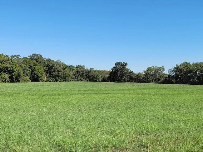
9891 Harmonson Rd
R68014
A0711A KNIGHT, TR 2, 23.64 ACRES, OLD DCAD TR 4A
Agriculturalland
DENTON
B and X Area of moderate flood hazard, usually the area between the limits of the 100-year and 500-year floods.
Texas
2024
14 AC
2025
Alliance
020319
Dallas/Ft Worth
9,843 SF
Dallas-Fort Worth-Arlington, TX
NEARBY LISTINGS FOR SALE OR LEASE
DEMOGRAPHICS near 9891 Harmonson Rd
1 mile
3 mile
5 mile
2025 Total Population
1,111
17,171
59,317
2030 Population
1,308
19,943
68,804
Pop Growth 2025-2030
+ 17.73%
+ 16.14%
+ 15.99%
Average Age
40
38
37
2025 Total Households
368
5,575
19,579
HH Growth 2025-2030
+ 17.93%
+ 16.72%
+ 16.28%
Median Household Inc
$155,042
$122,357
$133,812
Avg Household Size
3.00
3.10
3.00
2025 Avg HH Vehicles
2.00
2.00
2.00
Median Home Value
$514,423
$420,995
$484,576
Median Year Built
2009
2008
2011
Nearby Places
Map Layers
Map Styles
 Street
 Aerial
Layers
 Traffic
 Biking
Places
Listings with unknown addresses are not visible on the map
- Restaurants
- Banks
- Shops
- Fitness
- Groceries
PUBLIC TRANSPORTATION
AIRPORT
Dallas-Fort Worth International
Drive
Walk
Distance
Dallas-Fort Worth International
34 min
24.7 mi
Dallas Love Field
Drive
Walk
Distance
Dallas Love Field
53 min
38.4 mi
Freight Ports
Port of Shreveport
Drive
Walk
Distance
Port of Shreveport
262 min
238.2 mi
Nearby Properties
Address
Land Use
TOTAL SIZE
Lot Size
Zoning
Address
Land Use
TOTAL SIZE
Lot Size
Zoning
9,800 SF
1,266.35 AC
Address
Land Use
TOTAL SIZE
Lot Size
Zoning
1,316.60 AC
Address
Land Use
TOTAL SIZE
Lot Size
Zoning
921,130 SF
44.75 AC
Address
Land Use
TOTAL SIZE
Lot Size
Zoning
1,217,200 SF
56.35 AC
Address
Land Use
TOTAL SIZE
Lot Size
Zoning
984,910 SF
83.90 AC
Address
Land Use
TOTAL SIZE
Lot Size
Zoning
542,880 SF
28.13 AC
Address
Land Use
TOTAL SIZE
Lot Size
Zoning
1,049,614 SF
47.33 AC
Address
Land Use
TOTAL SIZE
Lot Size
Zoning
374,389 SF
9.08 AC
Address
Land Use
TOTAL SIZE
Lot Size
Zoning
795,626 SF
44.84 AC
Address
Land Use
TOTAL SIZE
Lot Size
Zoning
728,888 SF
39.67 AC
Address
Land Use
TOTAL SIZE
Lot Size
Zoning
639,877 SF
29.59 AC
Address
Land Use
TOTAL SIZE
Lot Size
Zoning
327,228 SF
4.79 AC
Address
Land Use
TOTAL SIZE
Lot Size
Zoning
498,960 SF
34.03 AC
Address
Land Use
TOTAL SIZE
Lot Size
Zoning
461,930 SF
30.31 AC
Address
Land Use
TOTAL SIZE
Lot Size
Zoning
460,570 SF
25.66 AC
Address
Land Use
TOTAL SIZE
Lot Size
Zoning
405,105 SF
34.61 AC
Address
Land Use
TOTAL SIZE
Lot Size
Zoning
408,326 SF
25.48 AC
Address
Land Use
TOTAL SIZE
Lot Size
Zoning
75,723 SF
14.02 AC
Address
Land Use
TOTAL SIZE
Lot Size
Zoning
387,098 SF
29.50 AC
Address
Land Use
TOTAL SIZE
Lot Size
Zoning
362,525 SF
21.01 AC
Address
Land Use
TOTAL SIZE
Lot Size
Zoning
252,948 SF
24.50 AC
Address
Land Use
TOTAL SIZE
Lot Size
Zoning
354,730 SF
20.03 AC
Address
Land Use
TOTAL SIZE
Lot Size
Zoning
333,148 SF
18.28 AC
Address
Land Use
TOTAL SIZE
Lot Size
Zoning
323,053 SF
17.96 AC
Address
Land Use
TOTAL SIZE
Lot Size
Zoning
318,060 SF
19.21 AC
Address
Land Use
TOTAL SIZE
Lot Size
Zoning
99,770 SF
22.94 AC
Address
Land Use
TOTAL SIZE
Lot Size
Zoning
246,358 SF
16.45 AC
Address
Land Use
TOTAL SIZE
Lot Size
Zoning
227,500 SF
16.37 AC
Address
Land Use
TOTAL SIZE
Lot Size
Zoning
72,023 SF
9.77 AC
Address
Land Use
TOTAL SIZE
Lot Size
Zoning
18,000 SF
142.51 AC
The World's #1 Commercial Real Estate Marketplace
Connect with us
© 2026 CoStar Group
The information above has been obtained from sources believed reliable. While we do not doubt its accuracy we have not verified it and make no guarantee, warranty or representation about it. It is your responsibility to independently confirm its accuracy and completeness. Any projections, opinions, assumptions, or estimates used are for example only and do not represent the current or future performance of the property. The value of this transaction to you depends on tax and other factors which should be evaluated by your tax, financial, and legal advisors. You and your advisors should conduct a careful, independent investigation of the property to determine to your satisfaction the suitability of the property for your needs.