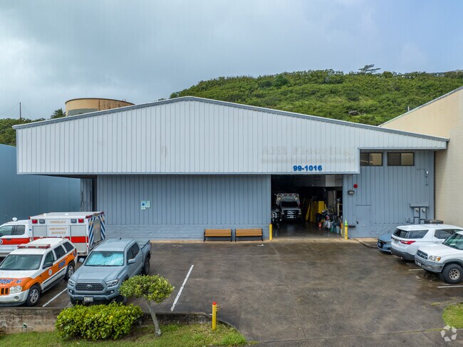
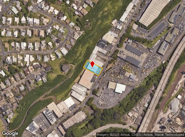
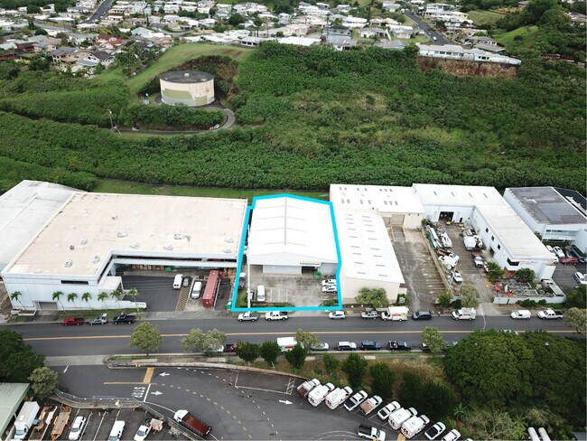
Property Record
99 Iwaena St, Aiea, HI 96701
NEARBY LISTINGS FOR SALE OR LEASE
Property Detail
99 Iwaena St
1-9-9-072-021-0000
LOT 258 MAP 141 LCAPP 966
Industrialgeneral
Honolulu
X
Hawaii
15003C0244G
258
2024
0.48 AC
2025
Leeward
007507
Hawaii
9,608 SF
Urban Honolulu, HI
DEMOGRAPHICS near 99 Iwaena St
1 Mile
3 Mile
5 Mile
2024 Total Population
13,969
89,262
199,203
2029 Population
13,439
86,374
191,746
Pop Growth 2024-2029
(3.79%)
(3.24%)
(3.74%)
Average Age
41
39
40
2024 Total Households
4,689
28,658
59,335
HH Growth 2024-2029
(4.59%)
(3.88%)
(4.39%)
Median Household Inc
$98,126
$94,079
$92,905
Avg Household Size
2.80
2.80
3.00
2024 Avg HH Vehicles
2.00
2.00
2.00
Median Home Value
$861,356
$723,081
$739,337
Median Year Built
1972
1976
1973
Nearby Places
Map Layers
Map Styles
 Street
 Aerial
- Restaurants
- Banks
- Shops
- Fitness
- Groceries
PUBLIC TRANSPORTATION
AIRPORT
Daniel K Inouye International
DRIVE
WALK
Distance
Daniel K Inouye International
12 min
6.0 mi
Freight Ports
Honolulu Harbor, Oahu
DRIVE
WALK
Distance
Honolulu Harbor, Oahu
18 min
8.3 mi
SALE & LEASE HISTORY
LISTING DATE
SALE/LEASE

Oct 13, 2021
For Lease
Oct 05, 2021
For Lease
Nearby Properties
Address
Land Use
TOTAL SIZE
Lot Size
Zoning
Address
Land Use
TOTAL SIZE
Lot Size
Zoning
355.21 AC
F-1
Address
Land Use
TOTAL SIZE
Lot Size
Zoning
1,725,655 SF
11 AC
I-2
Address
Land Use
TOTAL SIZE
Lot Size
Zoning
1,725,655 SF
11 AC
I-2
Address
Land Use
TOTAL SIZE
Lot Size
Zoning
163,285 SF
15.08 AC
R-7.5
Address
Land Use
TOTAL SIZE
Lot Size
Zoning
26,537 SF
2,470.86 AC
I-2
Address
Land Use
TOTAL SIZE
Lot Size
Zoning
1,447,909 SF
12.54 AC
IMX-1
Address
Land Use
TOTAL SIZE
Lot Size
Zoning
6.20 AC
I-2
Address
Land Use
TOTAL SIZE
Lot Size
Zoning
435,857 SF
10.69 AC
BMX-3
Address
Land Use
TOTAL SIZE
Lot Size
Zoning
12.54 AC
IMX-1
Address
Land Use
TOTAL SIZE
Lot Size
Zoning
419,067 SF
7.34 AC
BMX-3
Address
Land Use
TOTAL SIZE
Lot Size
Zoning
154,018 SF
15.24 AC
F-1
Address
Land Use
TOTAL SIZE
Lot Size
Zoning
202,766 SF
2.84 AC
BMX-3
Address
Land Use
TOTAL SIZE
Lot Size
Zoning
12.47 AC
F-1
Address
Land Use
TOTAL SIZE
Lot Size
Zoning
117,641 SF
9.61 AC
B-2
Address
Land Use
TOTAL SIZE
Lot Size
Zoning
164,921 SF
9.31 AC
BMX-3
Address
Land Use
TOTAL SIZE
Lot Size
Zoning
299,696 SF
16.26 AC
BMX-3
Address
Land Use
TOTAL SIZE
Lot Size
Zoning
100,170 SF
6.85 AC
IMX-1
Address
Land Use
TOTAL SIZE
Lot Size
Zoning
165,493 SF
6.85 AC
B-2
Address
Land Use
TOTAL SIZE
Lot Size
Zoning
203,701 SF
7.14 AC
BMX-3
Address
Land Use
TOTAL SIZE
Lot Size
Zoning
151,200 SF
5.23 AC
BMX-3
Address
Land Use
TOTAL SIZE
Lot Size
Zoning
6,788 SF
13.98 AC
BMX-3
Address
Land Use
TOTAL SIZE
Lot Size
Zoning
77,760 SF
7.75 AC
I-2
Address
Land Use
TOTAL SIZE
Lot Size
Zoning
59,018 SF
2.76 AC
I-2
Address
Land Use
TOTAL SIZE
Lot Size
Zoning
305,962 SF
7.48 AC
B-1
Address
Land Use
TOTAL SIZE
Lot Size
Zoning
74,556 SF
4.30 AC
B-2
Address
Land Use
TOTAL SIZE
Lot Size
Zoning
9.83 AC
F-1
Address
Land Use
TOTAL SIZE
Lot Size
Zoning
26,734 SF
10.66 AC
I-2
Address
Land Use
TOTAL SIZE
Lot Size
Zoning
78,258 SF
3.39 AC
IMX-1
Address
Land Use
TOTAL SIZE
Lot Size
Zoning
185,586 SF
3.59 AC
BMX-3
Address
Land Use
TOTAL SIZE
Lot Size
Zoning
50,017 SF
1.91 AC
IMX-1
The World's #1 Commercial Real Estate Marketplace
Connect with us
© 2025 CoStar Group
The information above has been obtained from sources believed reliable. While we do not doubt its accuracy we have not verified it and make no guarantee, warranty or representation about it. It is your responsibility to independently confirm its accuracy and completeness. Any projections, opinions, assumptions, or estimates used are for example only and do not represent the current or future performance of the property. The value of this transaction to you depends on tax and other factors which should be evaluated by your tax, financial, and legal advisors. You and your advisors should conduct a careful, independent investigation of the property to determine to your satisfaction the suitability of the property for your needs.