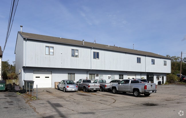
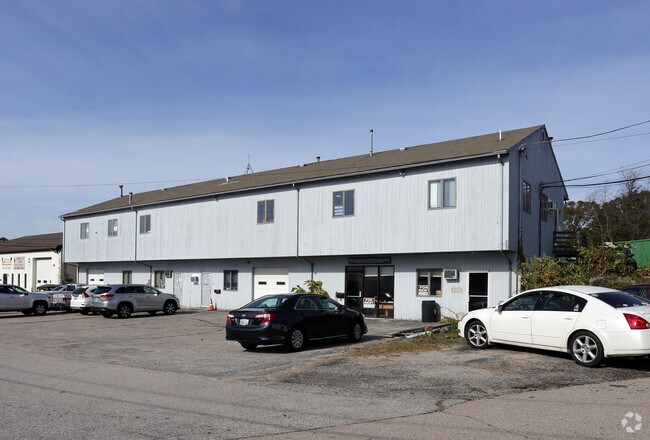
Property Record
99 Brownlee Blvd, Warwick, RI 02886
NEARBY LISTINGS FOR SALE OR LEASE
Property Detail
99 Brownlee Blvd
Commercialbuilding
Kent
X
Rhode Island
44003C0129J
0.35 AC
2025
Warwick
2025
Providence
022000
Providence-Warwick, RI-MA
7,700 SF
WARW-000245-000334-000000
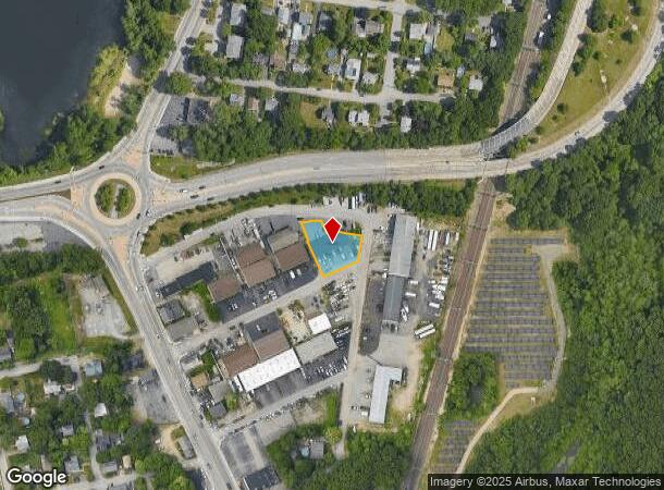
DEMOGRAPHICS near 99 Brownlee Blvd
1 Mile
3 Mile
5 Mile
2024 Total Population
9,443
57,997
163,469
2029 Population
9,600
58,737
165,034
Pop Growth 2024-2029
+ 1.66%
+ 1.28%
+ 0.96%
Average Age
44
44
43
2024 Total Households
4,210
24,768
69,286
HH Growth 2024-2029
+ 1.71%
+ 1.42%
+ 0.98%
Median Household Inc
$71,607
$72,318
$73,781
Avg Household Size
2.20
2.20
2.30
2024 Avg HH Vehicles
2.00
2.00
2.00
Median Home Value
$305,668
$311,447
$309,631
Median Year Built
1963
1965
1962
Nearby Places
Map Layers
Map Styles
 Street
 Aerial
- Restaurants
- Banks
- Shops
- Fitness
- Groceries
SALE & LEASE HISTORY
LISTING DATE
SALE/LEASE

Oct 03, 2016
For Lease
Nov 09, 2017
For Lease
Nearby Properties
Address
Land Use
TOTAL SIZE
Lot Size
Zoning
Address
Land Use
TOTAL SIZE
Lot Size
Zoning
39.98 AC
S1
Address
Land Use
TOTAL SIZE
Lot Size
Zoning
24,276 SF
0.01 AC
A15
Address
Land Use
TOTAL SIZE
Lot Size
Zoning
6,640 SF
0.01 AC
A10
Address
Land Use
TOTAL SIZE
Lot Size
Zoning
6,720 SF
0.01 AC
GB
Address
Land Use
TOTAL SIZE
Lot Size
Zoning
83,747 SF
20.32 AC
GB
Address
Land Use
TOTAL SIZE
Lot Size
Zoning
9.38 AC
S1
Address
Land Use
TOTAL SIZE
Lot Size
Zoning
171,576 SF
0.70 AC
O
Address
Land Use
TOTAL SIZE
Lot Size
Zoning
4,212 SF
32.62 AC
S1
Address
Land Use
TOTAL SIZE
Lot Size
Zoning
228,067 SF
30.74 AC
A7
Address
Land Use
TOTAL SIZE
Lot Size
Zoning
485,238 SF
2.05 AC
GB
Address
Land Use
TOTAL SIZE
Lot Size
Zoning
283,536 SF
97.97 AC
O
Address
Land Use
TOTAL SIZE
Lot Size
Zoning
6,702 SF
49.97 AC
GI
Address
Land Use
TOTAL SIZE
Lot Size
Zoning
411,032 SF
31.40 AC
GB
Address
Land Use
TOTAL SIZE
Lot Size
Zoning
517,743 SF
3.55 AC
GI
Address
Land Use
TOTAL SIZE
Lot Size
Zoning
491,496 SF
46.72 AC
LI
Address
Land Use
TOTAL SIZE
Lot Size
Zoning
18,720 SF
15 AC
PDR
Address
Land Use
TOTAL SIZE
Lot Size
Zoning
3,743 SF
A15
Address
Land Use
TOTAL SIZE
Lot Size
Zoning
25 AC
CI
Address
Land Use
TOTAL SIZE
Lot Size
Zoning
100,638 SF
6.80 AC
GB
Address
Land Use
TOTAL SIZE
Lot Size
Zoning
135,317 SF
27.16 AC
A10
Address
Land Use
TOTAL SIZE
Lot Size
Zoning
139,256 SF
29.40 AC
GB
Address
Land Use
TOTAL SIZE
Lot Size
Zoning
243,057 SF
9.59 AC
GB
Address
Land Use
TOTAL SIZE
Lot Size
Zoning
116,940 SF
23.17 AC
Address
Land Use
TOTAL SIZE
Lot Size
Zoning
157,486 SF
13.09 AC
A7
Address
Land Use
TOTAL SIZE
Lot Size
Zoning
118,798 SF
25.61 AC
GB
Address
Land Use
TOTAL SIZE
Lot Size
Zoning
294,355 SF
19.51 AC
Address
Land Use
TOTAL SIZE
Lot Size
Zoning
163,358 SF
A7
Address
Land Use
TOTAL SIZE
Lot Size
Zoning
278,684 SF
1.39 AC
GB
Address
Land Use
TOTAL SIZE
Lot Size
Zoning
65,646 SF
5.60 AC
Address
Land Use
TOTAL SIZE
Lot Size
Zoning
99,177 SF
LI
The World's #1 Commercial Real Estate Marketplace
Connect with us
© 2026 CoStar Group
The information above has been obtained from sources believed reliable. While we do not doubt its accuracy we have not verified it and make no guarantee, warranty or representation about it. It is your responsibility to independently confirm its accuracy and completeness. Any projections, opinions, assumptions, or estimates used are for example only and do not represent the current or future performance of the property. The value of this transaction to you depends on tax and other factors which should be evaluated by your tax, financial, and legal advisors. You and your advisors should conduct a careful, independent investigation of the property to determine to your satisfaction the suitability of the property for your needs.