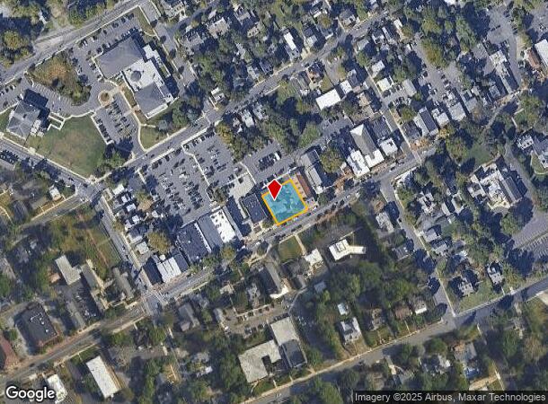
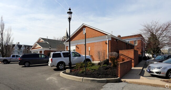
Property Record
99 W Main St, Moorestown, NJ 08057


NEARBY LISTINGS FOR SALE OR LEASE
Property Detail
99 W Main St
22-02407-0000-00024
120 Madison Avenue
Officebuilding
Burlington
X
New Jersey
34005C0229F
24
2024
0.35 AC
2025
North Burlington County
700504
Philadelphia
6,149 SF
Philadelphia-Camden-Wilmington, PA-NJ-DE-MD
DEMOGRAPHICS near 99 W Main St
1 Mile
3 Mile
5 Mile
2024 Total Population
8,888
63,756
198,277
2029 Population
9,059
65,071
201,462
Pop Growth 2024-2029
+ 1.92%
+ 2.06%
+ 1.61%
Average Age
42
42
42
2024 Total Households
3,222
24,959
77,909
HH Growth 2024-2029
+ 1.92%
+ 1.98%
+ 1.60%
Median Household Inc
$141,433
$104,643
$104,228
Avg Household Size
2.70
2.50
2.50
2024 Avg HH Vehicles
2.00
2.00
2.00
Median Home Value
$486,175
$349,873
$298,146
Median Year Built
1954
1973
1974
Nearby Places
Map Layers
Map Styles
 Street
 Aerial
- Restaurants
- Banks
- Shops
- Fitness
- Groceries
PUBLIC TRANSPORTATION
COMMUTER RAIL
DRIVE
WALK
Distance
14 min
7.2 mi
Tacony (R7 - Southeastern Pennsylvania Transportation Authority Regional Rail (SEPTA Regional Rail))
DRIVE
WALK
Distance
Tacony (R7 - Southeastern Pennsylvania Transportation Authority Regional Rail (SEPTA Regional Rail))
16 min
7.8 mi
AIRPORT
Philadelphia International
DRIVE
WALK
Distance
Philadelphia International
39 min
21.5 mi
Trenton Mercer
DRIVE
WALK
Distance
Trenton Mercer
48 min
32.7 mi
Atlantic City International
DRIVE
WALK
Distance
Atlantic City International
84 min
46.3 mi
Freight Ports
Port of Philadelphia
DRIVE
WALK
Distance
Port of Philadelphia
21 min
10.1 mi
Nearby Properties
Address
Land Use
TOTAL SIZE
Lot Size
Zoning
Address
Land Use
TOTAL SIZE
Lot Size
Zoning
90.41 AC
Address
Land Use
TOTAL SIZE
Lot Size
Zoning
120.80 AC
Address
Land Use
TOTAL SIZE
Lot Size
Zoning
38.76 AC
Address
Land Use
TOTAL SIZE
Lot Size
Zoning
1 SF
42.23 AC
Address
Land Use
TOTAL SIZE
Lot Size
Zoning
39.71 AC
Address
Land Use
TOTAL SIZE
Lot Size
Zoning
40.92 AC
Address
Land Use
TOTAL SIZE
Lot Size
Zoning
199,049 SF
15.90 AC
Address
Land Use
TOTAL SIZE
Lot Size
Zoning
16.69 AC
Address
Land Use
TOTAL SIZE
Lot Size
Zoning
6.25 AC
Address
Land Use
TOTAL SIZE
Lot Size
Zoning
25.84 AC
Address
Land Use
TOTAL SIZE
Lot Size
Zoning
79.67 AC
I
Address
Land Use
TOTAL SIZE
Lot Size
Zoning
43.20 AC
Address
Land Use
TOTAL SIZE
Lot Size
Zoning
999,999,999 SF
21.10 AC
Address
Land Use
TOTAL SIZE
Lot Size
Zoning
15.02 AC
Address
Land Use
TOTAL SIZE
Lot Size
Zoning
28.96 AC
Address
Land Use
TOTAL SIZE
Lot Size
Zoning
22.45 AC
MD
Address
Land Use
TOTAL SIZE
Lot Size
Zoning
19.79 AC
Address
Land Use
TOTAL SIZE
Lot Size
Zoning
15.10 AC
Address
Land Use
TOTAL SIZE
Lot Size
Zoning
27.77 AC
Address
Land Use
TOTAL SIZE
Lot Size
Zoning
Address
Land Use
TOTAL SIZE
Lot Size
Zoning
14.46 AC
Address
Land Use
TOTAL SIZE
Lot Size
Zoning
79.78 AC
Address
Land Use
TOTAL SIZE
Lot Size
Zoning
26.25 AC
Address
Land Use
TOTAL SIZE
Lot Size
Zoning
22,125 SF
15.01 AC
Address
Land Use
TOTAL SIZE
Lot Size
Zoning
13.98 AC
Address
Land Use
TOTAL SIZE
Lot Size
Zoning
13.15 AC
Address
Land Use
TOTAL SIZE
Lot Size
Zoning
15.49 AC
Address
Land Use
TOTAL SIZE
Lot Size
Zoning
22.91 AC
Address
Land Use
TOTAL SIZE
Lot Size
Zoning
15.46 AC
Address
Land Use
TOTAL SIZE
Lot Size
Zoning
23.76 AC
The World's #1 Commercial Real Estate Marketplace
Connect with us
© 2026 CoStar Group
The information above has been obtained from sources believed reliable. While we do not doubt its accuracy we have not verified it and make no guarantee, warranty or representation about it. It is your responsibility to independently confirm its accuracy and completeness. Any projections, opinions, assumptions, or estimates used are for example only and do not represent the current or future performance of the property. The value of this transaction to you depends on tax and other factors which should be evaluated by your tax, financial, and legal advisors. You and your advisors should conduct a careful, independent investigation of the property to determine to your satisfaction the suitability of the property for your needs.