Property Record
990 Serramonte Blvd, Colma, CA 94014


NEARBY LISTINGS FOR SALE OR LEASE
Property Detail
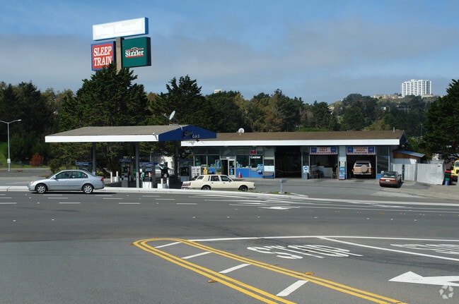
990 Serramonte Blvd
San Francisco-Redwood City-South San Francisco, CA
C C & F Serra Center
008-373-550
PARCEL 6 PARCEL MAP VOL 11/25 & ADJ A STRIP OF JUNIPERO SERRA BOULEVARD RIGHT OF WAY
Storebuilding
San Mateo
X
California
06081C0037E
1
2024
0.81 AC
2025
Brisbane/Daly City
601601
San Francisco
7,665 SF
DEMOGRAPHICS near 990 Serramonte Blvd
1 Mile
3 Mile
5 Mile
2024 Total Population
20,814
189,953
383,945
2029 Population
19,755
179,368
357,648
Pop Growth 2024-2029
(5.09%)
(5.57%)
(6.85%)
Average Age
43
43
43
2024 Total Households
6,829
59,976
124,186
HH Growth 2024-2029
(5.23%)
(5.75%)
(7.07%)
Median Household Inc
$115,035
$112,233
$113,091
Avg Household Size
2.90
3.00
2.90
2024 Avg HH Vehicles
2.00
2.00
2.00
Median Home Value
$954,560
$1,038,428
$1,060,530
Median Year Built
1973
1964
1958
Nearby Places
Map Layers
Map Styles
 Street
 Aerial
- Restaurants
- Banks
- Shops
- Fitness
- Groceries
PUBLIC TRANSPORTATION
COMMUTER RAIL
South San Francisco (Caltrain - Caltrain (Caltrain))
DRIVE
WALK
Distance
South San Francisco (Caltrain - Caltrain (Caltrain))
9 min
4.5 mi
DRIVE
WALK
Distance
9 min
4.6 mi
AIRPORT
San Francisco International
DRIVE
WALK
Distance
San Francisco International
14 min
8.0 mi
Metro Oakland International
DRIVE
WALK
Distance
Metro Oakland International
42 min
29.6 mi
Norman Y Mineta San Jose International
DRIVE
WALK
Distance
Norman Y Mineta San Jose International
51 min
39.6 mi
Freight Ports
Port of San Francisco
DRIVE
WALK
Distance
Port of San Francisco
19 min
13.0 mi
Nearby Properties
Address
Land Use
TOTAL SIZE
Lot Size
Zoning
Address
Land Use
TOTAL SIZE
Lot Size
Zoning
53.85 AC
Address
Land Use
TOTAL SIZE
Lot Size
Zoning
312,191 SF
2.74 AC
Address
Land Use
TOTAL SIZE
Lot Size
Zoning
167,105 SF
2.07 AC
C10000
Address
Land Use
TOTAL SIZE
Lot Size
Zoning
42.95 AC
Address
Land Use
TOTAL SIZE
Lot Size
Zoning
447,674 SF
21.51 AC
Address
Land Use
TOTAL SIZE
Lot Size
Zoning
178,110 SF
1.67 AC
Address
Land Use
TOTAL SIZE
Lot Size
Zoning
Address
Land Use
TOTAL SIZE
Lot Size
Zoning
10.62 AC
Address
Land Use
TOTAL SIZE
Lot Size
Zoning
187,865 SF
3.54 AC
Address
Land Use
TOTAL SIZE
Lot Size
Zoning
209,692 SF
8.20 AC
R30000
Address
Land Use
TOTAL SIZE
Lot Size
Zoning
2,011 SF
2.49 AC
Address
Land Use
TOTAL SIZE
Lot Size
Zoning
12.83 AC
PD0000
Address
Land Use
TOTAL SIZE
Lot Size
Zoning
175,618 SF
2.44 AC
Address
Land Use
TOTAL SIZE
Lot Size
Zoning
181,172 SF
2.11 AC
Address
Land Use
TOTAL SIZE
Lot Size
Zoning
108,917 SF
4.61 AC
PD0004
Address
Land Use
TOTAL SIZE
Lot Size
Zoning
153,054 SF
15.13 AC
Address
Land Use
TOTAL SIZE
Lot Size
Zoning
141,956 SF
1.74 AC
Address
Land Use
TOTAL SIZE
Lot Size
Zoning
73.91 AC
Address
Land Use
TOTAL SIZE
Lot Size
Zoning
128,506 SF
2.17 AC
Address
Land Use
TOTAL SIZE
Lot Size
Zoning
206.09 AC
Address
Land Use
TOTAL SIZE
Lot Size
Zoning
67,432 SF
4.55 AC
CL00C1
Address
Land Use
TOTAL SIZE
Lot Size
Zoning
113,136 SF
9.09 AC
G10000
Address
Land Use
TOTAL SIZE
Lot Size
Zoning
113,782 SF
2.90 AC
Address
Land Use
TOTAL SIZE
Lot Size
Zoning
71,780 SF
4.11 AC
PC000M
Address
Land Use
TOTAL SIZE
Lot Size
Zoning
257,754 SF
1.37 AC
Address
Land Use
TOTAL SIZE
Lot Size
Zoning
63,943 SF
0.77 AC
Address
Land Use
TOTAL SIZE
Lot Size
Zoning
75,559 SF
2.48 AC
R30000
Address
Land Use
TOTAL SIZE
Lot Size
Zoning
410,683 SF
9.76 AC
R30000
Address
Land Use
TOTAL SIZE
Lot Size
Zoning
6.73 AC
CL00C1
Address
Land Use
TOTAL SIZE
Lot Size
Zoning
58,775 SF
3.04 AC
R30000
The World's #1 Commercial Real Estate Marketplace
Connect with us
© 2026 CoStar Group
The information above has been obtained from sources believed reliable. While we do not doubt its accuracy we have not verified it and make no guarantee, warranty or representation about it. It is your responsibility to independently confirm its accuracy and completeness. Any projections, opinions, assumptions, or estimates used are for example only and do not represent the current or future performance of the property. The value of this transaction to you depends on tax and other factors which should be evaluated by your tax, financial, and legal advisors. You and your advisors should conduct a careful, independent investigation of the property to determine to your satisfaction the suitability of the property for your needs.