Property Record
990 Main St, West Barnstable, MA 02668

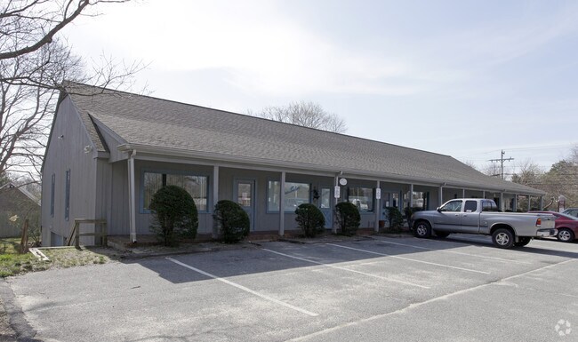
Property Detail
990 Main St
Commercialcondominium
Barnstable
WBVBD;
Massachusetts
B and X Area of moderate flood hazard, usually the area between the limits of the 100-year and 500-year floods.
100e
2025
Other Market Areas
2025
Barnstable Town, MA
012200
BARN-000179-000000-000001-C000000
560 SF
NEARBY LISTINGS FOR SALE OR LEASE
-
-
View all West Barnstable listings for sale on LoopNet.com
DEMOGRAPHICS near 990 Main St
1 mile
3 mile
5 mile
2025 Total Population
462
8,634
33,159
2030 Population
437
8,231
32,076
Pop Growth 2025-2030
(5.41%)
(4.67%)
(3.27%)
Average Age
49
48
47
2025 Total Households
182
3,461
13,426
HH Growth 2025-2030
(6.04%)
(5.11%)
(3.57%)
Median Household Inc
$106,346
$113,350
$108,068
Avg Household Size
2.30
2.40
2.40
2025 Avg HH Vehicles
2.00
2.00
2.00
Median Home Value
$741,304
$672,700
$663,832
Median Year Built
1985
1982
1981
Nearby Places
Map Layers
Map Styles
 Street
 Aerial
Layers
 Traffic
 Biking
Places
Listings with unknown addresses are not visible on the map
- Restaurants
- Banks
- Shops
- Fitness
- Groceries
PUBLIC TRANSPORTATION
COMMUTER RAIL
Drive
Walk
Distance
12 min
6.1 mi
AIRPORT
Martha's Vineyard
Drive
Walk
Distance
Martha's Vineyard
101 min
36.8 mi
Freight Ports
Port of New Bedford Harbor
Drive
Walk
Distance
Port of New Bedford Harbor
59 min
42.8 mi
Nearby Properties
Address
Land Use
TOTAL SIZE
Lot Size
Zoning
Address
Land Use
TOTAL SIZE
Lot Size
Zoning
44 AC
RG;RF
Address
Land Use
TOTAL SIZE
Lot Size
Zoning
1,114.30 AC
Address
Land Use
TOTAL SIZE
Lot Size
Zoning
36,536 SF
36.91 AC
RG;RF-
Address
Land Use
TOTAL SIZE
Lot Size
Zoning
39,689 SF
9.12 AC
Address
Land Use
TOTAL SIZE
Lot Size
Zoning
126.31 AC
RG;RF-
Address
Land Use
TOTAL SIZE
Lot Size
Zoning
1,188.31 AC
RF;RF-
Address
Land Use
TOTAL SIZE
Lot Size
Zoning
143.68 AC
R
Address
Land Use
TOTAL SIZE
Lot Size
Zoning
1.91 AC
RF
Address
Land Use
TOTAL SIZE
Lot Size
Zoning
5.32 AC
RF
Address
Land Use
TOTAL SIZE
Lot Size
Zoning
7.13 AC
1
Address
Land Use
TOTAL SIZE
Lot Size
Zoning
61 AC
1
Address
Land Use
TOTAL SIZE
Lot Size
Zoning
6,209 SF
7.18 AC
R-2
Address
Land Use
TOTAL SIZE
Lot Size
Zoning
172.75 AC
RG;RF-
Address
Land Use
TOTAL SIZE
Lot Size
Zoning
4,217 SF
1.86 AC
R-2
Address
Land Use
TOTAL SIZE
Lot Size
Zoning
14,273 SF
5.60 AC
Address
Land Use
TOTAL SIZE
Lot Size
Zoning
2.73 AC
R
Address
Land Use
TOTAL SIZE
Lot Size
Zoning
7,452 SF
1.72 AC
RF;RF-
Address
Land Use
TOTAL SIZE
Lot Size
Zoning
27 AC
R-2
Address
Land Use
TOTAL SIZE
Lot Size
Zoning
8,858 SF
1.47 AC
Address
Land Use
TOTAL SIZE
Lot Size
Zoning
133 AC
Address
Land Use
TOTAL SIZE
Lot Size
Zoning
2,826 SF
4.13 AC
RF
Address
Land Use
TOTAL SIZE
Lot Size
Zoning
1.35 AC
RD
Address
Land Use
TOTAL SIZE
Lot Size
Zoning
6.58 AC
Address
Land Use
TOTAL SIZE
Lot Size
Zoning
7,572 SF
14.18 AC
Address
Land Use
TOTAL SIZE
Lot Size
Zoning
10,047 SF
2 AC
RIDGE
Address
Land Use
TOTAL SIZE
Lot Size
Zoning
1,200 SF
14.75 AC
1
Address
Land Use
TOTAL SIZE
Lot Size
Zoning
Address
Land Use
TOTAL SIZE
Lot Size
Zoning
1 AC
RF-1;R
Address
Land Use
TOTAL SIZE
Lot Size
Zoning
2.13 AC
Address
Land Use
TOTAL SIZE
Lot Size
Zoning
The World's #1 Commercial Real Estate Marketplace
Connect with us
© 2026 CoStar Group
The information above has been obtained from sources believed reliable. While we do not doubt its accuracy we have not verified it and make no guarantee, warranty or representation about it. It is your responsibility to independently confirm its accuracy and completeness. Any projections, opinions, assumptions, or estimates used are for example only and do not represent the current or future performance of the property. The value of this transaction to you depends on tax and other factors which should be evaluated by your tax, financial, and legal advisors. You and your advisors should conduct a careful, independent investigation of the property to determine to your satisfaction the suitability of the property for your needs.