Property Record
9900 W State Route 66, Newburgh, IN 47630
NEARBY LISTINGS FOR SALE OR LEASE
-
-
-
-
-
-
1510 Tutor Lane Evansville In 47715
Evansville, IN 47715
$329,000 - $2,354,000
0.78 - 1.22 AC Lot
Land
-
-
View all Newburgh listings for sale on LoopNet.com
Property Detail
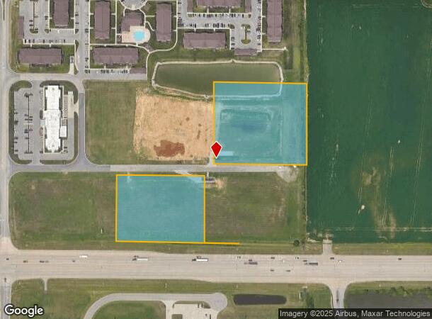
9900 W State Route 66
Evansville, IN-KY
Arbor Pointe
87-12-21-300-013.000-019
PT W 1/2 SW S21 T6 R9 6.774 A
Commercialacreage
Warrick
AE
Indiana
21101C0110F
6.77 AC
2024
Warrick County
2024
Evansville
030703
DEMOGRAPHICS near 9900 W State Route 66
1 Mile
3 Mile
5 Mile
2024 Total Population
3,126
39,530
83,138
2029 Population
3,309
40,684
84,702
Pop Growth 2024-2029
+ 5.85%
+ 2.92%
+ 1.88%
Average Age
42
41
41
2024 Total Households
1,150
16,115
35,320
HH Growth 2024-2029
+ 5.91%
+ 2.83%
+ 1.65%
Median Household Inc
$132,907
$84,001
$69,766
Avg Household Size
2.60
2.40
2.30
2024 Avg HH Vehicles
2.00
2.00
2.00
Median Home Value
$299,215
$222,436
$189,020
Median Year Built
1997
1987
1981
Nearby Places
- Restaurants
- Banks
- Shops
- Fitness
- Groceries
PUBLIC TRANSPORTATION
AIRPORT
Evansville Regional
DRIVE
WALK
Distance
Evansville Regional
17 min
10.1 mi
Freight Ports
Port of Toledo
DRIVE
WALK
Distance
Port of Toledo
453 min
391.1 mi
SALE & LEASE HISTORY
LISTING DATE
SALE/LEASE

Sep 06, 2017
For Sale
Nearby Properties
Address
Land Use
TOTAL SIZE
Lot Size
Zoning
Address
Land Use
TOTAL SIZE
Lot Size
Zoning
43,824 SF
32.02 AC
Address
Land Use
TOTAL SIZE
Lot Size
Zoning
6,110 SF
28.46 AC
Address
Land Use
TOTAL SIZE
Lot Size
Zoning
136,449 SF
14.07 AC
Address
Land Use
TOTAL SIZE
Lot Size
Zoning
130,000 SF
Address
Land Use
TOTAL SIZE
Lot Size
Zoning
109,983 SF
27.50 AC
Address
Land Use
TOTAL SIZE
Lot Size
Zoning
75,107 SF
13.68 AC
Address
Land Use
TOTAL SIZE
Lot Size
Zoning
3,940 SF
17.67 AC
Address
Land Use
TOTAL SIZE
Lot Size
Zoning
30,039 SF
6.67 AC
Address
Land Use
TOTAL SIZE
Lot Size
Zoning
132,150 SF
11.36 AC
Address
Land Use
TOTAL SIZE
Lot Size
Zoning
3,260 SF
9.96 AC
Address
Land Use
TOTAL SIZE
Lot Size
Zoning
31,950 SF
6.22 AC
Address
Land Use
TOTAL SIZE
Lot Size
Zoning
3,405 SF
24.60 AC
Address
Land Use
TOTAL SIZE
Lot Size
Zoning
26,664 SF
10.81 AC
Address
Land Use
TOTAL SIZE
Lot Size
Zoning
176,128 SF
18.79 AC
Address
Land Use
TOTAL SIZE
Lot Size
Zoning
37,199 SF
27.28 AC
Address
Land Use
TOTAL SIZE
Lot Size
Zoning
49,154 SF
3.60 AC
Address
Land Use
TOTAL SIZE
Lot Size
Zoning
75,282 SF
7.56 AC
Address
Land Use
TOTAL SIZE
Lot Size
Zoning
43,230 SF
7.08 AC
Address
Land Use
TOTAL SIZE
Lot Size
Zoning
4,389 SF
9.09 AC
Address
Land Use
TOTAL SIZE
Lot Size
Zoning
114,160 SF
11 AC
Address
Land Use
TOTAL SIZE
Lot Size
Zoning
45,431 SF
22.08 AC
Address
Land Use
TOTAL SIZE
Lot Size
Zoning
3,051 SF
14.65 AC
Address
Land Use
TOTAL SIZE
Lot Size
Zoning
27,984 SF
10.28 AC
Address
Land Use
TOTAL SIZE
Lot Size
Zoning
153,640 SF
20.09 AC
Address
Land Use
TOTAL SIZE
Lot Size
Zoning
8,700 SF
22.09 AC
Address
Land Use
TOTAL SIZE
Lot Size
Zoning
28,632 SF
6.27 AC
Address
Land Use
TOTAL SIZE
Lot Size
Zoning
16,918 SF
17.66 AC
Address
Land Use
TOTAL SIZE
Lot Size
Zoning
210,137 SF
18 AC
Address
Land Use
TOTAL SIZE
Lot Size
Zoning
130,978 SF
24.94 AC
Address
Land Use
TOTAL SIZE
Lot Size
Zoning
197,528 SF
21.55 AC
The World's #1 Commercial Real Estate Marketplace
Connect with us
© 2025 CoStar Group
The information above has been obtained from sources believed reliable. While we do not doubt its accuracy we have not verified it and make no guarantee, warranty or representation about it. It is your responsibility to independently confirm its accuracy and completeness. Any projections, opinions, assumptions, or estimates used are for example only and do not represent the current or future performance of the property. The value of this transaction to you depends on tax and other factors which should be evaluated by your tax, financial, and legal advisors. You and your advisors should conduct a careful, independent investigation of the property to determine to your satisfaction the suitability of the property for your needs.