Property Record
9902 Clayton Rd, Saint Louis, MO 63124
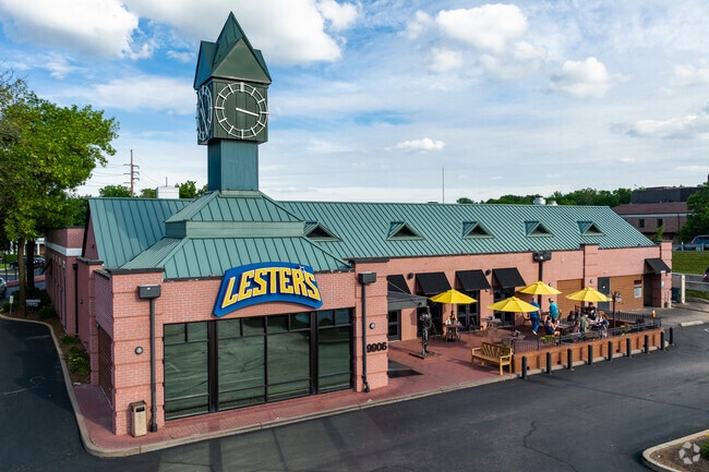


Property Detail
9902 Clayton Rd
19M-31-0062
DESCOMBE EST LOT PTS 1 & 2 CLAYTON RD & HWY 40
Stripcommercialcenter
Saint Louis
33G
Missouri
B and X Area of moderate flood hazard, usually the area between the limits of the 100-year and 500-year floods.
1,2
2024
0.82 AC
2025
Mid County
217500
St. Louis
8,234 SF
St. Louis, MO-IL
NEARBY LISTINGS FOR SALE OR LEASE
DEMOGRAPHICS near 9902 Clayton Rd
1 mile
3 mile
5 mile
2025 Total Population
2,679
63,406
230,062
2030 Population
2,662
62,951
227,905
Pop Growth 2025-2030
(0.63%)
(0.72%)
(0.94%)
Average Age
43
42
41
2025 Total Households
959
26,381
97,150
HH Growth 2025-2030
(0.63%)
(0.64%)
(0.99%)
Median Household Inc
$241,294
$132,892
$103,471
Avg Household Size
2.80
2.30
2.20
2025 Avg HH Vehicles
2.00
2.00
2.00
Median Home Value
$1,013,235
$598,803
$410,973
Median Year Built
1953
1958
1957
Nearby Places
Map Layers
Map Styles
 Street
 Aerial
Layers
 Traffic
 Biking
Places
Listings with unknown addresses are not visible on the map
- Restaurants
- Banks
- Shops
- Fitness
- Groceries
PUBLIC TRANSPORTATION
COMMUTER RAIL
Brentwood I-64 (Shrewsbury-Lansdowne I-44 Emerson Park - St. Louis MetroLink (MetroLink))
Drive
Walk
Distance
Brentwood I-64 (Shrewsbury-Lansdowne I-44 Emerson Park - St. Louis MetroLink (MetroLink))
6 min
3.5 mi
Richmond Heights (Shrewsbury-Lansdowne I-44 Emerson Park - St. Louis MetroLink (MetroLink))
Drive
Walk
Distance
Richmond Heights (Shrewsbury-Lansdowne I-44 Emerson Park - St. Louis MetroLink (MetroLink))
9 min
4.0 mi
AIRPORT
St Louis Lambert International
Drive
Walk
Distance
St Louis Lambert International
20 min
13.1 mi
Scott AFB/Midamerica St Louis
Drive
Walk
Distance
Scott AFB/Midamerica St Louis
54 min
36.7 mi
SALE & LEASE HISTORY
LISTING DATE
SALE/LEASE

Jan 31, 2018
For Lease
Nearby Properties
Address
Land Use
TOTAL SIZE
Lot Size
Zoning
Address
Land Use
TOTAL SIZE
Lot Size
Zoning
20,852 SF
48.33 AC
82PH
Address
Land Use
TOTAL SIZE
Lot Size
Zoning
389,075 SF
19.85 AC
83H
Address
Land Use
TOTAL SIZE
Lot Size
Zoning
5,898 SF
21.62 AC
R2
Address
Land Use
TOTAL SIZE
Lot Size
Zoning
43,617 SF
7.04 AC
83O
Address
Land Use
TOTAL SIZE
Lot Size
Zoning
34.35 AC
25R-1
Address
Land Use
TOTAL SIZE
Lot Size
Zoning
238,035 SF
3.23 AC
14HDC
Address
Land Use
TOTAL SIZE
Lot Size
Zoning
52.13 AC
42PA
Address
Land Use
TOTAL SIZE
Lot Size
Zoning
5,551 SF
0.72 AC
14HDC
Address
Land Use
TOTAL SIZE
Lot Size
Zoning
501,837 SF
21.52 AC
14PUD
Address
Land Use
TOTAL SIZE
Lot Size
Zoning
434,971 SF
24.80 AC
G
Address
Land Use
TOTAL SIZE
Lot Size
Zoning
201,879 SF
29.52 AC
82RO
Address
Land Use
TOTAL SIZE
Lot Size
Zoning
442,503 SF
3.52 AC
82PH
Address
Land Use
TOTAL SIZE
Lot Size
Zoning
272,933 SF
0.82 AC
14PUD
Address
Land Use
TOTAL SIZE
Lot Size
Zoning
33.71 AC
R3
Address
Land Use
TOTAL SIZE
Lot Size
Zoning
56.62 AC
82A
Address
Land Use
TOTAL SIZE
Lot Size
Zoning
1,280,539 SF
151.20 AC
H
Address
Land Use
TOTAL SIZE
Lot Size
Zoning
544,556 SF
95.75 AC
H
Address
Land Use
TOTAL SIZE
Lot Size
Zoning
277,568 SF
0.68 AC
14HDC
Address
Land Use
TOTAL SIZE
Lot Size
Zoning
4,150 SF
21.42 AC
83H
Address
Land Use
TOTAL SIZE
Lot Size
Zoning
272,940 SF
0.87 AC
14PUD
Address
Land Use
TOTAL SIZE
Lot Size
Zoning
1.33 AC
C4
Address
Land Use
TOTAL SIZE
Lot Size
Zoning
31.83 AC
R2
Address
Land Use
TOTAL SIZE
Lot Size
Zoning
262,446 SF
1.97 AC
14S-1
Address
Land Use
TOTAL SIZE
Lot Size
Zoning
17,239 SF
51.14 AC
R2
Address
Land Use
TOTAL SIZE
Lot Size
Zoning
3.52 AC
82PH
Address
Land Use
TOTAL SIZE
Lot Size
Zoning
281,259 SF
0.50 AC
14HDC
Address
Land Use
TOTAL SIZE
Lot Size
Zoning
233,748 SF
0.67 AC
14PUD
Address
Land Use
TOTAL SIZE
Lot Size
Zoning
642,298 SF
1.78 AC
14PUD
Address
Land Use
TOTAL SIZE
Lot Size
Zoning
178,963 SF
14.98 AC
E
Address
Land Use
TOTAL SIZE
Lot Size
Zoning
10.57 AC
33C
The World's #1 Commercial Real Estate Marketplace
Connect with us
© 2026 CoStar Group
The information above has been obtained from sources believed reliable. While we do not doubt its accuracy we have not verified it and make no guarantee, warranty or representation about it. It is your responsibility to independently confirm its accuracy and completeness. Any projections, opinions, assumptions, or estimates used are for example only and do not represent the current or future performance of the property. The value of this transaction to you depends on tax and other factors which should be evaluated by your tax, financial, and legal advisors. You and your advisors should conduct a careful, independent investigation of the property to determine to your satisfaction the suitability of the property for your needs.