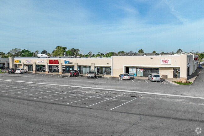
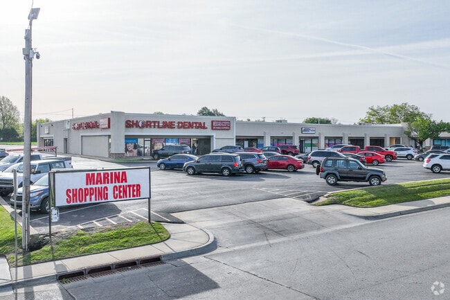
Property Record
9908 E 21St St, Tulsa, OK 74129
NEARBY LISTINGS FOR SALE OR LEASE
Property Detail
9908 E 21St St
Tulsa, OK
Country Harbor Center
09940-94-18-13580
LT 1 BLK 1
Regionalshoppingcenterormallwithanchorstore
Tulsa
X
Oklahoma
40131C0350J
1
2025
3.41 AC
2025
North Central Tulsa
007314
Tulsa
39,750 SF
DEMOGRAPHICS near 9908 E 21St St
1 Mile
3 Mile
5 Mile
2024 Total Population
13,179
93,648
189,584
2029 Population
13,637
96,670
195,990
Pop Growth 2024-2029
+ 3.48%
+ 3.23%
+ 3.38%
Average Age
36
36
37
2024 Total Households
4,932
35,779
76,325
HH Growth 2024-2029
+ 3.65%
+ 3.31%
+ 3.47%
Median Household Inc
$43,365
$45,016
$50,002
Avg Household Size
2.50
2.50
2.40
2024 Avg HH Vehicles
2.00
2.00
2.00
Median Home Value
$134,419
$125,498
$149,975
Median Year Built
1973
1971
1969
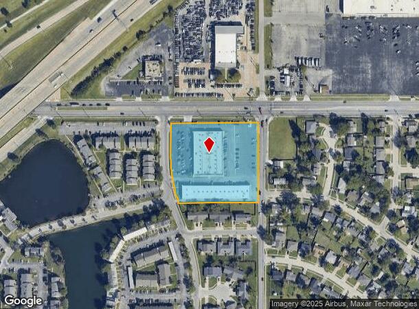
Nearby Places
Map Layers
Map Styles
 Street
 Aerial
- Restaurants
- Banks
- Shops
- Fitness
- Groceries
PUBLIC TRANSPORTATION
AIRPORT
Tulsa International
DRIVE
WALK
Distance
Tulsa International
15 min
9.1 mi
Freight Ports
DRIVE
WALK
Distance
18 min
12.9 mi
SALE & LEASE HISTORY
LISTING DATE
SALE/LEASE

Sep 25, 2016
For Lease
Apr 25, 2018
For Lease
Nearby Properties
Address
Land Use
TOTAL SIZE
Lot Size
Zoning
Address
Land Use
TOTAL SIZE
Lot Size
Zoning
80,431 SF
9.51 AC
IL
Address
Land Use
TOTAL SIZE
Lot Size
Zoning
350,741 SF
28.01 AC
CS
Address
Land Use
TOTAL SIZE
Lot Size
Zoning
78,119 SF
11.11 AC
CO
Address
Land Use
TOTAL SIZE
Lot Size
Zoning
46,859 SF
5.80 AC
CH
Address
Land Use
TOTAL SIZE
Lot Size
Zoning
108,416 SF
4.26 AC
OM
Address
Land Use
TOTAL SIZE
Lot Size
Zoning
180,642 SF
5.14 AC
CS
Address
Land Use
TOTAL SIZE
Lot Size
Zoning
77,346 SF
8.59 AC
RS3
Address
Land Use
TOTAL SIZE
Lot Size
Zoning
112,556 SF
11.07 AC
CH
Address
Land Use
TOTAL SIZE
Lot Size
Zoning
96,983 SF
5.42 AC
RM2
Address
Land Use
TOTAL SIZE
Lot Size
Zoning
118,824 SF
38.79 AC
IM
Address
Land Use
TOTAL SIZE
Lot Size
Zoning
106,898 SF
5.25 AC
RM2
Address
Land Use
TOTAL SIZE
Lot Size
Zoning
117,537 SF
14.99 AC
CO
Address
Land Use
TOTAL SIZE
Lot Size
Zoning
73,294 SF
10.08 AC
RS3
Address
Land Use
TOTAL SIZE
Lot Size
Zoning
103,248 SF
8.87 AC
IL
Address
Land Use
TOTAL SIZE
Lot Size
Zoning
25,604 SF
25.15 AC
IL
Address
Land Use
TOTAL SIZE
Lot Size
Zoning
106,270 SF
9.47 AC
RM0
Address
Land Use
TOTAL SIZE
Lot Size
Zoning
92,121 SF
9.34 AC
CS
Address
Land Use
TOTAL SIZE
Lot Size
Zoning
62,352 SF
4.88 AC
CS
Address
Land Use
TOTAL SIZE
Lot Size
Zoning
86,980 SF
2.74 AC
RM1
Address
Land Use
TOTAL SIZE
Lot Size
Zoning
117,204 SF
9.79 AC
IM
Address
Land Use
TOTAL SIZE
Lot Size
Zoning
41,057 SF
5.45 AC
IL
Address
Land Use
TOTAL SIZE
Lot Size
Zoning
31,248 SF
2.05 AC
CS
Address
Land Use
TOTAL SIZE
Lot Size
Zoning
35,474 SF
6.11 AC
CM
Address
Land Use
TOTAL SIZE
Lot Size
Zoning
66,324 SF
12.85 AC
CS
Address
Land Use
TOTAL SIZE
Lot Size
Zoning
101,090 SF
1.70 AC
RS2
Address
Land Use
TOTAL SIZE
Lot Size
Zoning
40,626 SF
2.25 AC
CS
Address
Land Use
TOTAL SIZE
Lot Size
Zoning
94,952 SF
8.57 AC
IL
Address
Land Use
TOTAL SIZE
Lot Size
Zoning
55,425 SF
2.96 AC
IL
Address
Land Use
TOTAL SIZE
Lot Size
Zoning
31,200 SF
2.45 AC
IL
Address
Land Use
TOTAL SIZE
Lot Size
Zoning
36,334 SF
9.43 AC
CS
The World's #1 Commercial Real Estate Marketplace
Connect with us
© 2026 CoStar Group
The information above has been obtained from sources believed reliable. While we do not doubt its accuracy we have not verified it and make no guarantee, warranty or representation about it. It is your responsibility to independently confirm its accuracy and completeness. Any projections, opinions, assumptions, or estimates used are for example only and do not represent the current or future performance of the property. The value of this transaction to you depends on tax and other factors which should be evaluated by your tax, financial, and legal advisors. You and your advisors should conduct a careful, independent investigation of the property to determine to your satisfaction the suitability of the property for your needs.