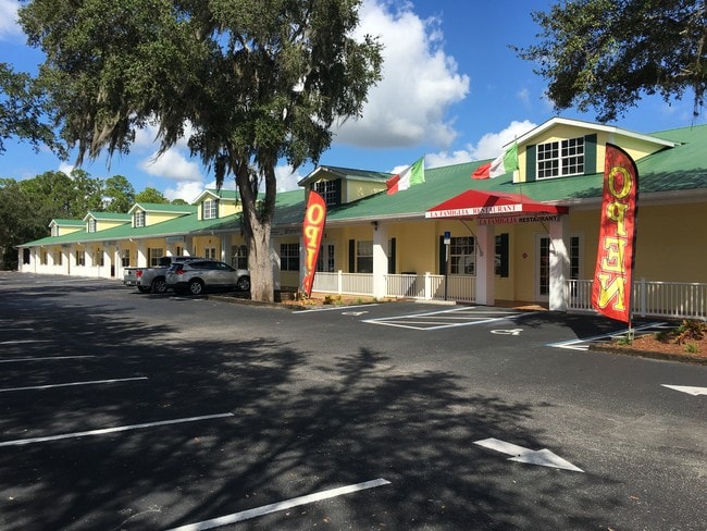
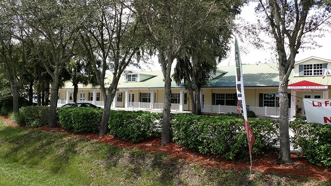
Property Record
992 Tamiami Trl, Port Charlotte, FL 33953

NEARBY LISTINGS FOR SALE OR LEASE
Property Detail
992 Tamiami Trl
Punta Gorda, FL
Pc
402207101001
07 40 22 P-7&12 1.65 AC M/L BEG AT SW COR LT 3 BLK 1062 OF PC SUB SEC 14 TH E 125 FT TH S 107.03 FT E 100 FT TH SW 151.06 FT TH NE ALG NE/LY ROW LN OF HWY US 41 175.52 FT TH N 161.97 FT TO POB AKA P7 ALSO COMM INTXN OF C/L OF ACCESS RD & ENTERPRI
Commercialnec
Charlotte
AE
Florida
12015C0044G
3
2024
3.34 AC
2025
Charlotte County
020301
Southwest Florida
33,803 SF
DEMOGRAPHICS near 992 Tamiami Trl
1 Mile
3 Mile
5 Mile
2024 Total Population
1,238
33,379
100,883
2029 Population
1,495
39,234
118,339
Pop Growth 2024-2029
+ 20.76%
+ 17.54%
+ 17.30%
Average Age
43
46
46
2024 Total Households
451
13,630
41,604
HH Growth 2024-2029
+ 21.51%
+ 17.82%
+ 17.57%
Median Household Inc
$41,500
$57,948
$60,939
Avg Household Size
2.40
2.40
2.30
2024 Avg HH Vehicles
2.00
2.00
2.00
Median Home Value
$263,698
$238,364
$241,246
Median Year Built
2004
1997
1993
Nearby Places
Map Layers
Map Styles
 Street
 Aerial
- Restaurants
- Banks
- Shops
- Fitness
- Groceries
PUBLIC TRANSPORTATION
AIRPORT
Punta Gorda
DRIVE
WALK
Distance
Punta Gorda
26 min
13.3 mi
Freight Ports
Port Manatee
DRIVE
WALK
Distance
Port Manatee
76 min
61.7 mi
SALE & LEASE HISTORY
LISTING DATE
SALE/LEASE

Sep 24, 2016
For Lease
May 10, 2022
For Sale
Jul 27, 2017
For Lease
Feb 29, 2024
For Sale
Nearby Properties
Address
Land Use
TOTAL SIZE
Lot Size
Zoning
Address
Land Use
TOTAL SIZE
Lot Size
Zoning
316,994 SF
40.88 AC
V
Address
Land Use
TOTAL SIZE
Lot Size
Zoning
103,886 SF
21.48 AC
PD
Address
Land Use
TOTAL SIZE
Lot Size
Zoning
198,132 SF
17.61 AC
RMF15
Address
Land Use
TOTAL SIZE
Lot Size
Zoning
132,969 SF
80.28 AC
PKR
Address
Land Use
TOTAL SIZE
Lot Size
Zoning
53,564 SF
22 AC
PD
Address
Land Use
TOTAL SIZE
Lot Size
Zoning
261,557 SF
46.25 AC
OMI
Address
Land Use
TOTAL SIZE
Lot Size
Zoning
196,676 SF
30 AC
OMI
Address
Land Use
TOTAL SIZE
Lot Size
Zoning
174,965 SF
13.52 AC
CG
Address
Land Use
TOTAL SIZE
Lot Size
Zoning
131,053 SF
14.40 AC
PD
Address
Land Use
TOTAL SIZE
Lot Size
Zoning
583,831 SF
54.32 AC
CG
Address
Land Use
TOTAL SIZE
Lot Size
Zoning
9,511 SF
40.53 AC
PD
Address
Land Use
TOTAL SIZE
Lot Size
Zoning
119,749 SF
12.90 AC
RSF3.5
Address
Land Use
TOTAL SIZE
Lot Size
Zoning
141,619 SF
12.39 AC
II
Address
Land Use
TOTAL SIZE
Lot Size
Zoning
208,372 SF
21.98 AC
II
Address
Land Use
TOTAL SIZE
Lot Size
Zoning
122,030 SF
7.43 AC
CG
Address
Land Use
TOTAL SIZE
Lot Size
Zoning
141,647 SF
20.29 AC
CG
Address
Land Use
TOTAL SIZE
Lot Size
Zoning
94,423 SF
12.87 AC
V
Address
Land Use
TOTAL SIZE
Lot Size
Zoning
52,706 SF
4.81 AC
V
Address
Land Use
TOTAL SIZE
Lot Size
Zoning
98,599 SF
9.75 AC
CG
Address
Land Use
TOTAL SIZE
Lot Size
Zoning
107,237 SF
20.14 AC
CG
Address
Land Use
TOTAL SIZE
Lot Size
Zoning
91,281 SF
10 AC
CG
Address
Land Use
TOTAL SIZE
Lot Size
Zoning
95.20 AC
PD
Address
Land Use
TOTAL SIZE
Lot Size
Zoning
96,253 SF
7.89 AC
CG
Address
Land Use
TOTAL SIZE
Lot Size
Zoning
37,045 SF
21.20 AC
PD
Address
Land Use
TOTAL SIZE
Lot Size
Zoning
88,259 SF
4.71 AC
CG
Address
Land Use
TOTAL SIZE
Lot Size
Zoning
52,925 SF
7.49 AC
V
Address
Land Use
TOTAL SIZE
Lot Size
Zoning
37,567 SF
36.76 AC
PKR
Address
Land Use
TOTAL SIZE
Lot Size
Zoning
4,562 SF
8.08 AC
CG
Address
Land Use
TOTAL SIZE
Lot Size
Zoning
135,717 SF
10.55 AC
CG
Address
Land Use
TOTAL SIZE
Lot Size
Zoning
82,800 SF
9.45 AC
CG
The World's #1 Commercial Real Estate Marketplace
Connect with us
© 2026 CoStar Group
The information above has been obtained from sources believed reliable. While we do not doubt its accuracy we have not verified it and make no guarantee, warranty or representation about it. It is your responsibility to independently confirm its accuracy and completeness. Any projections, opinions, assumptions, or estimates used are for example only and do not represent the current or future performance of the property. The value of this transaction to you depends on tax and other factors which should be evaluated by your tax, financial, and legal advisors. You and your advisors should conduct a careful, independent investigation of the property to determine to your satisfaction the suitability of the property for your needs.