Property Record
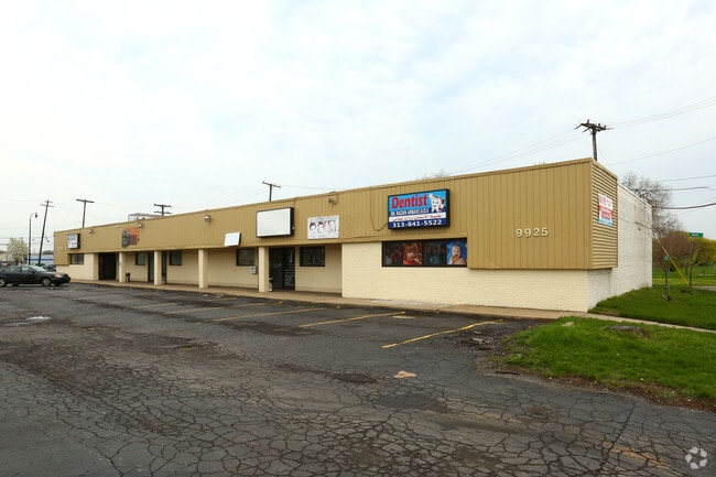
9925 Dix, Dearborn, MI 48120


Property Detail
9925 Dix
32-10-213-15-003
A PARCEL OF LAND IN PC 216 T2SR11E BEG AT THE NW COR OF VERNOR HWY & DALE AVE, TH S- 58-20-00-W 114 FT, TH N-35-17-00-W 156.55 FT, TH N-25-27-00-E 151.10 FT, TH S-30-56-30-E 238.29 FT TO POB .549 A
Dentalbldg
Wayne
BB
Michigan
B and X Area of moderate flood hazard, usually the area between the limits of the 100-year and 500-year floods.
0.55 AC
2025
Downriver North
2025
Detroit
573501
Detroit-Warren-Dearborn, MI
6,688 SF
NEARBY LISTINGS FOR SALE OR LEASE
DEMOGRAPHICS near 9925 Dix
1 mile
3 mile
5 mile
2025 Total Population
12,397
109,831
276,374
2030 Population
12,140
108,841
277,013
Pop Growth 2025-2030
(2.07%)
(0.90%)
+ 0.23%
Average Age
33
35
36
2025 Total Households
3,547
34,904
99,438
HH Growth 2025-2030
(1.92%)
(0.85%)
+ 0.52%
Median Household Inc
$40,322
$42,055
$41,835
Avg Household Size
3.30
3.00
2.70
2025 Avg HH Vehicles
2.00
1.00
1.00
Median Home Value
$103,571
$116,850
$116,065
Median Year Built
1948
1948
1949
Nearby Places
Map Layers
Map Styles
 Street
 Aerial
Layers
 Traffic
 Biking
Places
Listings with unknown addresses are not visible on the map
- Restaurants
- Banks
- Shops
- Fitness
- Groceries
SALE & LEASE HISTORY
LISTING DATE
SALE/LEASE

Jun 28, 2017
For Sale
Jul 30, 2019
For Lease
Nearby Properties
Address
Land Use
TOTAL SIZE
Lot Size
Zoning
Address
Land Use
TOTAL SIZE
Lot Size
Zoning
590,116 SF
388.80 AC
ID
Address
Land Use
TOTAL SIZE
Lot Size
Zoning
1,043,110 SF
35.36 AC
RE
Address
Land Use
TOTAL SIZE
Lot Size
Zoning
153,040 SF
2.13 AC
BC
Address
Land Use
TOTAL SIZE
Lot Size
Zoning
304,206 SF
29.53 AC
RC
Address
Land Use
TOTAL SIZE
Lot Size
Zoning
135,775 SF
18.39 AC
BC
Address
Land Use
TOTAL SIZE
Lot Size
Zoning
309,661 SF
8.81 AC
M4
Address
Land Use
TOTAL SIZE
Lot Size
Zoning
678,368 SF
48.99 AC
RD RESEARC
Address
Land Use
TOTAL SIZE
Lot Size
Zoning
198,237 SF
11.07 AC
RE
Address
Land Use
TOTAL SIZE
Lot Size
Zoning
80,861 SF
1.17 AC
BC
Address
Land Use
TOTAL SIZE
Lot Size
Zoning
111,008 SF
26.62 AC
IB
Address
Land Use
TOTAL SIZE
Lot Size
Zoning
365,040 SF
382 AC
M4
Address
Land Use
TOTAL SIZE
Lot Size
Zoning
590,652 SF
21.79 AC
TM
Address
Land Use
TOTAL SIZE
Lot Size
Zoning
169,200 SF
19.92 AC
RD RESEARC
Address
Land Use
TOTAL SIZE
Lot Size
Zoning
342,272 SF
16.48 AC
M4
Address
Land Use
TOTAL SIZE
Lot Size
Zoning
303,705 SF
17.28 AC
ID
Address
Land Use
TOTAL SIZE
Lot Size
Zoning
196,801 SF
38.32 AC
M5
Address
Land Use
TOTAL SIZE
Lot Size
Zoning
153,668 SF
9.16 AC
RD
Address
Land Use
TOTAL SIZE
Lot Size
Zoning
115,159 SF
10.49 AC
BB
Address
Land Use
TOTAL SIZE
Lot Size
Zoning
83,552 SF
20.32 AC
IC
Address
Land Use
TOTAL SIZE
Lot Size
Zoning
95,549 SF
6.46 AC
RE
Address
Land Use
TOTAL SIZE
Lot Size
Zoning
147,942 SF
14 AC
IA
Address
Land Use
TOTAL SIZE
Lot Size
Zoning
193,155 SF
8.68 AC
R1 1 FA
Address
Land Use
TOTAL SIZE
Lot Size
Zoning
1,452 SF
19.24 AC
IC
Address
Land Use
TOTAL SIZE
Lot Size
Zoning
145,572 SF
58.41 AC
M4
Address
Land Use
TOTAL SIZE
Lot Size
Zoning
314,003 SF
26.32 AC
B6
Address
Land Use
TOTAL SIZE
Lot Size
Zoning
336,958 SF
15.54 AC
IB
Address
Land Use
TOTAL SIZE
Lot Size
Zoning
79.03 AC
M2 HEAV
Address
Land Use
TOTAL SIZE
Lot Size
Zoning
193,114 SF
20.29 AC
M4
Address
Land Use
TOTAL SIZE
Lot Size
Zoning
290,849 SF
13.21 AC
IC
Address
Land Use
TOTAL SIZE
Lot Size
Zoning
52,964 SF
10.89 AC
The World's #1 Commercial Real Estate Marketplace
Connect with us
© 2026 CoStar Group
The information above has been obtained from sources believed reliable. While we do not doubt its accuracy we have not verified it and make no guarantee, warranty or representation about it. It is your responsibility to independently confirm its accuracy and completeness. Any projections, opinions, assumptions, or estimates used are for example only and do not represent the current or future performance of the property. The value of this transaction to you depends on tax and other factors which should be evaluated by your tax, financial, and legal advisors. You and your advisors should conduct a careful, independent investigation of the property to determine to your satisfaction the suitability of the property for your needs.