Property Record
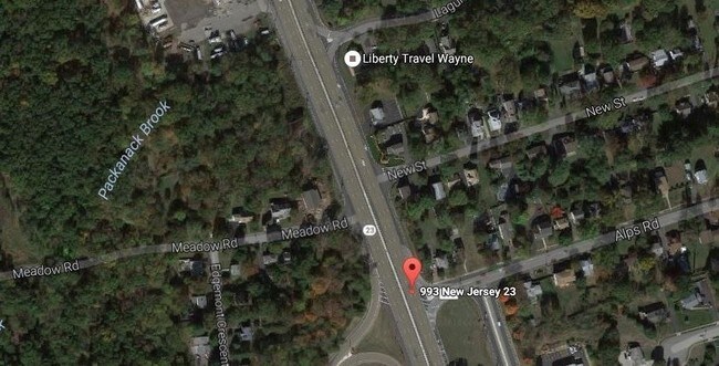
993 State Route 23, Wayne, NJ 07470

Property Detail
993 State Route 23
New York-Jersey City-White Plains, NY-NJ
ADDITIONAL LOTS: 1,3/FACILITY NAME: RESIDENCE
14-00940-0000-00004
PASSAIC
Religious
New Jersey
B and X Area of moderate flood hazard, usually the area between the limits of the 100-year and 500-year floods.
4.1
0
0.40 AC
2025
Passaic Rt 46/23
246300
Northern New Jersey
2,200 SF
NEARBY LISTINGS FOR SALE OR LEASE
DEMOGRAPHICS near 993 State Route 23
1 mile
3 mile
5 mile
2025 Total Population
7,248
63,938
223,524
2030 Population
7,526
66,341
230,251
Pop Growth 2025-2030
+ 3.84%
+ 3.76%
+ 3.01%
Average Age
42
43
41
2025 Total Households
2,641
22,557
76,998
HH Growth 2025-2030
+ 3.67%
+ 3.62%
+ 3.14%
Median Household Inc
$123,081
$135,660
$113,221
Avg Household Size
2.70
2.80
2.80
2025 Avg HH Vehicles
2.00
2.00
2.00
Median Home Value
$555,720
$630,674
$596,726
Median Year Built
1964
1963
1963
Nearby Places
Map Layers
Map Styles
 Street
 Aerial
Transit
 Traffic
 Biking
Places
Listings with unknown addresses are not visible on the map
- Restaurants
- Banks
- Shops
- Fitness
- Groceries
PUBLIC TRANSPORTATION
COMMUTER RAIL
Mountain View (Montclair-Boonton Line - NJ Transit Commuter Rail (NJ Transit))
Drive
Walk
Distance
Mountain View (Montclair-Boonton Line - NJ Transit Commuter Rail (NJ Transit))
3 min
1.5 mi
Wayne/Route 23 Transit Center (Montclair-Boonton Line - NJ Transit Commuter Rail (NJ Transit))
Drive
Walk
Distance
Wayne/Route 23 Transit Center (Montclair-Boonton Line - NJ Transit Commuter Rail (NJ Transit))
4 min
2.0 mi
AIRPORT
Newark Liberty International
Drive
Walk
Distance
Newark Liberty International
28 min
23.6 mi
LaGuardia
Drive
Walk
Distance
LaGuardia
44 min
31.7 mi
Freight Ports
Port Newark Container Terminal
Drive
Walk
Distance
Port Newark Container Terminal
34 min
22.9 mi
SALE & LEASE HISTORY
LISTING DATE
SALE/LEASE

Jul 21, 2017
For Sale
Nearby Properties
Address
Land Use
TOTAL SIZE
Lot Size
Zoning
Address
Land Use
TOTAL SIZE
Lot Size
Zoning
667,698 SF
38.15 AC
Address
Land Use
TOTAL SIZE
Lot Size
Zoning
56.67 AC
Address
Land Use
TOTAL SIZE
Lot Size
Zoning
21.99 AC
H
Address
Land Use
TOTAL SIZE
Lot Size
Zoning
49,701 SF
29.34 AC
GAR
Address
Land Use
TOTAL SIZE
Lot Size
Zoning
49.48 AC
Address
Land Use
TOTAL SIZE
Lot Size
Zoning
260,609 SF
35.39 AC
Address
Land Use
TOTAL SIZE
Lot Size
Zoning
2.87 AC
Address
Land Use
TOTAL SIZE
Lot Size
Zoning
24,200 SF
19.33 AC
Address
Land Use
TOTAL SIZE
Lot Size
Zoning
8,600 SF
27.27 AC
L3
Address
Land Use
TOTAL SIZE
Lot Size
Zoning
315,332 SF
19.60 AC
Address
Land Use
TOTAL SIZE
Lot Size
Zoning
12.86 AC
Address
Land Use
TOTAL SIZE
Lot Size
Zoning
960 SF
22.84 AC
GWS
Address
Land Use
TOTAL SIZE
Lot Size
Zoning
67.49 AC
Address
Land Use
TOTAL SIZE
Lot Size
Zoning
243,660 SF
20.53 AC
Address
Land Use
TOTAL SIZE
Lot Size
Zoning
207,519 SF
32.39 AC
Address
Land Use
TOTAL SIZE
Lot Size
Zoning
5,880 SF
17.46 AC
I
Address
Land Use
TOTAL SIZE
Lot Size
Zoning
342,518 SF
31.80 AC
IP
Address
Land Use
TOTAL SIZE
Lot Size
Zoning
251,974 SF
27.96 AC
Address
Land Use
TOTAL SIZE
Lot Size
Zoning
116,505 SF
10.77 AC
Address
Land Use
TOTAL SIZE
Lot Size
Zoning
136,500 SF
12.65 AC
HD
Address
Land Use
TOTAL SIZE
Lot Size
Zoning
130,000 SF
11 AC
Address
Land Use
TOTAL SIZE
Lot Size
Zoning
192,206 SF
7.73 AC
R-20
Address
Land Use
TOTAL SIZE
Lot Size
Zoning
41.71 AC
C-4
Address
Land Use
TOTAL SIZE
Lot Size
Zoning
439,114 SF
19.21 AC
Address
Land Use
TOTAL SIZE
Lot Size
Zoning
9,874 SF
9.20 AC
HD
Address
Land Use
TOTAL SIZE
Lot Size
Zoning
97,631 SF
10.01 AC
B-2
Address
Land Use
TOTAL SIZE
Lot Size
Zoning
121,041 SF
7.60 AC
Address
Land Use
TOTAL SIZE
Lot Size
Zoning
175,000 SF
12.54 AC
L-1
Address
Land Use
TOTAL SIZE
Lot Size
Zoning
6.48 AC
HD
Address
Land Use
TOTAL SIZE
Lot Size
Zoning
374,755 SF
24.88 AC
The World's #1 Commercial Real Estate Marketplace
Connect with us
© 2026 CoStar Group
The information above has been obtained from sources believed reliable. While we do not doubt its accuracy we have not verified it and make no guarantee, warranty or representation about it. It is your responsibility to independently confirm its accuracy and completeness. Any projections, opinions, assumptions, or estimates used are for example only and do not represent the current or future performance of the property. The value of this transaction to you depends on tax and other factors which should be evaluated by your tax, financial, and legal advisors. You and your advisors should conduct a careful, independent investigation of the property to determine to your satisfaction the suitability of the property for your needs.