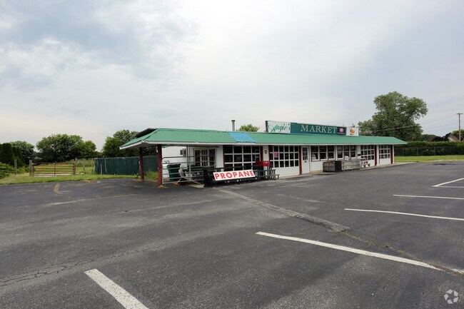
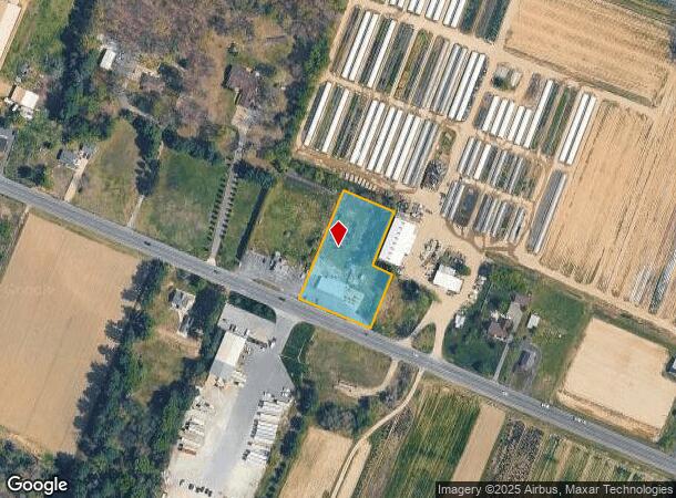
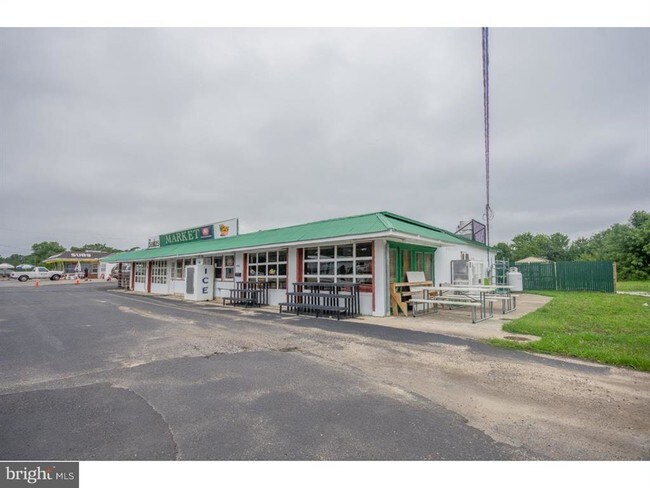
Property Record
994 Harding Hwy, Newfield, NJ 08344
NEARBY LISTINGS FOR SALE OR LEASE
Property Detail
994 Harding Hwy
05-07101-0000-00036
ADDITIONAL LOTS: PETRINI FARM MARKET
Supermarket
Gloucester
X
New Jersey
34001C0090F
36
2024
1.31 AC
2025
Gloucester County
501702
Philadelphia
2,588 SF
Philadelphia-Camden-Wilmington, PA-NJ-DE-MD
DEMOGRAPHICS near 994 Harding Hwy
1 Mile
3 Mile
5 Mile
2024 Total Population
434
9,379
38,771
2029 Population
440
9,439
38,534
Pop Growth 2024-2029
+ 1.38%
+ 0.64%
(0.61%)
Average Age
44
42
41
2024 Total Households
163
3,577
14,377
HH Growth 2024-2029
+ 1.23%
+ 0.36%
(0.76%)
Median Household Inc
$95,192
$83,972
$67,408
Avg Household Size
2.60
2.60
2.60
2024 Avg HH Vehicles
2.00
2.00
2.00
Median Home Value
$238,043
$231,867
$199,922
Median Year Built
1978
1974
1969
Nearby Places
Map Layers
Map Styles
 Street
 Aerial
- Restaurants
- Banks
- Shops
- Fitness
- Groceries
PUBLIC TRANSPORTATION
AIRPORT
Atlantic City International
DRIVE
WALK
Distance
Atlantic City International
61 min
28.0 mi
Philadelphia International
DRIVE
WALK
Distance
Philadelphia International
58 min
36.5 mi
Freight Ports
Broadway Terminal - Pier 5
DRIVE
WALK
Distance
Broadway Terminal - Pier 5
42 min
28.0 mi
SALE & LEASE HISTORY
LISTING DATE
SALE/LEASE

Sep 23, 2016
For Sale
Oct 07, 2016
For Sale
Jun 21, 2019
For Sale
Jun 15, 2018
For Lease
Jun 15, 2018
For Sale
Jul 08, 2019
For Sale
Jan 29, 2018
For Sale
Nearby Properties
Address
Land Use
TOTAL SIZE
Lot Size
Zoning
Address
Land Use
TOTAL SIZE
Lot Size
Zoning
8.53 AC
R-3
Address
Land Use
TOTAL SIZE
Lot Size
Zoning
44.19 AC
PIRA
Address
Land Use
TOTAL SIZE
Lot Size
Zoning
4,936 SF
35.45 AC
RA
Address
Land Use
TOTAL SIZE
Lot Size
Zoning
22.29 AC
A
Address
Land Use
TOTAL SIZE
Lot Size
Zoning
10.33 AC
RA
Address
Land Use
TOTAL SIZE
Lot Size
Zoning
1,358 SF
9.10 AC
RA
Address
Land Use
TOTAL SIZE
Lot Size
Zoning
2.44 AC
I2
Address
Land Use
TOTAL SIZE
Lot Size
Zoning
6.37 AC
RA
Address
Land Use
TOTAL SIZE
Lot Size
Zoning
Address
Land Use
TOTAL SIZE
Lot Size
Zoning
3.07 AC
R-2
Address
Land Use
TOTAL SIZE
Lot Size
Zoning
13.12 AC
I
Address
Land Use
TOTAL SIZE
Lot Size
Zoning
7.94 AC
R2
Address
Land Use
TOTAL SIZE
Lot Size
Zoning
4.28 AC
R-3
Address
Land Use
TOTAL SIZE
Lot Size
Zoning
12 AC
PAP
Address
Land Use
TOTAL SIZE
Lot Size
Zoning
1,344 SF
49.22 AC
LM
Address
Land Use
TOTAL SIZE
Lot Size
Zoning
4 AC
C
Address
Land Use
TOTAL SIZE
Lot Size
Zoning
3,060 SF
6 AC
PAP
Address
Land Use
TOTAL SIZE
Lot Size
Zoning
1.95 AC
Address
Land Use
TOTAL SIZE
Lot Size
Zoning
7.36 AC
RA
Address
Land Use
TOTAL SIZE
Lot Size
Zoning
1.88 AC
I2
Address
Land Use
TOTAL SIZE
Lot Size
Zoning
15.63 AC
A
Address
Land Use
TOTAL SIZE
Lot Size
Zoning
11.59 AC
R-4
Address
Land Use
TOTAL SIZE
Lot Size
Zoning
54.66 AC
MH
Address
Land Use
TOTAL SIZE
Lot Size
Zoning
2,496 SF
2.56 AC
01
Address
Land Use
TOTAL SIZE
Lot Size
Zoning
18.80 AC
R-3
Address
Land Use
TOTAL SIZE
Lot Size
Zoning
3.80 AC
R4
Address
Land Use
TOTAL SIZE
Lot Size
Zoning
6.21 AC
Address
Land Use
TOTAL SIZE
Lot Size
Zoning
1.92 AC
C
Address
Land Use
TOTAL SIZE
Lot Size
Zoning
7.33 AC
R3
Address
Land Use
TOTAL SIZE
Lot Size
Zoning
0.60 AC
R2
The World's #1 Commercial Real Estate Marketplace
Connect with us
© 2025 CoStar Group
The information above has been obtained from sources believed reliable. While we do not doubt its accuracy we have not verified it and make no guarantee, warranty or representation about it. It is your responsibility to independently confirm its accuracy and completeness. Any projections, opinions, assumptions, or estimates used are for example only and do not represent the current or future performance of the property. The value of this transaction to you depends on tax and other factors which should be evaluated by your tax, financial, and legal advisors. You and your advisors should conduct a careful, independent investigation of the property to determine to your satisfaction the suitability of the property for your needs.