Property Record
9942 Gerber Rd, Sacramento, CA 95829

NEARBY LISTINGS FOR SALE OR LEASE
Property Detail
9942 Gerber Rd
Sacramento--Roseville--Arden-Arcade, CA
Wildhawk North Unit 9
122-0050-033
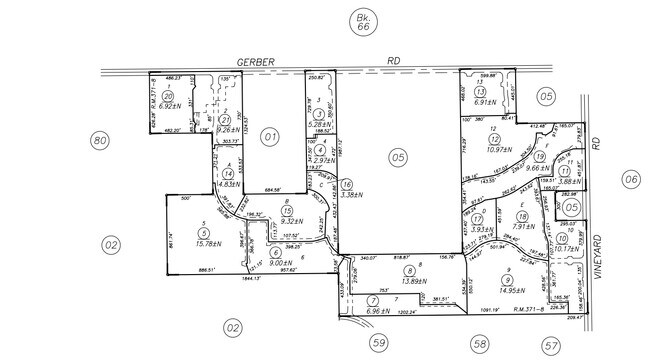
POR OF PCL 1&2 OF PM123-022. DESC AS BEG AT NE SD PCL 2 TH S89D2749 W842.13FT; TH S00D3211 E80FT; TH N89D2749 E7.27FT; TH
Recreationalacreage
Sacramento
AE
California
06067C0327H
10.38 AC
2024
South Sacramento
2024
Sacramento
009311
DEMOGRAPHICS near 9942 Gerber Rd
1 Mile
3 Mile
5 Mile
2024 Total Population
4,363
39,581
126,594
2029 Population
4,342
39,847
126,953
Pop Growth 2024-2029
(0.48%)
+ 0.67%
+ 0.28%
Average Age
38
38
38
2024 Total Households
1,249
11,507
37,548
HH Growth 2024-2029
(0.48%)
+ 0.63%
+ 0.25%
Median Household Inc
$132,796
$109,162
$97,417
Avg Household Size
3.40
3.30
3.30
2024 Avg HH Vehicles
3.00
2.00
2.00
Median Home Value
$663,180
$504,346
$479,338
Median Year Built
2004
2001
1994
Nearby Places
Map Layers
Map Styles
 Street
 Aerial
- Restaurants
- Banks
- Shops
- Fitness
- Groceries
PUBLIC TRANSPORTATION
AIRPORT
Sacramento International
DRIVE
WALK
Distance
Sacramento International
39 min
26.0 mi
Freight Ports
Port of Stockton
DRIVE
WALK
Distance
Port of Stockton
59 min
44.5 mi
Nearby Properties
Address
Land Use
TOTAL SIZE
Lot Size
Zoning
Address
Land Use
TOTAL SIZE
Lot Size
Zoning
204,290 SF
11.86 AC
RD-20
Address
Land Use
TOTAL SIZE
Lot Size
Zoning
161,834 SF
15.23 AC
LC
Address
Land Use
TOTAL SIZE
Lot Size
Zoning
167,152 SF
7.53 AC
RD-20
Address
Land Use
TOTAL SIZE
Lot Size
Zoning
90,925 SF
9.77 AC
AR-1
Address
Land Use
TOTAL SIZE
Lot Size
Zoning
17.32 AC
RD-7 RD-10
Address
Land Use
TOTAL SIZE
Lot Size
Zoning
49,900 SF
6.16 AC
RD-20
Address
Land Use
TOTAL SIZE
Lot Size
Zoning
11.09 AC
RD-5
Address
Land Use
TOTAL SIZE
Lot Size
Zoning
RD-5 O RD-
Address
Land Use
TOTAL SIZE
Lot Size
Zoning
22.42 AC
RD-5
Address
Land Use
TOTAL SIZE
Lot Size
Zoning
2,256 SF
4.64 AC
PS
Address
Land Use
TOTAL SIZE
Lot Size
Zoning
12,900 SF
1.70 AC
GC
Address
Land Use
TOTAL SIZE
Lot Size
Zoning
2,993 SF
6.57 AC
AR-5
Address
Land Use
TOTAL SIZE
Lot Size
Zoning
14,423 SF
9.60 AC
AR-10
Address
Land Use
TOTAL SIZE
Lot Size
Zoning
39.69 AC
RD-3 RD-5
Address
Land Use
TOTAL SIZE
Lot Size
Zoning
5,000 SF
161.69 AC
AG-80
Address
Land Use
TOTAL SIZE
Lot Size
Zoning
26,385 SF
2.33 AC
SC
Address
Land Use
TOTAL SIZE
Lot Size
Zoning
36,270 SF
15.88 AC
M-1
Address
Land Use
TOTAL SIZE
Lot Size
Zoning
720 SF
38.04 AC
AR-10
Address
Land Use
TOTAL SIZE
Lot Size
Zoning
52,925 SF
4.28 AC
RD-20
Address
Land Use
TOTAL SIZE
Lot Size
Zoning
3,027 SF
158 AC
AG-80 (SM)
Address
Land Use
TOTAL SIZE
Lot Size
Zoning
2,750 SF
19.47 AC
AR-5
Address
Land Use
TOTAL SIZE
Lot Size
Zoning
43.50 AC
M-1 (SM)
Address
Land Use
TOTAL SIZE
Lot Size
Zoning
1,188 SF
36.09 AC
SC
Address
Land Use
TOTAL SIZE
Lot Size
Zoning
10,563 SF
2.20 AC
RD-4
Address
Land Use
TOTAL SIZE
Lot Size
Zoning
31.90 AC
M-1
Address
Land Use
TOTAL SIZE
Lot Size
Zoning
14,400 SF
3.54 AC
M-1
Address
Land Use
TOTAL SIZE
Lot Size
Zoning
15.79 AC
LC
Address
Land Use
TOTAL SIZE
Lot Size
Zoning
5.78 AC
LC
Address
Land Use
TOTAL SIZE
Lot Size
Zoning
10,354 SF
4.76 AC
M-1
Address
Land Use
TOTAL SIZE
Lot Size
Zoning
5,160 SF
10.10 AC
M-1
The World's #1 Commercial Real Estate Marketplace
Connect with us
© 2025 CoStar Group
The information above has been obtained from sources believed reliable. While we do not doubt its accuracy we have not verified it and make no guarantee, warranty or representation about it. It is your responsibility to independently confirm its accuracy and completeness. Any projections, opinions, assumptions, or estimates used are for example only and do not represent the current or future performance of the property. The value of this transaction to you depends on tax and other factors which should be evaluated by your tax, financial, and legal advisors. You and your advisors should conduct a careful, independent investigation of the property to determine to your satisfaction the suitability of the property for your needs.