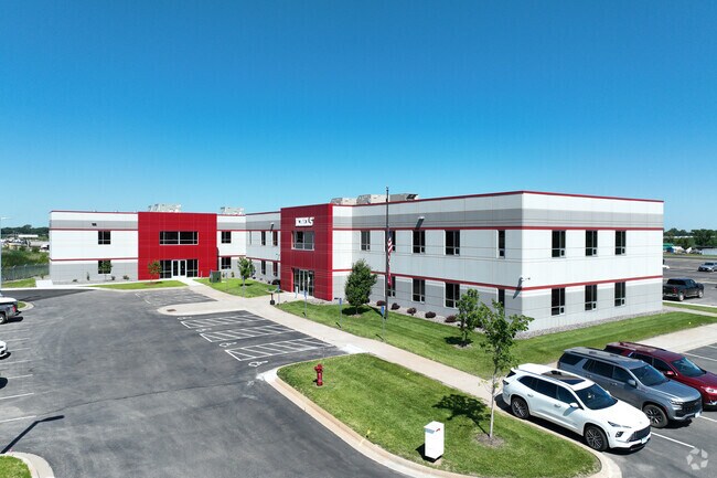
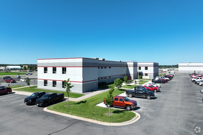
Property Record
9950 73Rd St Ne, Monticello, MN 55362

NEARBY LISTINGS FOR SALE OR LEASE
Property Detail
9950 73Rd St Ne
Minneapolis/St Paul
Michels Otsego Addition
Minneapolis-St. Paul-Bloomington, MN-WI
SECT-27 TWP-121 RANGE-024 MICHELS OTSEGO ADDITION LOT-001 BLOCK-001 OCK-001
118-350-001010
Wright
Officebuilding
Minnesota
2024
1
2025
45.81 AC
100102
Wright County
46,521 SF
DEMOGRAPHICS near 9950 73Rd St Ne
1 Mile
3 Mile
5 Mile
2024 Total Population
1,392
22,632
53,408
2029 Population
1,701
27,392
64,178
Pop Growth 2024-2029
+ 22.20%
+ 21.03%
+ 20.17%
Average Age
34
35
36
2024 Total Households
467
7,359
17,558
HH Growth 2024-2029
+ 22.70%
+ 21.46%
+ 20.63%
Median Household Inc
$122,115
$132,533
$127,652
Avg Household Size
2.90
3.00
2.90
2024 Avg HH Vehicles
2.00
2.00
2.00
Median Home Value
$324,528
$366,272
$372,105
Median Year Built
2008
2004
2001
Nearby Places
Map Layers
Map Styles
 Street
 Aerial
- Restaurants
- Banks
- Shops
- Fitness
- Groceries
Nearby Properties
Address
Land Use
TOTAL SIZE
Lot Size
Zoning
Address
Land Use
TOTAL SIZE
Lot Size
Zoning
25,380 SF
130.75 AC
Address
Land Use
TOTAL SIZE
Lot Size
Zoning
44.82 AC
Address
Land Use
TOTAL SIZE
Lot Size
Zoning
40,984 SF
19.16 AC
Address
Land Use
TOTAL SIZE
Lot Size
Zoning
110,784 SF
15.36 AC
Address
Land Use
TOTAL SIZE
Lot Size
Zoning
4,240 SF
2.45 AC
Address
Land Use
TOTAL SIZE
Lot Size
Zoning
106,614 SF
19.89 AC
Address
Land Use
TOTAL SIZE
Lot Size
Zoning
Address
Land Use
TOTAL SIZE
Lot Size
Zoning
Address
Land Use
TOTAL SIZE
Lot Size
Zoning
178,398 SF
24 AC
Address
Land Use
TOTAL SIZE
Lot Size
Zoning
78,300 SF
3.81 AC
Address
Land Use
TOTAL SIZE
Lot Size
Zoning
29,184 SF
5 AC
Address
Land Use
TOTAL SIZE
Lot Size
Zoning
15,560 SF
59.44 AC
Address
Land Use
TOTAL SIZE
Lot Size
Zoning
105,140 SF
12.88 AC
Address
Land Use
TOTAL SIZE
Lot Size
Zoning
28,764 SF
4.10 AC
Address
Land Use
TOTAL SIZE
Lot Size
Zoning
Address
Land Use
TOTAL SIZE
Lot Size
Zoning
Address
Land Use
TOTAL SIZE
Lot Size
Zoning
Address
Land Use
TOTAL SIZE
Lot Size
Zoning
136,750 SF
7.74 AC
Address
Land Use
TOTAL SIZE
Lot Size
Zoning
Address
Land Use
TOTAL SIZE
Lot Size
Zoning
62,662 SF
2 AC
Address
Land Use
TOTAL SIZE
Lot Size
Zoning
72,520 SF
4.63 AC
Address
Land Use
TOTAL SIZE
Lot Size
Zoning
55,680 SF
13.60 AC
Address
Land Use
TOTAL SIZE
Lot Size
Zoning
50,836 SF
6.18 AC
Address
Land Use
TOTAL SIZE
Lot Size
Zoning
21,490 SF
3.23 AC
Address
Land Use
TOTAL SIZE
Lot Size
Zoning
49,000 SF
14.50 AC
Address
Land Use
TOTAL SIZE
Lot Size
Zoning
69,410 SF
13.49 AC
Address
Land Use
TOTAL SIZE
Lot Size
Zoning
15.07 AC
Address
Land Use
TOTAL SIZE
Lot Size
Zoning
102,061 SF
4.70 AC
The World's #1 Commercial Real Estate Marketplace
Connect with us
© 2026 CoStar Group
The information above has been obtained from sources believed reliable. While we do not doubt its accuracy we have not verified it and make no guarantee, warranty or representation about it. It is your responsibility to independently confirm its accuracy and completeness. Any projections, opinions, assumptions, or estimates used are for example only and do not represent the current or future performance of the property. The value of this transaction to you depends on tax and other factors which should be evaluated by your tax, financial, and legal advisors. You and your advisors should conduct a careful, independent investigation of the property to determine to your satisfaction the suitability of the property for your needs.