Property Record
9950 Lone Tree Pky, Lone Tree, CO 80124
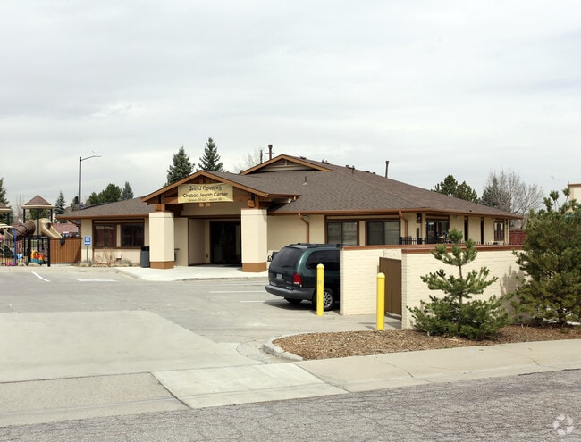


Property Detail
9950 Lone Tree Pky
2231-162-05-002
TRACT C CENTENNIAL RIDGE 2 0.018 AM/L
Religious
Douglas
B and X Area of moderate flood hazard, usually the area between the limits of the 100-year and 500-year floods.
Colorado
0
0.73 AC
2026
South
0141371000
Denver
5,415 SF
Denver-Aurora-Centennial, CO
NEARBY LISTINGS FOR SALE OR LEASE
DEMOGRAPHICS near 9950 Lone Tree Pky
1 mile
3 mile
5 mile
2025 Total Population
12,661
87,618
196,124
2030 Population
13,505
92,991
205,672
Pop Growth 2025-2030
+ 6.67%
+ 6.13%
+ 4.87%
Average Age
42
40
40
2025 Total Households
4,492
34,241
75,475
HH Growth 2025-2030
+ 7.08%
+ 6.62%
+ 5.11%
Median Household Inc
$159,952
$139,901
$143,039
Avg Household Size
2.80
2.50
2.60
2025 Avg HH Vehicles
2.00
2.00
2.00
Median Home Value
$790,910
$762,746
$756,850
Median Year Built
1993
1998
1995
Nearby Places
Map Layers
Map Styles
 Street
 Aerial
Layers
 Traffic
 Biking
Places
Listings with unknown addresses are not visible on the map
- Restaurants
- Banks
- Shops
- Fitness
- Groceries
PUBLIC TRANSPORTATION
AIRPORT
Denver International
Drive
Walk
Distance
Denver International
41 min
35.8 mi
Freight Ports
Tulsa Port Of Catoosa
Drive
Walk
Distance
Tulsa Port Of Catoosa
734 min
715.7 mi
Nearby Properties
Address
Land Use
TOTAL SIZE
Lot Size
Zoning
Address
Land Use
TOTAL SIZE
Lot Size
Zoning
709,725 SF
15.21 AC
Address
Land Use
TOTAL SIZE
Lot Size
Zoning
709,725 SF
29.14 AC
Address
Land Use
TOTAL SIZE
Lot Size
Zoning
805,440 SF
28.65 AC
Address
Land Use
TOTAL SIZE
Lot Size
Zoning
260,667 SF
19.72 AC
Address
Land Use
TOTAL SIZE
Lot Size
Zoning
530,720 SF
38.86 AC
PDU
Address
Land Use
TOTAL SIZE
Lot Size
Zoning
207,637 SF
28.17 AC
PDU
Address
Land Use
TOTAL SIZE
Lot Size
Zoning
1,630,979 SF
32.01 AC
Address
Land Use
TOTAL SIZE
Lot Size
Zoning
248,965 SF
70.73 AC
Address
Land Use
TOTAL SIZE
Lot Size
Zoning
364,806 SF
75.76 AC
PDU
Address
Land Use
TOTAL SIZE
Lot Size
Zoning
1,210,850 SF
13.65 AC
AMU
Address
Land Use
TOTAL SIZE
Lot Size
Zoning
305,198 SF
34.41 AC
PUD
Address
Land Use
TOTAL SIZE
Lot Size
Zoning
162,758 SF
11.21 AC
Address
Land Use
TOTAL SIZE
Lot Size
Zoning
650,416 SF
33.37 AC
LI
Address
Land Use
TOTAL SIZE
Lot Size
Zoning
253,902 SF
34.30 AC
PDU
Address
Land Use
TOTAL SIZE
Lot Size
Zoning
163,443 SF
14.39 AC
Address
Land Use
TOTAL SIZE
Lot Size
Zoning
231,715 SF
5.58 AC
Address
Land Use
TOTAL SIZE
Lot Size
Zoning
661,139 SF
Address
Land Use
TOTAL SIZE
Lot Size
Zoning
488,998 SF
32.43 AC
PDU
Address
Land Use
TOTAL SIZE
Lot Size
Zoning
418,258 SF
14.46 AC
PDU
Address
Land Use
TOTAL SIZE
Lot Size
Zoning
475,502 SF
36 AC
PDU
Address
Land Use
TOTAL SIZE
Lot Size
Zoning
494,862 SF
30.59 AC
PDU
Address
Land Use
TOTAL SIZE
Lot Size
Zoning
484,323 SF
5.23 AC
Address
Land Use
TOTAL SIZE
Lot Size
Zoning
651,701 SF
10.77 AC
PDU
Address
Land Use
TOTAL SIZE
Lot Size
Zoning
126,202 SF
2.27 AC
Address
Land Use
TOTAL SIZE
Lot Size
Zoning
200,897 SF
9.69 AC
Address
Land Use
TOTAL SIZE
Lot Size
Zoning
128,812 SF
2.55 AC
Address
Land Use
TOTAL SIZE
Lot Size
Zoning
169,233 SF
12.17 AC
PDU
Address
Land Use
TOTAL SIZE
Lot Size
Zoning
632,485 SF
38.43 AC
PDU
Address
Land Use
TOTAL SIZE
Lot Size
Zoning
112,021 SF
3.17 AC
Address
Land Use
TOTAL SIZE
Lot Size
Zoning
324,829 SF
20.45 AC
SR
The World's #1 Commercial Real Estate Marketplace
Connect with us
© 2026 CoStar Group
The information above has been obtained from sources believed reliable. While we do not doubt its accuracy we have not verified it and make no guarantee, warranty or representation about it. It is your responsibility to independently confirm its accuracy and completeness. Any projections, opinions, assumptions, or estimates used are for example only and do not represent the current or future performance of the property. The value of this transaction to you depends on tax and other factors which should be evaluated by your tax, financial, and legal advisors. You and your advisors should conduct a careful, independent investigation of the property to determine to your satisfaction the suitability of the property for your needs.