Property Record
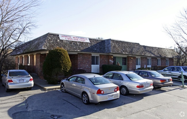
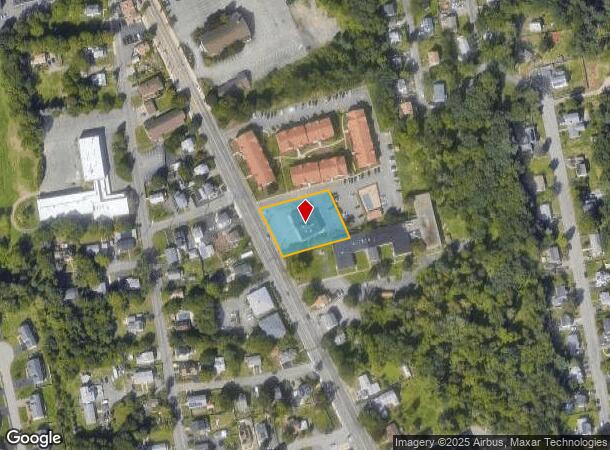
999 N Main St, Randolph, MA 02368
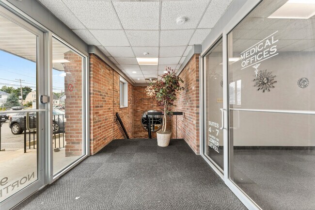
This Property Is For Sale
NEARBY LISTINGS FOR SALE OR LEASE
Property Detail
999 N Main St
RAND-000012-I000000-000073
Norfolk
Commercialbuilding
Massachusetts
X
73
25021C0208F
0.79 AC
2025
Route 24
2025
Boston
420102
Boston-Cambridge-Newton, MA-NH
7,690 SF
DEMOGRAPHICS near 999 N Main St
1 Mile
3 Mile
5 Mile
2024 Total Population
11,459
49,722
169,712
2029 Population
11,330
49,170
168,380
Pop Growth 2024-2029
(1.13%)
(1.11%)
(0.78%)
Average Age
41
41
41
2024 Total Households
4,077
17,859
64,385
HH Growth 2024-2029
(1.23%)
(1.18%)
(0.76%)
Median Household Inc
$82,722
$94,812
$103,709
Avg Household Size
2.70
2.70
2.50
2024 Avg HH Vehicles
2.00
2.00
2.00
Median Home Value
$410,465
$476,110
$576,750
Median Year Built
1965
1965
1961
Nearby Places
- Restaurants
- Banks
- Shops
- Fitness
- Groceries
PUBLIC TRANSPORTATION
COMMUTER RAIL
Holbrook/Randolph (Middleborough/Lakeville Line - Massachusetts Bay Transportation Authority Commuter Rail (Purple Line))
DRIVE
WALK
Distance
Holbrook/Randolph (Middleborough/Lakeville Line - Massachusetts Bay Transportation Authority Commuter Rail (Purple Line))
8 min
3.1 mi
Braintree (Kingston/Plymouth Line - Massachusetts Bay Transportation Authority Commuter Rail (Purple Line), Middleborough/Lakeville Line - Massachusetts Bay Transportation Authority Commuter Rail (Purple Line))
DRIVE
WALK
Distance
Braintree (Kingston/Plymouth Line - Massachusetts Bay Transportation Authority Commuter Rail (Purple Line), Middleborough/Lakeville Line - Massachusetts Bay Transportation Authority Commuter Rail (Purple Line))
10 min
4.3 mi
AIRPORT
General Edward Lawrence Logan International
DRIVE
WALK
Distance
General Edward Lawrence Logan International
26 min
16.6 mi
Rhode Island Tf Green International
DRIVE
WALK
Distance
Rhode Island Tf Green International
67 min
46.7 mi
Freight Ports
Port of Boston
DRIVE
WALK
Distance
Port of Boston
24 min
14.4 mi
Nearby Properties
Address
Land Use
TOTAL SIZE
Lot Size
Zoning
Address
Land Use
TOTAL SIZE
Lot Size
Zoning
0.25 AC
RH
Address
Land Use
TOTAL SIZE
Lot Size
Zoning
38.48 AC
B
Address
Land Use
TOTAL SIZE
Lot Size
Zoning
13.08 AC
HB
Address
Land Use
TOTAL SIZE
Lot Size
Zoning
154,871 SF
34.30 AC
10
Address
Land Use
TOTAL SIZE
Lot Size
Zoning
16.08 AC
OSC
Address
Land Use
TOTAL SIZE
Lot Size
Zoning
0.25 AC
I
Address
Land Use
TOTAL SIZE
Lot Size
Zoning
132,143 SF
23.70 AC
RH
Address
Land Use
TOTAL SIZE
Lot Size
Zoning
167,076 SF
16 AC
A
Address
Land Use
TOTAL SIZE
Lot Size
Zoning
10.10 AC
CSBD
Address
Land Use
TOTAL SIZE
Lot Size
Zoning
86,564 SF
8.45 AC
GBHD
Address
Land Use
TOTAL SIZE
Lot Size
Zoning
199,072 SF
10.07 AC
HB
Address
Land Use
TOTAL SIZE
Lot Size
Zoning
494,520 SF
20.80 AC
IND
Address
Land Use
TOTAL SIZE
Lot Size
Zoning
128,753 SF
17.50 AC
10
Address
Land Use
TOTAL SIZE
Lot Size
Zoning
138,400 SF
55.71 AC
RM
Address
Land Use
TOTAL SIZE
Lot Size
Zoning
146,402 SF
10 AC
RES
Address
Land Use
TOTAL SIZE
Lot Size
Zoning
22.64 AC
B
Address
Land Use
TOTAL SIZE
Lot Size
Zoning
76,223 SF
19.83 AC
B
Address
Land Use
TOTAL SIZE
Lot Size
Zoning
150,000 SF
11.91 AC
HBD
Address
Land Use
TOTAL SIZE
Lot Size
Zoning
114,176 SF
11.69 AC
RH
Address
Land Use
TOTAL SIZE
Lot Size
Zoning
162,909 SF
7.02 AC
HBD
Address
Land Use
TOTAL SIZE
Lot Size
Zoning
34.45 AC
HB
Address
Land Use
TOTAL SIZE
Lot Size
Zoning
37,252 SF
44.33 AC
10
Address
Land Use
TOTAL SIZE
Lot Size
Zoning
135,973 SF
6.54 AC
Address
Land Use
TOTAL SIZE
Lot Size
Zoning
7.50 AC
HBD
Address
Land Use
TOTAL SIZE
Lot Size
Zoning
121,424 SF
11.11 AC
HB
Address
Land Use
TOTAL SIZE
Lot Size
Zoning
152,250 SF
5.38 AC
HBD
Address
Land Use
TOTAL SIZE
Lot Size
Zoning
8.86 AC
HBD
Address
Land Use
TOTAL SIZE
Lot Size
Zoning
154,550 SF
14.18 AC
HBD
Address
Land Use
TOTAL SIZE
Lot Size
Zoning
13.13 AC
HBD
Address
Land Use
TOTAL SIZE
Lot Size
Zoning
90,500 SF
4.39 AC
HBD
The World's #1 Commercial Real Estate Marketplace
Connect with us
© 2025 CoStar Group
The information above has been obtained from sources believed reliable. While we do not doubt its accuracy we have not verified it and make no guarantee, warranty or representation about it. It is your responsibility to independently confirm its accuracy and completeness. Any projections, opinions, assumptions, or estimates used are for example only and do not represent the current or future performance of the property. The value of this transaction to you depends on tax and other factors which should be evaluated by your tax, financial, and legal advisors. You and your advisors should conduct a careful, independent investigation of the property to determine to your satisfaction the suitability of the property for your needs.