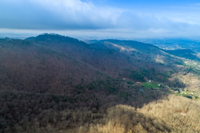
Property Record
134 Rice Branch Rd, Asheville, NC 28804

NEARBY LISTINGS FOR SALE OR LEASE
Property Detail
134 Rice Branch Rd
Asheville, NC
Survey Of The Property Of Dr Richard C N
9750-74-3650-00000
PLAT: 0211-0115
Vacantlandnec
Buncombe
X
North Carolina
3700975000J
127.60 AC
2024
Buncombe County
2025
Asheville
001700
DEMOGRAPHICS near 134 Rice Branch Rd
1 Mile
3 Mile
5 Mile
2024 Total Population
1,114
22,994
72,603
2029 Population
1,161
23,787
75,292
Pop Growth 2024-2029
+ 4.22%
+ 3.45%
+ 3.70%
Average Age
50
45
44
2024 Total Households
504
10,496
33,207
HH Growth 2024-2029
+ 3.77%
+ 2.94%
+ 3.26%
Median Household Inc
$109,908
$82,856
$65,896
Avg Household Size
2.10
2.00
2.00
2024 Avg HH Vehicles
2.00
2.00
2.00
Median Home Value
$547,619
$504,536
$395,435
Median Year Built
1975
1971
1978
Nearby Places
Map Layers
Map Styles
 Street
 Aerial
- Restaurants
- Banks
- Shops
- Fitness
- Groceries
PUBLIC TRANSPORTATION
AIRPORT
Asheville Regional
DRIVE
WALK
Distance
Asheville Regional
30 min
20.1 mi
Freight Ports
North Charleston Terminal
DRIVE
WALK
Distance
North Charleston Terminal
302 min
263.8 mi
SALE & LEASE HISTORY
LISTING DATE
SALE/LEASE

Apr 30, 2019
For Sale
Apr 02, 2020
For Sale
Nearby Properties
Address
Land Use
TOTAL SIZE
Lot Size
Zoning
Address
Land Use
TOTAL SIZE
Lot Size
Zoning
358,342 SF
137.57 AC
RESORT
Address
Land Use
TOTAL SIZE
Lot Size
Zoning
84,458 SF
16.51 AC
RM16
Address
Land Use
TOTAL SIZE
Lot Size
Zoning
32,858 SF
13.52 AC
INST
Address
Land Use
TOTAL SIZE
Lot Size
Zoning
70,025 SF
22.85 AC
RS4
Address
Land Use
TOTAL SIZE
Lot Size
Zoning
41,751 SF
10.05 AC
RS4
Address
Land Use
TOTAL SIZE
Lot Size
Zoning
4,455 SF
9.53 AC
CBI
Address
Land Use
TOTAL SIZE
Lot Size
Zoning
66,858 SF
10.24 AC
RM16
Address
Land Use
TOTAL SIZE
Lot Size
Zoning
12,313 SF
1.22 AC
RB
Address
Land Use
TOTAL SIZE
Lot Size
Zoning
15,296 SF
3.65 AC
RM16
Address
Land Use
TOTAL SIZE
Lot Size
Zoning
56,460 SF
10.13 AC
RM6
Address
Land Use
TOTAL SIZE
Lot Size
Zoning
58,360 SF
6.21 AC
UP
Address
Land Use
TOTAL SIZE
Lot Size
Zoning
15,932 SF
4.82 AC
RS8
Address
Land Use
TOTAL SIZE
Lot Size
Zoning
85,047 SF
17.92 AC
RM6
Address
Land Use
TOTAL SIZE
Lot Size
Zoning
15,405 SF
1.48 AC
RS4
Address
Land Use
TOTAL SIZE
Lot Size
Zoning
34,678 SF
3.90 AC
RM8
Address
Land Use
TOTAL SIZE
Lot Size
Zoning
19,418 SF
2.27 AC
OB
Address
Land Use
TOTAL SIZE
Lot Size
Zoning
17,812 SF
1.37 AC
CBII EXP
Address
Land Use
TOTAL SIZE
Lot Size
Zoning
42,362 SF
2.87 AC
UP
Address
Land Use
TOTAL SIZE
Lot Size
Zoning
12,540 SF
17 AC
OU
Address
Land Use
TOTAL SIZE
Lot Size
Zoning
21,494 SF
2.93 AC
RM8
Address
Land Use
TOTAL SIZE
Lot Size
Zoning
7,984 SF
1.59 AC
RM8
Address
Land Use
TOTAL SIZE
Lot Size
Zoning
34,626 SF
2.95 AC
UP
Address
Land Use
TOTAL SIZE
Lot Size
Zoning
10,228 SF
2.54 AC
RS8
Address
Land Use
TOTAL SIZE
Lot Size
Zoning
12,316 SF
1.52 AC
INST
Address
Land Use
TOTAL SIZE
Lot Size
Zoning
10,800 SF
1.30 AC
CBI
Address
Land Use
TOTAL SIZE
Lot Size
Zoning
55,926 SF
155.14 AC
RS4
Address
Land Use
TOTAL SIZE
Lot Size
Zoning
6.49 AC
RS8
Address
Land Use
TOTAL SIZE
Lot Size
Zoning
6,136 SF
0.59 AC
INST
Address
Land Use
TOTAL SIZE
Lot Size
Zoning
17,954 SF
4.44 AC
RS4
Address
Land Use
TOTAL SIZE
Lot Size
Zoning
54,842 SF
11.20 AC
RESORT
The World's #1 Commercial Real Estate Marketplace
Connect with us
© 2025 CoStar Group
The information above has been obtained from sources believed reliable. While we do not doubt its accuracy we have not verified it and make no guarantee, warranty or representation about it. It is your responsibility to independently confirm its accuracy and completeness. Any projections, opinions, assumptions, or estimates used are for example only and do not represent the current or future performance of the property. The value of this transaction to you depends on tax and other factors which should be evaluated by your tax, financial, and legal advisors. You and your advisors should conduct a careful, independent investigation of the property to determine to your satisfaction the suitability of the property for your needs.