Property Record
9Th St N, Arlington, VA 22203
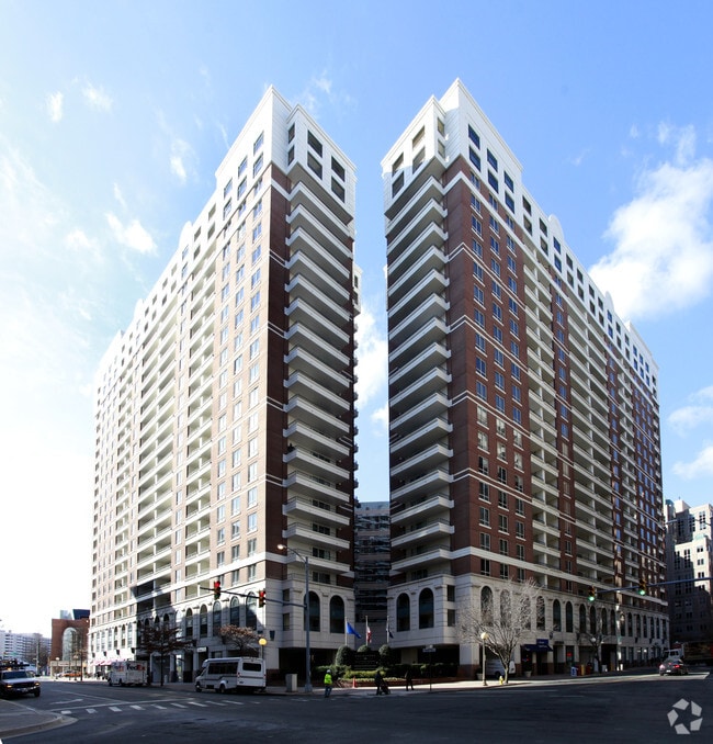


Property Detail
9Th St N
14-047-019
PARCEL 2C RESUB PARCEL 2B STAFFORD PLACE 42,275 SQ FT 0.9705 ACRE
Apartment
ARLINGTON
C-O-A
Virginia
B and X Area of moderate flood hazard, usually the area between the limits of the 100-year and 500-year floods.
19
2025
0.97 AC
2025
Ballston/Virginia Square
102001
Washington, DC
1,882 SF
Washington-Arlington-Alexandria, DC-VA-MD-WV
NEARBY LISTINGS FOR SALE OR LEASE
DEMOGRAPHICS near 9Th St N
1 mile
3 mile
5 mile
2025 Total Population
46,525
260,627
648,692
2030 Population
48,375
269,445
672,808
Pop Growth 2025-2030
+ 3.98%
+ 3.38%
+ 3.72%
Average Age
37
38
39
2025 Total Households
22,836
114,286
297,918
HH Growth 2025-2030
+ 4.20%
+ 3.57%
+ 4.22%
Median Household Inc
$155,930
$131,516
$132,356
Avg Household Size
2.00
2.20
2.10
2025 Avg HH Vehicles
1.00
1.00
1.00
Median Home Value
$870,438
$823,416
$715,415
Median Year Built
1992
1975
1968
Nearby Places
Map Layers
Map Styles
 Street
 Aerial
Layers
 Traffic
 Biking
Places
Listings with unknown addresses are not visible on the map
- Restaurants
- Banks
- Shops
- Fitness
- Groceries
PUBLIC TRANSPORTATION
COMMUTER RAIL
Drive
Walk
Distance
13 min
5.6 mi
Union Station (Red Line - Washington Metropolitan Area Transit Authority Metrorail (Metrorail))
Drive
Walk
Distance
Union Station (Red Line - Washington Metropolitan Area Transit Authority Metrorail (Metrorail))
16 min
6.9 mi
AIRPORT
Ronald Reagan Washington Ntl
Drive
Walk
Distance
Ronald Reagan Washington Ntl
14 min
6.0 mi
Washington Dulles International
Drive
Walk
Distance
Washington Dulles International
36 min
22.1 mi
Baltimore/Washington International Thurgood Marshall
Drive
Walk
Distance
Baltimore/Washington International Thurgood Marshall
58 min
36.8 mi
Freight Ports
Port of Baltimore
Drive
Walk
Distance
Port of Baltimore
66 min
44.3 mi
SALE & LEASE HISTORY
LISTING DATE
SALE/LEASE

Feb 26, 2019
For Lease
Nearby Properties
Address
Land Use
TOTAL SIZE
Lot Size
Zoning
Address
Land Use
TOTAL SIZE
Lot Size
Zoning
6,500,000 SF
92.03 AC
S-3A
Address
Land Use
TOTAL SIZE
Lot Size
Zoning
900,000 SF
260 AC
S-3A
Address
Land Use
TOTAL SIZE
Lot Size
Zoning
77.26 AC
R-3/GT
Address
Land Use
TOTAL SIZE
Lot Size
Zoning
636,768 SF
1.91 AC
C-O-ROSSLY
Address
Land Use
TOTAL SIZE
Lot Size
Zoning
508,547 SF
4.58 AC
C-O-2.5
Address
Land Use
TOTAL SIZE
Lot Size
Zoning
293,674 SF
13.45 AC
C-O-2.5
Address
Land Use
TOTAL SIZE
Lot Size
Zoning
20.19 AC
S-3A/S-D
Address
Land Use
TOTAL SIZE
Lot Size
Zoning
45,523 SF
0.24 AC
C-O-ROSSLY
Address
Land Use
TOTAL SIZE
Lot Size
Zoning
62,298 SF
2.58 AC
R-5
Address
Land Use
TOTAL SIZE
Lot Size
Zoning
20,513 SF
0.82 AC
C-O
Address
Land Use
TOTAL SIZE
Lot Size
Zoning
580,759 SF
0.69 AC
C-O/C-O-RO
Address
Land Use
TOTAL SIZE
Lot Size
Zoning
633,810 SF
3.45 AC
RA-H-3.2
Address
Land Use
TOTAL SIZE
Lot Size
Zoning
591,243 SF
1.90 AC
RA-H-3.2
Address
Land Use
TOTAL SIZE
Lot Size
Zoning
986,000 SF
2.30 AC
C-O-A
Address
Land Use
TOTAL SIZE
Lot Size
Zoning
6,370 SF
3.06 AC
RA6-15
Address
Land Use
TOTAL SIZE
Lot Size
Zoning
597,364 SF
1.66 AC
C-O/C-O-2.
Address
Land Use
TOTAL SIZE
Lot Size
Zoning
1,174,771 SF
20.30 AC
RA
Address
Land Use
TOTAL SIZE
Lot Size
Zoning
224,700 SF
1.30 AC
C-O-2.5
Address
Land Use
TOTAL SIZE
Lot Size
Zoning
12,786 SF
2.19 AC
C-2
Address
Land Use
TOTAL SIZE
Lot Size
Zoning
354,000 SF
0.67 AC
C-O-ROSSLY
Address
Land Use
TOTAL SIZE
Lot Size
Zoning
924,015 SF
89.81 AC
S-3A
Address
Land Use
TOTAL SIZE
Lot Size
Zoning
523,155 SF
1.76 AC
RA-H-3.2
Address
Land Use
TOTAL SIZE
Lot Size
Zoning
0.94 AC
C-O-2.5
Address
Land Use
TOTAL SIZE
Lot Size
Zoning
436 SF
75 AC
UNZONED
Address
Land Use
TOTAL SIZE
Lot Size
Zoning
9,800 SF
1.40 AC
C-O-A
Address
Land Use
TOTAL SIZE
Lot Size
Zoning
727,145 SF
19.72 AC
S-3A
Address
Land Use
TOTAL SIZE
Lot Size
Zoning
528 SF
296.59 AC
MU-11;MU-1
The World's #1 Commercial Real Estate Marketplace
Connect with us
© 2026 CoStar Group
The information above has been obtained from sources believed reliable. While we do not doubt its accuracy we have not verified it and make no guarantee, warranty or representation about it. It is your responsibility to independently confirm its accuracy and completeness. Any projections, opinions, assumptions, or estimates used are for example only and do not represent the current or future performance of the property. The value of this transaction to you depends on tax and other factors which should be evaluated by your tax, financial, and legal advisors. You and your advisors should conduct a careful, independent investigation of the property to determine to your satisfaction the suitability of the property for your needs.