Property Record
Access Undetermined, Cape Coral, FL 33993

NEARBY LISTINGS FOR SALE OR LEASE
-
-
View all Cape Coral listings for sale on LoopNet.com
Property Detail
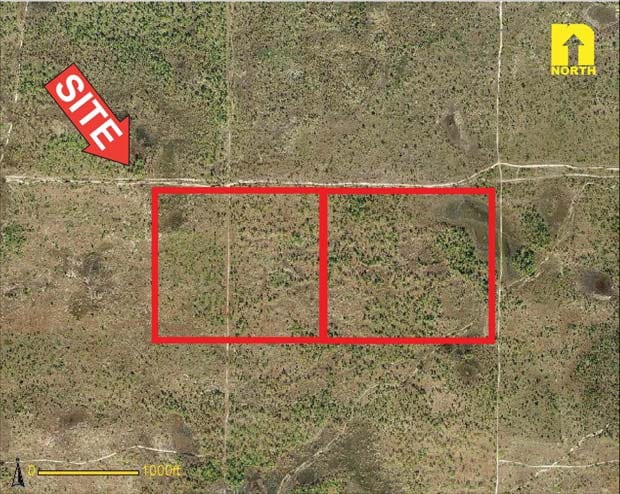
Access Undetermined
Cape Coral-Fort Myers, FL
Zemel
14-43-23-00-00001.0010
E 1/2 OF N 1/2 OF NW 1/4 IN SEC 14 TWN 43 RGE 23
Miscellaneous
Lee
X
Florida
12071C0251G
1
2024
45.55 AC
2025
Cape Coral
010111
Southwest Florida
DEMOGRAPHICS near Access Undetermined
1 mile
3 mile
5 mile
2024 Total Population
0
11,380
58,199
2029 Population
0
13,760
70,158
Pop Growth 2024-2029
0.00%
+ 20.91%
+ 20.55%
Average Age
0
38
44
2024 Total Households
0
3,762
22,294
HH Growth 2024-2029
0.00%
+ 20.47%
+ 20.19%
Median Household Inc
$0
$68,952
$68,195
Avg Household Size
.00
2.90
2.50
2024 Avg HH Vehicles
.00
2.00
2.00
Median Home Value
$0
$261,449
$244,551
Median Year Built
0
2006
2003
Nearby Places
Map Layers
Map Styles
 Street
 Aerial
Transit
 Traffic
 Biking
Places
Listings with unknown addresses are not visible on the map
- Restaurants
- Banks
- Shops
- Fitness
- Groceries
PUBLIC TRANSPORTATION
AIRPORT
Punta Gorda
Drive
Walk
Distance
Punta Gorda
37 min
16.9 mi
Southwest Florida International
Drive
Walk
Distance
Southwest Florida International
50 min
26.0 mi
Freight Ports
Port Manatee
Drive
Walk
Distance
Port Manatee
117 min
88.6 mi
SALE & LEASE HISTORY
LISTING DATE
SALE/LEASE

Sep 24, 2016
For Sale
Nearby Properties
Address
Land Use
TOTAL SIZE
Lot Size
Zoning
Address
Land Use
TOTAL SIZE
Lot Size
Zoning
670.48 AC
AG-2
Address
Land Use
TOTAL SIZE
Lot Size
Zoning
9.12 AC
AG-2
Address
Land Use
TOTAL SIZE
Lot Size
Zoning
303.23 AC
AG-2
Address
Land Use
TOTAL SIZE
Lot Size
Zoning
228.33 AC
R1A
Address
Land Use
TOTAL SIZE
Lot Size
Zoning
632.90 AC
NZ
Address
Land Use
TOTAL SIZE
Lot Size
Zoning
142.97 AC
AG-2
Address
Land Use
TOTAL SIZE
Lot Size
Zoning
113.70 AC
AG-2
Address
Land Use
TOTAL SIZE
Lot Size
Zoning
22,500 SF
1.56 AC
I1
Address
Land Use
TOTAL SIZE
Lot Size
Zoning
3,819 SF
0.95 AC
C
Address
Land Use
TOTAL SIZE
Lot Size
Zoning
18,599 SF
10.56 AC
AG-2
Address
Land Use
TOTAL SIZE
Lot Size
Zoning
4,518 SF
12.91 AC
AG-2
Address
Land Use
TOTAL SIZE
Lot Size
Zoning
7,967 SF
4.34 AC
AG-2
Address
Land Use
TOTAL SIZE
Lot Size
Zoning
7,853 SF
10.84 AC
AG-2
Address
Land Use
TOTAL SIZE
Lot Size
Zoning
11,171 SF
10.60 AC
AG-2
Address
Land Use
TOTAL SIZE
Lot Size
Zoning
11,587 SF
2.63 AC
AG-2
Address
Land Use
TOTAL SIZE
Lot Size
Zoning
8,384 SF
15.70 AC
AG-2
Address
Land Use
TOTAL SIZE
Lot Size
Zoning
38.49 AC
AG-2
Address
Land Use
TOTAL SIZE
Lot Size
Zoning
9,876 SF
1.85 AC
AG-2
Address
Land Use
TOTAL SIZE
Lot Size
Zoning
20.24 AC
AG-2
Address
Land Use
TOTAL SIZE
Lot Size
Zoning
8,869 SF
13.24 AC
AG-2
Address
Land Use
TOTAL SIZE
Lot Size
Zoning
0.23 AC
R1-W
Address
Land Use
TOTAL SIZE
Lot Size
Zoning
0.54 AC
R1-W
Address
Land Use
TOTAL SIZE
Lot Size
Zoning
42,280 SF
20.72 AC
AG-2
Address
Land Use
TOTAL SIZE
Lot Size
Zoning
7,386 SF
4.34 AC
AG-2
Address
Land Use
TOTAL SIZE
Lot Size
Zoning
9,651 SF
5 AC
AG-2
Address
Land Use
TOTAL SIZE
Lot Size
Zoning
7,979 SF
1.53 AC
AG-2
Address
Land Use
TOTAL SIZE
Lot Size
Zoning
0.34 AC
R1-D
Address
Land Use
TOTAL SIZE
Lot Size
Zoning
6,866 SF
11.15 AC
AG-2
Address
Land Use
TOTAL SIZE
Lot Size
Zoning
0.40 AC
R1-W
Address
Land Use
TOTAL SIZE
Lot Size
Zoning
6,138 SF
0.40 AC
MR
The World's #1 Commercial Real Estate Marketplace
Connect with us
© 2026 CoStar Group
The information above has been obtained from sources believed reliable. While we do not doubt its accuracy we have not verified it and make no guarantee, warranty or representation about it. It is your responsibility to independently confirm its accuracy and completeness. Any projections, opinions, assumptions, or estimates used are for example only and do not represent the current or future performance of the property. The value of this transaction to you depends on tax and other factors which should be evaluated by your tax, financial, and legal advisors. You and your advisors should conduct a careful, independent investigation of the property to determine to your satisfaction the suitability of the property for your needs.