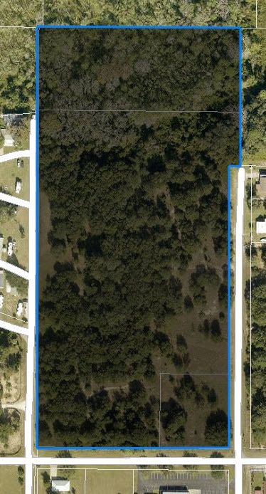
Property Record
Adams St, Astatula, FL 34705

NEARBY LISTINGS FOR SALE OR LEASE
Property Detail
Adams St
Orlando-Kissimmee-Sanford, FL
Astatula
29-20-26-0100-00A-00101
ASTATULA PB 1 PG 12 BEGIN ON EAST LINE LOT 1 BLK A AT POINT 1010 FEET NORTH OF SOUTHEAST CORNER OF LOT 5 BLK A RUN WEST TO WEST LINE OF LOT 1 NORTH TO NORTHWEST CORNER OF LOT 1 EAST TO POINT NORTH OF POINT OF BEGINNING SOUTH TO POINT OF BEGINNING WES
Residentialacreage
Lake
AE
Florida
12095C0100H
1
2024
12.81 AC
2026
Lake County
031001
Orlando
DEMOGRAPHICS near Adams St
1 Mile
3 Mile
5 Mile
2024 Total Population
1,860
7,522
15,768
2029 Population
2,200
8,876
18,666
Pop Growth 2024-2029
+ 18.28%
+ 18.00%
+ 18.38%
Average Age
44
47
47
2024 Total Households
712
3,057
6,413
HH Growth 2024-2029
+ 17.98%
+ 17.70%
+ 18.15%
Median Household Inc
$56,571
$65,671
$66,138
Avg Household Size
2.60
2.50
2.40
2024 Avg HH Vehicles
2.00
2.00
2.00
Median Home Value
$237,500
$265,831
$270,164
Median Year Built
1993
1998
1998
Nearby Places
Map Layers
Map Styles
 Street
 Aerial
- Restaurants
- Banks
- Shops
- Fitness
- Groceries
SALE & LEASE HISTORY
LISTING DATE
SALE/LEASE

Nov 17, 2023
For Sale
Nearby Properties
Address
Land Use
TOTAL SIZE
Lot Size
Zoning
Address
Land Use
TOTAL SIZE
Lot Size
Zoning
144,891 SF
288.42 AC
Address
Land Use
TOTAL SIZE
Lot Size
Zoning
149,998 SF
8.73 AC
I
Address
Land Use
TOTAL SIZE
Lot Size
Zoning
510,201 SF
36.54 AC
HM
Address
Land Use
TOTAL SIZE
Lot Size
Zoning
137.28 AC
A
Address
Land Use
TOTAL SIZE
Lot Size
Zoning
Address
Land Use
TOTAL SIZE
Lot Size
Zoning
36,629 SF
282.12 AC
CFD
Address
Land Use
TOTAL SIZE
Lot Size
Zoning
54,327 SF
168.71 AC
A
Address
Land Use
TOTAL SIZE
Lot Size
Zoning
166,821 SF
4.75 AC
IND
Address
Land Use
TOTAL SIZE
Lot Size
Zoning
35.46 AC
SF4
Address
Land Use
TOTAL SIZE
Lot Size
Zoning
42,515 SF
9.41 AC
HM
Address
Land Use
TOTAL SIZE
Lot Size
Zoning
116,340 SF
34.02 AC
INS
Address
Land Use
TOTAL SIZE
Lot Size
Zoning
5,788 SF
50.33 AC
R1
Address
Land Use
TOTAL SIZE
Lot Size
Zoning
87,660 SF
6.78 AC
HM
Address
Land Use
TOTAL SIZE
Lot Size
Zoning
42,529 SF
6.43 AC
PD
Address
Land Use
TOTAL SIZE
Lot Size
Zoning
55,145 SF
8.41 AC
HM
Address
Land Use
TOTAL SIZE
Lot Size
Zoning
2,000 SF
18.47 AC
R1A
Address
Land Use
TOTAL SIZE
Lot Size
Zoning
47,460 SF
11.86 AC
HM
Address
Land Use
TOTAL SIZE
Lot Size
Zoning
111,206 SF
33.05 AC
MP
Address
Land Use
TOTAL SIZE
Lot Size
Zoning
19,591 SF
67.41 AC
CFD
Address
Land Use
TOTAL SIZE
Lot Size
Zoning
113,800 SF
17.54 AC
Address
Land Use
TOTAL SIZE
Lot Size
Zoning
67.11 AC
A
Address
Land Use
TOTAL SIZE
Lot Size
Zoning
28,580 SF
2.88 AC
I
Address
Land Use
TOTAL SIZE
Lot Size
Zoning
105,489 SF
9.62 AC
Address
Land Use
TOTAL SIZE
Lot Size
Zoning
50,772 SF
21.41 AC
I
Address
Land Use
TOTAL SIZE
Lot Size
Zoning
36,650 SF
8.97 AC
HM
Address
Land Use
TOTAL SIZE
Lot Size
Zoning
46,046 SF
13.33 AC
AR
Address
Land Use
TOTAL SIZE
Lot Size
Zoning
23,881 SF
36.14 AC
Address
Land Use
TOTAL SIZE
Lot Size
Zoning
64,100 SF
22 AC
A
Address
Land Use
TOTAL SIZE
Lot Size
Zoning
21,280 SF
0.53 AC
R1B
Address
Land Use
TOTAL SIZE
Lot Size
Zoning
27,500 SF
2.88 AC
I
The World's #1 Commercial Real Estate Marketplace
Connect with us
© 2025 CoStar Group
The information above has been obtained from sources believed reliable. While we do not doubt its accuracy we have not verified it and make no guarantee, warranty or representation about it. It is your responsibility to independently confirm its accuracy and completeness. Any projections, opinions, assumptions, or estimates used are for example only and do not represent the current or future performance of the property. The value of this transaction to you depends on tax and other factors which should be evaluated by your tax, financial, and legal advisors. You and your advisors should conduct a careful, independent investigation of the property to determine to your satisfaction the suitability of the property for your needs.