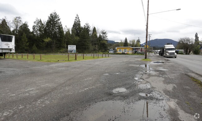
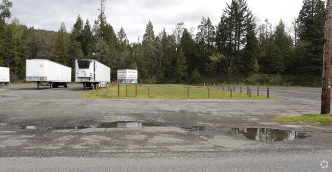
Property Record
Address Unknown, Oakridge, OR 97463

Property Detail
Address Unknown
Eugene-Springfield, OR
TL 02000
0954881
LANE
Commercialacreage
Oregon
C3
2000
B and X Area of moderate flood hazard, usually the area between the limits of the 100-year and 500-year floods.
0.28 AC
2025
Lane County
2025
Portland
0015004029
NEARBY LISTINGS FOR SALE OR LEASE
-
-
View all Oakridge listings for sale on LoopNet.com
DEMOGRAPHICS near Address Unknown
1 mile
3 mile
5 mile
2025 Total Population
3,083
4,676
5,285
2030 Population
3,155
4,796
5,424
Pop Growth 2025-2030
+ 2.34%
+ 2.57%
+ 2.63%
Average Age
46
46
46
2025 Total Households
1,418
2,104
2,351
HH Growth 2025-2030
+ 2.26%
+ 2.47%
+ 2.55%
Median Household Inc
$33,142
$34,752
$35,035
Avg Household Size
2.20
2.20
2.20
2025 Avg HH Vehicles
2.00
2.00
2.00
Median Home Value
$236,132
$244,878
$250,215
Median Year Built
1970
1970
1971
Nearby Places
Map Layers
Map Styles
 Street
 Aerial
Transit
 Traffic
 Biking
Places
Listings with unknown addresses are not visible on the map
- Restaurants
- Banks
- Shops
- Fitness
- Groceries
SALE & LEASE HISTORY
LISTING DATE
SALE/LEASE

Sep 24, 2016
For Sale
Nearby Properties
Address
Land Use
TOTAL SIZE
Lot Size
Zoning
Address
Land Use
TOTAL SIZE
Lot Size
Zoning
5.58 AC
R1
Address
Land Use
TOTAL SIZE
Lot Size
Zoning
5,615.58 AC
F1
Address
Land Use
TOTAL SIZE
Lot Size
Zoning
248.60 AC
C3
Address
Land Use
TOTAL SIZE
Lot Size
Zoning
2.85 AC
F2
Address
Land Use
TOTAL SIZE
Lot Size
Zoning
4,081.10 AC
E40
Address
Land Use
TOTAL SIZE
Lot Size
Zoning
1.24 AC
C3
Address
Land Use
TOTAL SIZE
Lot Size
Zoning
2.09 AC
C3
Address
Land Use
TOTAL SIZE
Lot Size
Zoning
0.95 AC
C3
Address
Land Use
TOTAL SIZE
Lot Size
Zoning
0.61 AC
C3
Address
Land Use
TOTAL SIZE
Lot Size
Zoning
0.80 AC
C3
Address
Land Use
TOTAL SIZE
Lot Size
Zoning
2.12 AC
PRO-S
Address
Land Use
TOTAL SIZE
Lot Size
Zoning
0.95 AC
C3
Address
Land Use
TOTAL SIZE
Lot Size
Zoning
5.11 AC
R1
Address
Land Use
TOTAL SIZE
Lot Size
Zoning
39.24 AC
F2
Address
Land Use
TOTAL SIZE
Lot Size
Zoning
0.73 AC
R1
Address
Land Use
TOTAL SIZE
Lot Size
Zoning
4.89 AC
R1
Address
Land Use
TOTAL SIZE
Lot Size
Zoning
0.73 AC
C3
Address
Land Use
TOTAL SIZE
Lot Size
Zoning
0.64 AC
C2
Address
Land Use
TOTAL SIZE
Lot Size
Zoning
1.19 AC
C3
Address
Land Use
TOTAL SIZE
Lot Size
Zoning
91.20 AC
PR
Address
Land Use
TOTAL SIZE
Lot Size
Zoning
0.54 AC
C3
Address
Land Use
TOTAL SIZE
Lot Size
Zoning
6.12 AC
I2
Address
Land Use
TOTAL SIZE
Lot Size
Zoning
956.81 AC
F1
Address
Land Use
TOTAL SIZE
Lot Size
Zoning
4.48 AC
I1
Address
Land Use
TOTAL SIZE
Lot Size
Zoning
1.27 AC
R1
Address
Land Use
TOTAL SIZE
Lot Size
Zoning
3.07 AC
C3
Address
Land Use
TOTAL SIZE
Lot Size
Zoning
0.36 AC
F2
Address
Land Use
TOTAL SIZE
Lot Size
Zoning
0.79 AC
C3
Address
Land Use
TOTAL SIZE
Lot Size
Zoning
810 SF
1 AC
C3
Address
Land Use
TOTAL SIZE
Lot Size
Zoning
0.91 AC
C3
The World's #1 Commercial Real Estate Marketplace
Connect with us
© 2026 CoStar Group
The information above has been obtained from sources believed reliable. While we do not doubt its accuracy we have not verified it and make no guarantee, warranty or representation about it. It is your responsibility to independently confirm its accuracy and completeness. Any projections, opinions, assumptions, or estimates used are for example only and do not represent the current or future performance of the property. The value of this transaction to you depends on tax and other factors which should be evaluated by your tax, financial, and legal advisors. You and your advisors should conduct a careful, independent investigation of the property to determine to your satisfaction the suitability of the property for your needs.