Property Record
Agate Rd, White City, OR 97503
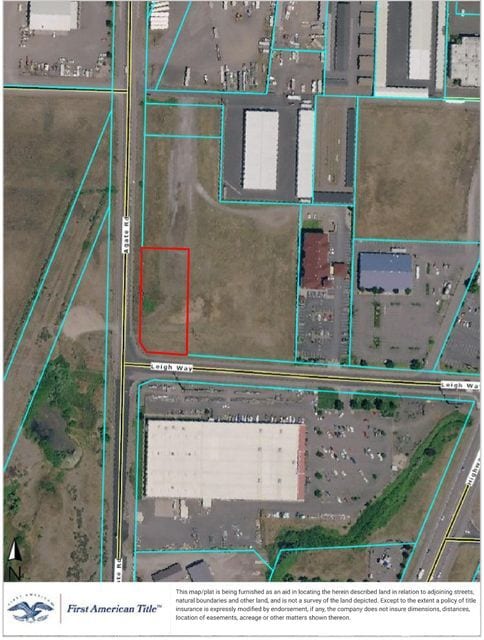


Property Detail
Agate Rd
10985928
JACKSON
Industrialgeneral
Oregon
GC
1
B and X Area of moderate flood hazard, usually the area between the limits of the 100-year and 500-year floods.
1 AC
2025
Medford/Grants Pass
2026
Other Market Areas
001301
Medford, OR
NEARBY LISTINGS FOR SALE OR LEASE
DEMOGRAPHICS near Agate Rd
1 mile
3 mile
5 mile
2025 Total Population
2,233
14,133
53,303
2030 Population
2,198
13,992
52,552
Pop Growth 2025-2030
(1.57%)
(1.00%)
(1.41%)
Average Age
39
39
41
2025 Total Households
745
4,660
19,587
HH Growth 2025-2030
(1.88%)
(1.18%)
(1.53%)
Median Household Inc
$66,603
$69,666
$80,628
Avg Household Size
2.90
2.90
2.60
2025 Avg HH Vehicles
2.00
2.00
2.00
Median Home Value
$337,272
$333,715
$374,197
Median Year Built
1978
1987
1991
Nearby Places
Map Layers
Map Styles
 Street
 Aerial
Layers
 Traffic
 Biking
Places
Listings with unknown addresses are not visible on the map
- Restaurants
- Banks
- Shops
- Fitness
- Groceries
PUBLIC TRANSPORTATION
AIRPORT
Rogue Valley International - Medford
Drive
Walk
Distance
Rogue Valley International - Medford
11 min
6.0 mi
SALE & LEASE HISTORY
LISTING DATE
SALE/LEASE

Sep 24, 2016
For Sale
Jun 02, 2021
For Sale
Jul 06, 2022
For Sale
Nearby Properties
Address
Land Use
TOTAL SIZE
Lot Size
Zoning
Address
Land Use
TOTAL SIZE
Lot Size
Zoning
49.38 AC
GI
Address
Land Use
TOTAL SIZE
Lot Size
Zoning
30.66 AC
GI
Address
Land Use
TOTAL SIZE
Lot Size
Zoning
145.26 AC
GI
Address
Land Use
TOTAL SIZE
Lot Size
Zoning
69.89 AC
GI
Address
Land Use
TOTAL SIZE
Lot Size
Zoning
14.84 AC
GI
Address
Land Use
TOTAL SIZE
Lot Size
Zoning
73.48 AC
GI
Address
Land Use
TOTAL SIZE
Lot Size
Zoning
2,088 SF
41.88 AC
OSR
Address
Land Use
TOTAL SIZE
Lot Size
Zoning
88.67 AC
I-L
Address
Land Use
TOTAL SIZE
Lot Size
Zoning
177.42 AC
GI
Address
Land Use
TOTAL SIZE
Lot Size
Zoning
49 AC
GI
Address
Land Use
TOTAL SIZE
Lot Size
Zoning
50.78 AC
GI
Address
Land Use
TOTAL SIZE
Lot Size
Zoning
35,272 SF
10.01 AC
GI
Address
Land Use
TOTAL SIZE
Lot Size
Zoning
25.77 AC
GI
Address
Land Use
TOTAL SIZE
Lot Size
Zoning
37.62 AC
GI
Address
Land Use
TOTAL SIZE
Lot Size
Zoning
27.82 AC
I-H
Address
Land Use
TOTAL SIZE
Lot Size
Zoning
1,584 SF
2.01 AC
WCUR-30
Address
Land Use
TOTAL SIZE
Lot Size
Zoning
39.24 AC
GI
Address
Land Use
TOTAL SIZE
Lot Size
Zoning
69.90 AC
GI
Address
Land Use
TOTAL SIZE
Lot Size
Zoning
100,000 SF
5.77 AC
I-G
Address
Land Use
TOTAL SIZE
Lot Size
Zoning
30.99 AC
GI
Address
Land Use
TOTAL SIZE
Lot Size
Zoning
235.09 AC
GI
Address
Land Use
TOTAL SIZE
Lot Size
Zoning
27.49 AC
WCUR-8
Address
Land Use
TOTAL SIZE
Lot Size
Zoning
6,108 SF
7.84 AC
GC
Address
Land Use
TOTAL SIZE
Lot Size
Zoning
19.25 AC
I-H
Address
Land Use
TOTAL SIZE
Lot Size
Zoning
82,520 SF
10.05 AC
GC
Address
Land Use
TOTAL SIZE
Lot Size
Zoning
144,500 SF
37.62 AC
GI
Address
Land Use
TOTAL SIZE
Lot Size
Zoning
34,707 SF
3.21 AC
I-L
Address
Land Use
TOTAL SIZE
Lot Size
Zoning
9.97 AC
GI
Address
Land Use
TOTAL SIZE
Lot Size
Zoning
25.77 AC
GI
Address
Land Use
TOTAL SIZE
Lot Size
Zoning
30,965 SF
3.15 AC
I-L
The World's #1 Commercial Real Estate Marketplace
Connect with us
© 2026 CoStar Group
The information above has been obtained from sources believed reliable. While we do not doubt its accuracy we have not verified it and make no guarantee, warranty or representation about it. It is your responsibility to independently confirm its accuracy and completeness. Any projections, opinions, assumptions, or estimates used are for example only and do not represent the current or future performance of the property. The value of this transaction to you depends on tax and other factors which should be evaluated by your tax, financial, and legal advisors. You and your advisors should conduct a careful, independent investigation of the property to determine to your satisfaction the suitability of the property for your needs.