Property Record
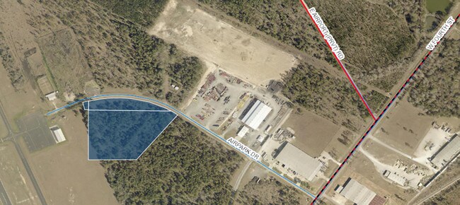
Airpark Dr, , LA


Property Detail
Airpark Dr
Lake Charles, LA
220711-0000-1200003 0000 220711-0000-2100003 0000 230711-0000-3400010 0000 230711-0000-4300007 0000 PARCEL OF LAND SITUATED IN E/2 22 AND W/2 23.7.11 DESC AS: COM SW COR NW OF SAID SEC 23 E 72 1.43 FT S 3.21 FT TO PT OF BEG TH S 34 DEGS W 612.61 W 42
01357151
CALCASIEU
Commercialacreage
Louisiana
B and X Area of moderate flood hazard, usually the area between the limits of the 100-year and 500-year floods.
3,7,10
2025
9.99 AC
2025
Lake Charles
002400
Other Market Areas
NEARBY LISTINGS FOR SALE OR LEASE
-
-
View all listings for sale on LoopNet.com
DEMOGRAPHICS near Airpark Dr
1 mile
3 mile
5 mile
2025 Total Population
241
4,558
6,089
2030 Population
247
4,641
6,189
Pop Growth 2025-2030
+ 2.49%
+ 1.82%
+ 1.64%
Average Age
41
40
40
2025 Total Households
92
1,736
2,299
HH Growth 2025-2030
+ 2.17%
+ 1.84%
+ 1.70%
Median Household Inc
$65,833
$58,967
$69,657
Avg Household Size
2.50
2.60
2.60
2025 Avg HH Vehicles
2.00
2.00
2.00
Median Home Value
$219,231
$176,557
$206,984
Median Year Built
1981
1983
1985
Nearby Places
Map Layers
Map Styles
 Street
 Aerial
Transit
 Traffic
 Biking
Places
Listings with unknown addresses are not visible on the map
- Restaurants
- Banks
- Shops
- Fitness
- Groceries
PUBLIC TRANSPORTATION
AIRPORT
Lake Charles Regional
Drive
Walk
Distance
Lake Charles Regional
60 min
36.3 mi
Freight Ports
Port of Lake Charles
Drive
Walk
Distance
Port of Lake Charles
52 min
29.3 mi
SALE & LEASE HISTORY
LISTING DATE
SALE/LEASE

Jun 05, 2017
For Sale
Nearby Properties
Address
Land Use
TOTAL SIZE
Lot Size
Zoning
Address
Land Use
TOTAL SIZE
Lot Size
Zoning
6.37 AC
Address
Land Use
TOTAL SIZE
Lot Size
Zoning
Address
Land Use
TOTAL SIZE
Lot Size
Zoning
Address
Land Use
TOTAL SIZE
Lot Size
Zoning
26.60 AC
Address
Land Use
TOTAL SIZE
Lot Size
Zoning
Address
Land Use
TOTAL SIZE
Lot Size
Zoning
1.80 AC
Address
Land Use
TOTAL SIZE
Lot Size
Zoning
35.06 AC
Address
Land Use
TOTAL SIZE
Lot Size
Zoning
1.55 AC
Address
Land Use
TOTAL SIZE
Lot Size
Zoning
Address
Land Use
TOTAL SIZE
Lot Size
Zoning
1.50 AC
Address
Land Use
TOTAL SIZE
Lot Size
Zoning
0.02 AC
Address
Land Use
TOTAL SIZE
Lot Size
Zoning
0.04 AC
Address
Land Use
TOTAL SIZE
Lot Size
Zoning
3,609 AC
Address
Land Use
TOTAL SIZE
Lot Size
Zoning
4.80 AC
Address
Land Use
TOTAL SIZE
Lot Size
Zoning
0.01 AC
Address
Land Use
TOTAL SIZE
Lot Size
Zoning
0.63 AC
Address
Land Use
TOTAL SIZE
Lot Size
Zoning
Address
Land Use
TOTAL SIZE
Lot Size
Zoning
10.10 AC
Address
Land Use
TOTAL SIZE
Lot Size
Zoning
2.40 AC
Address
Land Use
TOTAL SIZE
Lot Size
Zoning
0.01 AC
Address
Land Use
TOTAL SIZE
Lot Size
Zoning
Address
Land Use
TOTAL SIZE
Lot Size
Zoning
Address
Land Use
TOTAL SIZE
Lot Size
Zoning
1,909.91 AC
Address
Land Use
TOTAL SIZE
Lot Size
Zoning
0.01 AC
Address
Land Use
TOTAL SIZE
Lot Size
Zoning
0.50 AC
Address
Land Use
TOTAL SIZE
Lot Size
Zoning
0.03 AC
Address
Land Use
TOTAL SIZE
Lot Size
Zoning
0.01 AC
Address
Land Use
TOTAL SIZE
Lot Size
Zoning
37.16 AC
Address
Land Use
TOTAL SIZE
Lot Size
Zoning
The World's #1 Commercial Real Estate Marketplace
Connect with us
© 2026 CoStar Group
The information above has been obtained from sources believed reliable. While we do not doubt its accuracy we have not verified it and make no guarantee, warranty or representation about it. It is your responsibility to independently confirm its accuracy and completeness. Any projections, opinions, assumptions, or estimates used are for example only and do not represent the current or future performance of the property. The value of this transaction to you depends on tax and other factors which should be evaluated by your tax, financial, and legal advisors. You and your advisors should conduct a careful, independent investigation of the property to determine to your satisfaction the suitability of the property for your needs.